
Plumbing Long Range Still A Mess
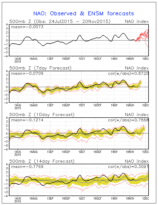
The way the pipes and the plumbing are laid out in the atmosphere still does not favor delivering the cold air to the east on a consistent basis. We continue to see an overall warm ridge in the east with occasional interruptions by cold air coming down for a few days. Such is the case this weekend with the North Atlantic Oscillation going slightly negative into early next week before going positive again. All of the ensembles members take the NAO positive again except for 1 which goes sharply negative.
However there is good news for cold weather/snow lovers in that the Pacific North America Pattern or PNA is going positive later next week and the general weather rule is that the PNA trumps the NAO in terms of which atmospheric condition dominates. Remember this was the case for all of last winter where the PNA and the NAO were positive from mid January through late March. It was also the case the winter before.

Okay now that we got that out of the way I want to look at today’s 18z GFS. First off a big variable is Typhoon In Fa which seems to be causing havoc on the models from run to run.If the typhoon remains strong it is forecast to re-curve and be absorbed by a developing storm that strengthens and heads for the Gulf of Alaska. Model runs have been going back and forth on this and this is a key to whether cold air will be allowed to flow into the United States going into the first week of December. This is the European view of In Fa with the 18z GFS view underneath.

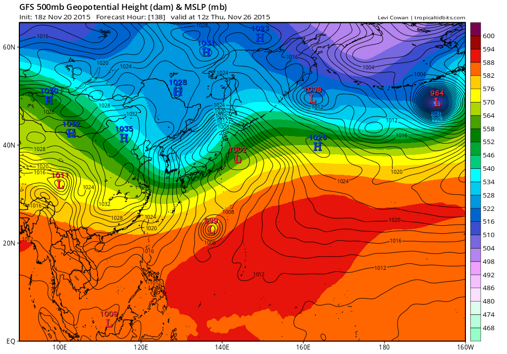
Today’s 18z GFS seems to want to do follow through on the typhoons re-curvature so we will see if that trend continues. Because of this today’s run is back to a colder look after Thanksgiving and wants to bring a front through with colder air and some overrunning moisture behind it.
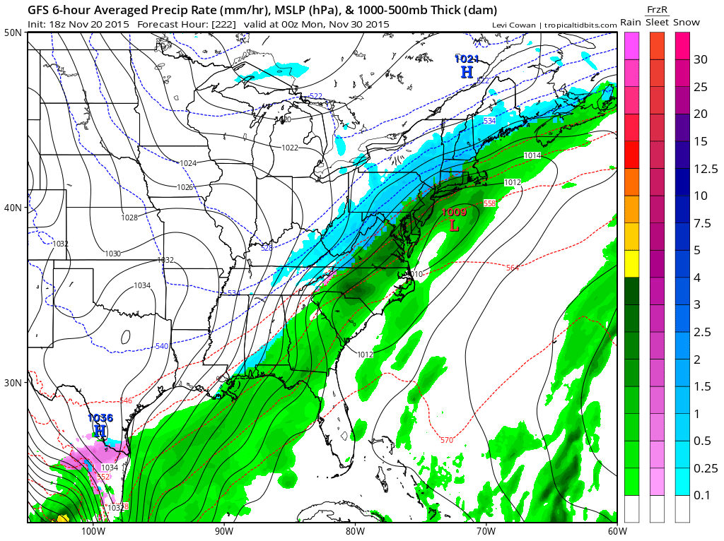
The wave on the front brings cold air in at the end. My experience we these sorts of things (if it is real) is that usually the cold air does not get here in time and the rain just ends as the front pushes east. Needless to say this is in what I refer to as clown land as far as the outlook period is concerned (day 9) but we really don’t have much to look at as Thanksgiving week looks to be dry and uneventful. We will follow this along and see where it all takes us. We will see if the overnight runs attempt to rearrange the plumbing.
WINTER STORM WARNINGS FOR PARTS OF THE MIDWEST PLUS OUR SHORT RANGE WEEKEND FORECAST
JOESTRADAMUS ON WARM NOVEMBERS AND WHETHER THEY MEAN SNOWLESS WINTERS
JOESTDAMUS ON THE SPLIT FLOW AND SUBTROPICAL JET
JOESTRADAMUS LATEST ON THE LONG RANGE
JOESTRADAMUS ON TYPHOO IN-FA AND THE IMPACT ON THE LONG RANGE