Overnight Thunderstorms Possible Very Warm Humid Weekend
Overnight Thunderstorms Possible Very Warm Humid Weekend
Now that the mid morning cloud cover has moved through most of the area, sunshine very warm and humid conditions are with us for the afternoon ahead. Temperatures are headed up to the mid to upper 80s in most places. There are no weather issues for the rest of this afternoon and through at least midnight tonight. Whatever outdoor plans you have, you can go ahead with them.
EASTERN SATELLITE

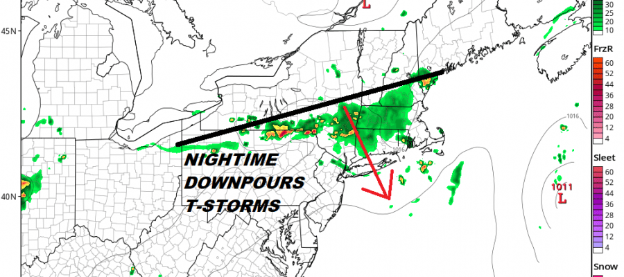
To the north we have a dying cold front and upper air disturbance that is moving southward. This should be passing through during the early morning hours. Regional and local radars don’t show much of anything at the moment but look for some thunderstorms to start developing tonight in upstate NY and they will be moving through here during the early morning hours.
REGIONAL RADAR

LOCAL RADAR NEW YORK CITY

Short range models are picking up on these downpours and thunderstorms as the HRRR model shows below. It doesn’t go out far enough to see how well they hold together but it seems that some will hold their own. Don’t be too surprised if some rumbles of thunder wake you up early Sunday morning.
HRRR 3AM SUNDAY JULY 15, 2018

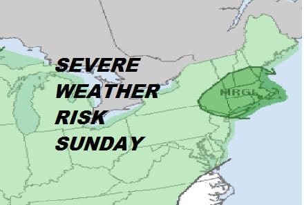
Sunday looks very warm and humid again. How much cloud cover and how well the thunderstorms hold up overnight will likely impact temperatures. 80s to near 90 look doable. There could be another round of thunderstorms scattered about late in the day Sunday and Sunday evening with a marginal risk of severe weather.
SEVERE WEATHER RISK SUNDAY JULY 15 2018
Monday will be hot and humid with some sunshine and late day scattered thunderstorms. Highs will reach into the 90s away from the ocean. Tuesday still brings about the next important cold front with thunderstorms likely late in the day. Highs will be in the 80s. Drier air arrives for Wednesday and Thursday of next week.
Please note that with regards to any tropical storms or hurricanes, should a storm be threatening, please consult your local National Weather Service office or your local government officials about what action you should be taking to protect life and property.
 GET JOE A CIGAR IF YOU LIKE

LATEST JOESTRADAMUS ON THE LONG RANGE


