Overcast Onshore Flow Rain Drizzle Halloween Showery Rains Wind
Clouds have rolled in overnight from the east and we are sitting in overcast skies today. Nothing like a moist onshore flow to make things gloomy in the area from Southern New England and Long Island west into Eastern Pennsylvania. There is also the risk of patchy light rain or drizzle along the coast. Some did occur overnight and we could see some more today. Breaks of sun will be very few and very far between if at all. Highs today will be in the raw upper 50s and lower 60s.
SATELLITE

REGIONAL RADAR

When it comes to very light precipitation like what we are seeing today it is very hard to see on the local radars but you can make out a few streaks looping back northwestward from offshore. The light rain and drizzle is very low to the ground and the radar has a tough time picking it.
LOCAL RADAR NEW YORK CITY

LOCAL RADAR PHILADELPHIA


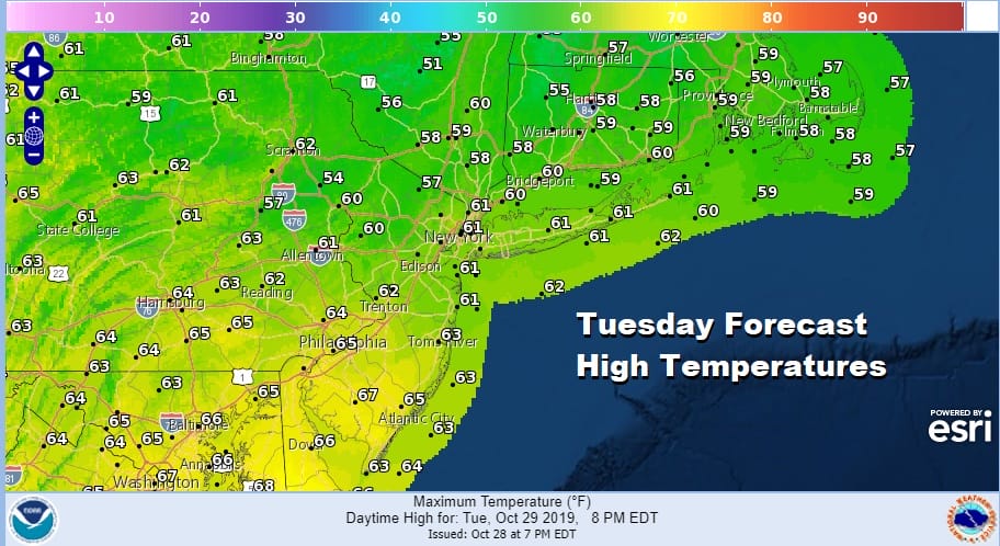
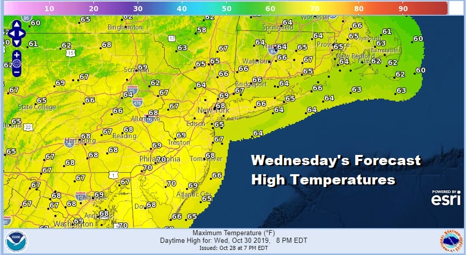
We are beginning to see the next storm system setting up for Halloween. This low is coming out of the Central Rockies and headed for the Great Lakes. Gulf of Mexico moisture is building today with showers along the Gulf Coast pushing northward. Snow is breaking out across Colorado and the Central Plains. This will start to come eastward tonight and Wednesday. We will stay cloudy tonight and probably Wednesday as well with the chance for some patchy light rain or drizzle continuing. Temperatures will hold in the 50s tonight and reach mid to upper 60s on Wednesday.
Thursday sees our storm system head toward the Great Lakes with a warm front pushing through from the south. Showery rains will arrive Overnight into early Thursday morning. We might catch a bit of break until the cold front swings far enough east with more showers later Thursday and Thursday night.

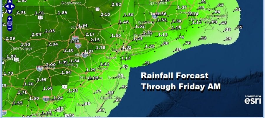
The GFS model sequence above starts Wednesday night at 8pm and ends on Friday at 2pm. Rainfall from this system could be substantial again on the order of 1 to 2 inches with the highest amounts as you go inland and west.
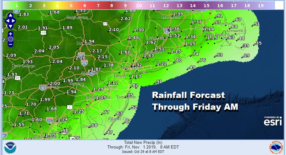
Rains should be gone Friday morning and weather conditions will improve with leftover clouds and leftover temperatures in the 60s early. A chilly air mass comes in behind this for the weekend. Clouds and some sunshine are forecast for Saturday and Sunday with highs both days just in the low to mid 50s and lows at night in the 30s to lower 40s. We should have a decent dry weekend.
DOWNLOAD MY TWO FREE WEATHER APPS TO FOLLOW YOUR DAILY WEATHER
MANY THANKS TO TROPICAL TIDBITS FOR THE USE OF MAPS
Please note that with regards to any severe weather, tropical storms, or hurricanes, should a storm be threatening, please consult your local National Weather Service office or your local government officials about what action you should be taking to protect life and property.


