
Long Range November West To East Pattern Normal Ups & Downs
It has been an active weather pattern for the last couple of a weeks and we are seeing another storm heading to the Great Lakes following up on the Sunday storm which was quite the rain maker. This low will likely bring showery rains on Thursday and then one solid line of heavy downpours Thursday night. There might even be a few thunderstorms in the mix as a strong front moves through early Friday morning.
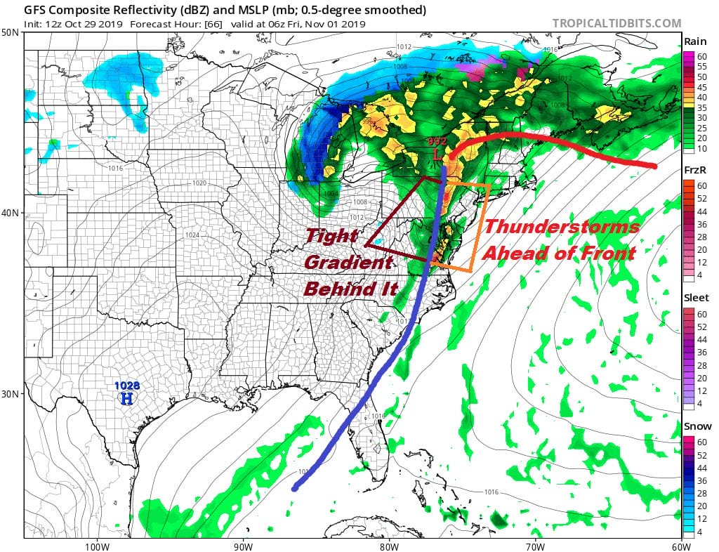
Along with whatever rains we get out of this (1 to 2 inches ) we will see some strong gusty winds behind the front Friday morning on the back side with the pressure gradient getting rather tight. Winds will be 20 to 30 mph with gusts into the 40mph+ range on the backside of this. Weather conditions improve Friday as the day wears on and colder air will be arriving for the weekend. It isn’t anything exceptional as far as the cold air is concerned. It will take us below average for a few days though the coldest air will likely be more to the west of us than overhead.
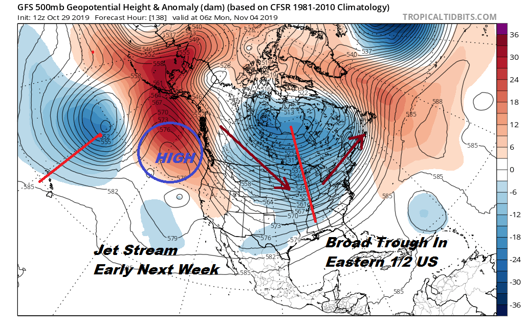
We are setting up a broad bowl type trough east of the Rockies early next week so once this storm is done it is likely to be on the quiet side overall with some ups and downs in the temperature department. It looks like the active pattern settles down for the next week or so. Teleconnections which are really just snapshots of the upper pattern really aren’t that useful when it comes to longer term predictability on specific events. They basically reflect the obvious on what is on the weather models themselves.
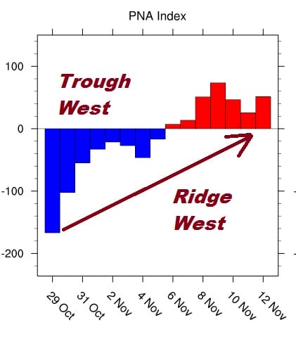
The Pacific North America index or PNA is telling us that the troughing in the west will give way to some weak ridging in the west in the next two weeks and it also means a trough along 160 degrees west near Hawaii. This would signal weak troughing moving to the Eastern 1/2 of the US but not necessarily close enough to the east coast to create serious issues.

The North Atlantic Oscillation or NAO is the one indicator snow weenies always point to and this in my view is always the least important of the teleconnections. It says that there is no blocking of any kind in the North Atlantic over the next few weeks so everything will be moving along.
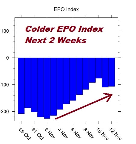
The East Pacific Oscillation or EPO is strongly negative which explains the cold air that covers much of the Plains and Rockies. The building Pacific ridge suggests some of that cold air moves east in the next two weeks but the progressive pattern (west to east) means cold fronts with ups and downs temperature wise (a little below..a little above) but otherwise nothing extraordinary or than cold fronts every 3 or 4 days. At least the recent run of strong storm systems will relax a bit over the next few weeks. Afterwards I suspect we may see things get busy again later in November (second half). Autumn in the East continues to roll along.
MANY THANKS TO TROPICAL TIDBITS FOR THE USE OF MAPS
Please note that with regards to any severe weather, tropical storms, or hurricanes, should a storm be threatening, please consult your local National Weather Service office or your local government officials about what action you should be taking to protect life and property.