
Our Labor Day Weekend Begins With Sunshine Low Humidity
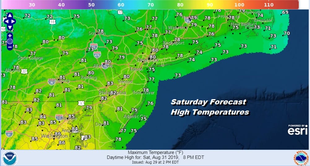
We have our Labor Day holiday weekend underway with a Saturday of lots of sunshine, low humidity and highs in the upper 70s to lower 80s. It is rather straight forward forecast. The satellite picture this morning does show a few patchy clouds around but there is ample dry air so that those clouds will sink southward and dissipate to a certain extent. Of the three days this holiday weekend today will likely be the best of the bunch overall though the next two days should be ok with no major issues. The radar is bone dry with no echos on it nor are any expected to develop today.
SATELLITE

REGIONAL RADAR

Tonight there are no issues forecast with mainly clear skies and most lows in the 50s to lower 60s. Sunday should be no worse than partly sunny. High pressure moves out to the east and an onshore flow begins but the air remains dry enough that we don’t expect much other than some patchy clouds in the mix. Highs will be mainly in the 70s to near 80. We will be transitioning to higher humidity Monday and there might be a few passing showers inland Sunday night but they should be scattered.
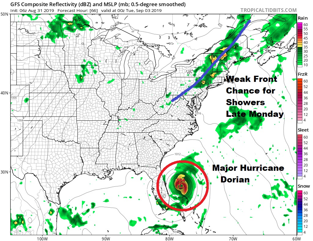
Monday Labor day we have a weak front that will be heading through here and that could trigger off a shower or thunderstorm late in the day. Otherwise we will have clouds and some breaks of sunshine with highs in the upper 70s and lower 80s. Showers should be scattered and for most the day side will be rain free. Hurricane Dorian will be in the Bahamas and overnight weather models are leaning away from Florida for a landfall. A gradual turn north increases the threat for the coastal Carolinas for the middle of next week. Lots of uncertainty continues for Florida and the Southeast US. We can say that the upper pattern remains unfavorable for Dorian to head up further north toward the Northeast as the flow from the Carolinas will take it out to the northeast.
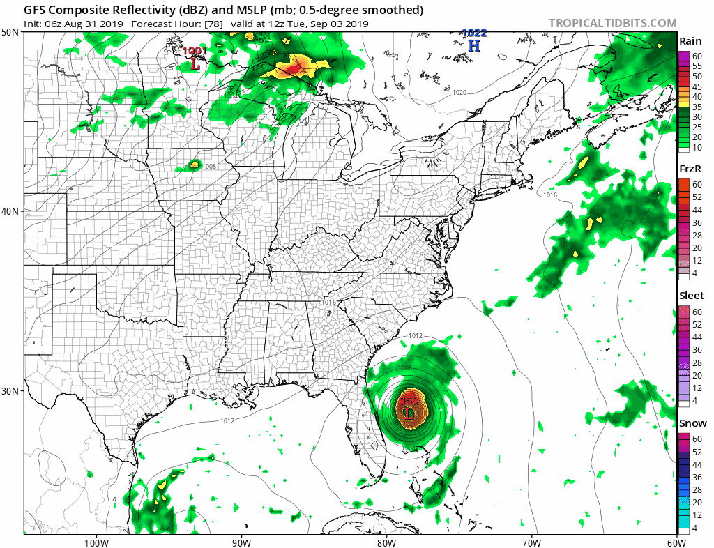
There is a second cold front that will arrive on Wednesday so ahead of it we look for some sunshine warm and somewhat humid conditions for Tuesday with highs in the 80s and the same for Wednesday with the chance for a shower or thunderstorm as that cold front passes. The front creates an alley way for Dorian to move along to the northeast as the model loop shows. It also brings down a shot of nice cool dry air for the end of next week.
MANY THANKS TO TROPICAL TIDBITS FOR THE USE OF MAPS
Please note that with regards to any tropical storms or hurricanes, should a storm be threatening, please consult your local National Weather Service office or your local government officials about what action you should be taking to protect life and property.


