
Labor Day Holiday Weekend No Serious Issues
The last weekend of the summer vacation season is here and we have no serious weather issues to worry about. A weak cold front is moving through tonight with just a few clouds which we can see on the satellite picture below. The front is so weak that we can barely find a spot shower anywhere. So we have a nice somewhat warm night through it will cool off overnight in the 50s in many inland areas and low to mid 60s everywhere else. Other than a few clouds that will be around it should turn partly to mostly clear later tonight.
SATELLITE

REGIONAL RADAR

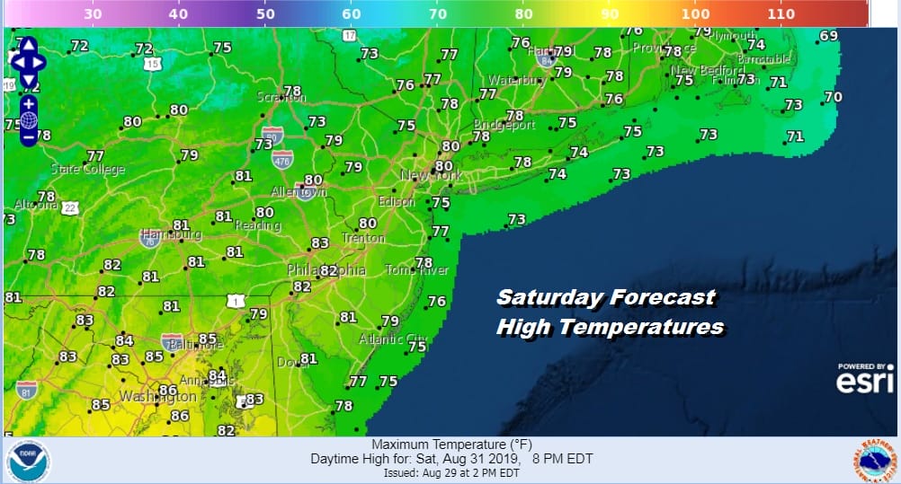
Once the front passes we have another dry high building in from the Great Lakes. We have a bone dry Saturday with lots of sunshine with highs in the 70s to near 80. It will be a terrific start to the Labor Day holiday weekend.
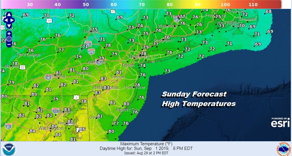
This high is going to be moving out to the east on Sunday setting us an onshore flow but there should still be plenty of dry air around. We see Sunday being no worse than partly sunny with most highs in the upper 70s to lower 80. I don’t believe there is any shower risk on Sunday.
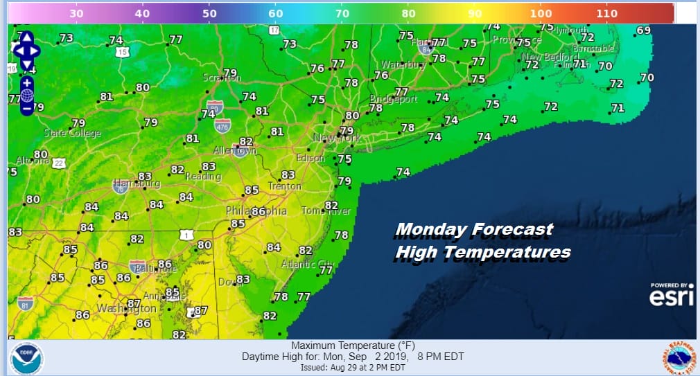
Monday we will start to see more clouds coming into the mix and the humidity will come up. We will lean toward a more optimistic partly sunny forecast with the chance for a spot shower with highs in the upper 70s to mid 80s in some places.
Next week of course it will be about Dorian and its impact to the Bahamas and Florida. Then we start to look at what might happen down the road. Tuesday will be warm and humid with another cold front approaching with some showers for Wednesday of next week. After that another cool big high builds into the Northeast for Thursday and Friday.
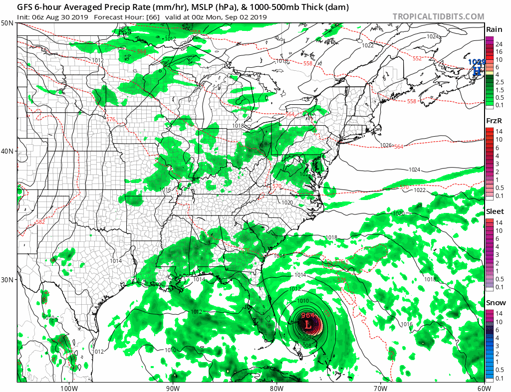
Dorian at this point assuming everything moves along will be moving northward possibly into the Southeast US or perhaps emerging back into the Atlantic off the Georgia coast. It is pointless at this stage to focus at all on the long range since we have too many short range issues with regards to Dorian to work out including a more specific landfall range. One thing that could happen after all this is done is we could have a rather robust shot of cool air coming into the Northeast once Dorian gets out of the way.
MANY THANKS TO TROPICAL TIDBITS FOR THE USE OF MAPS
Please note that with regards to any tropical storms or hurricanes, should a storm be threatening, please consult your local National Weather Service office or your local government officials about what action you should be taking to protect life and property.


