
Onshore Flow Weakening Slowly Improvement Later Today
Next Cold Front Showers Saturday

Weather in 5/Joe & Joe Weather Show Latest Podcast
Onshore Flow Weakening Slowly Improvement Later Today Next Cold Front Showers Saturday
We began the day with high pressure in Central New England and a remnant weak low off the Mid Atlantic coast. There are some leftover clouds around but as the day wears on some of the dry air to the Northeast in New England will drift southward and there should be some north to south improvement this afternoon. Skies should gradually go partly sunny but areas in Southern New Jersey and Southern Pennsylvania southward might have more of a struggle today to get the sun to cut through the clouds. This will have an impact on high temperatures but we should see most areas get back into the 70s.
SATELLITE

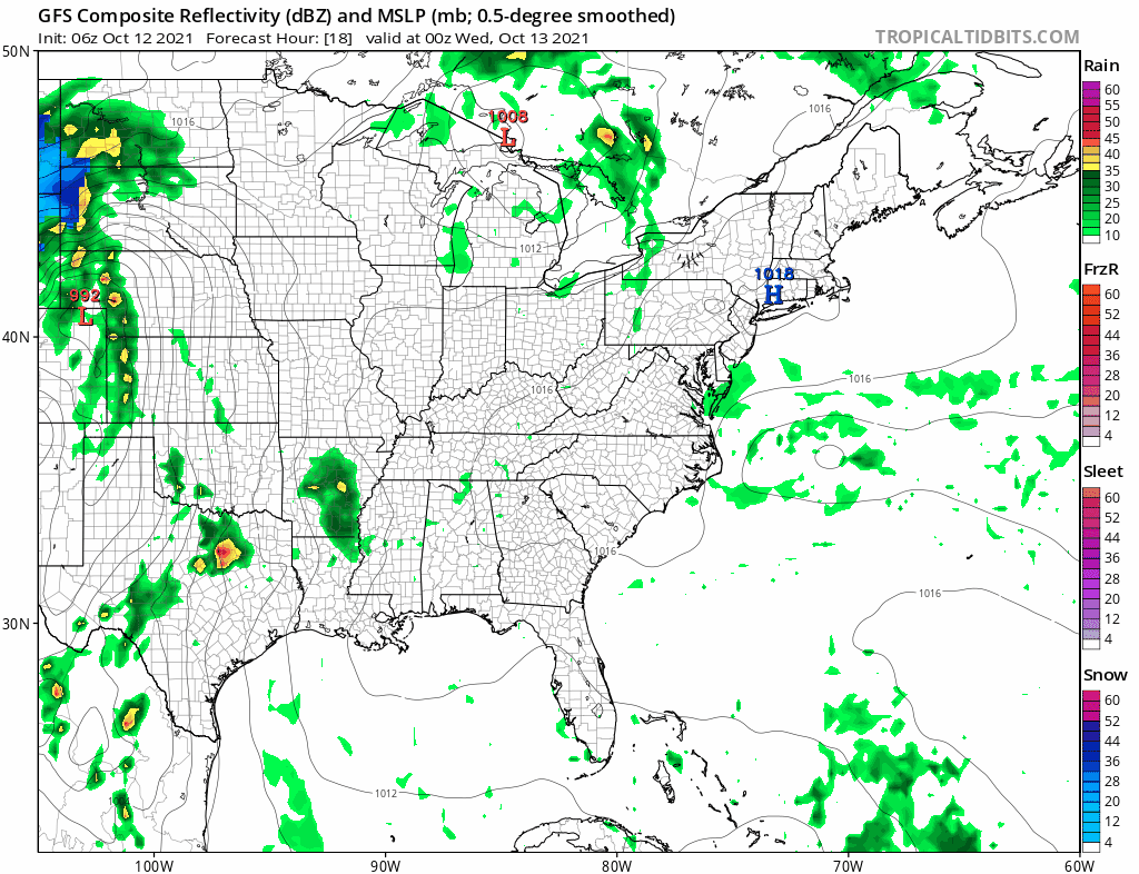
WEATHER RADAR

Except for some spotty drizzle or mist around this morning, the radars are quiet and will remain so for the rest of the week. We should continue to see decreasing clouds tonight and skies should be partly sunny for Wednesday. Lows overnight will be in the upper 50s and lower 60s. The trend for temperatures will be higher with highs in the 70s Wednesday afternoon.
The upper ridge along the East Coast which has kept cold fronts away for the better part of the last 2 weeks is breaking down setting us up for the next cold front which arrives on Saturday. There are no changes in the outlook for Thursday and Friday as both days should feature a good deal of sunshine. Highs will be very warm for this time of year in the upper 70s and lower 80s. Then Saturday as an upper trough moves across the Great Lakes a cold front will approach. This brings clouds and the chance for showers and perhaps a thunderstorm Saturday afternoon and evening. Highs will be in the 70s.
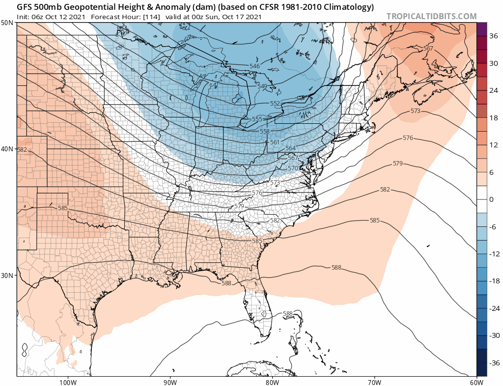
Sunday will be the better of the two weekend days as we will see sunshine but we will also see cooler than average temperatures. Highs will be in the 60s. The path from Canada opens up in the long range so that will bring a cooler flow and cold fronts coming through with more regularity. The dry weather pattern will continue into next week. Another front is likely around the middle of next week bringing even cooler air for the end of the next week. The pattern change will mean Autumn will finally gain some traction in the Northeast and Middle Atlantic states.
BE SURE TO DOWNLOAD THE FREE METEOROLOGIST JOE CIOFFI WEATHER APP &
ANGRY BEN’S FREE WEATHER APP “THE ANGRY WEATHERMAN!

MANY THANKS TO TROPICAL TIDBITS & F5 WEATHER FOR THE USE OF MAPS
Please note that with regards to any severe weather, tropical storms, or hurricanes, should a storm be threatening, please consult your local National Weather Service office or your local government officials about what action you should be taking to protect life and property.


