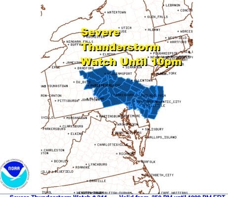
One Two Punch New Severe Thunderstorm Watch Southeast PA Southern New Jersey
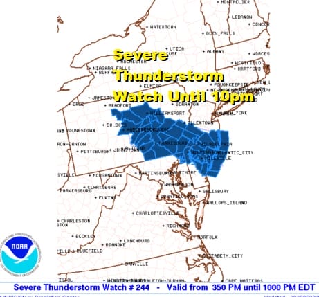
The first round of thunderstorms early this afternoon produced 90 mph gusts in some areas of Southern New Jersey and Southeastern Pennsylvania. Now comes another severe thunderstorm watch until 10pm for almost the same area as the map above shows. Usually when thunderstorms play through it is over and done with but this was a special case with a mesoscale convective cluster that traveled from Wisconsin yesterday at this time and held together and moved through early this afternoon. The atmosphere has become destabilized again and another round of thunderstorms is likely later this evening.
SATELLITE

REGIONAL RADAR

The regional radar shows the remnant area offshore but we are seeing new thunderstorms firing up in Central Pennsylvania and western NY moving east southeast. The areas outside of the watch zone could see some scatttered strong thunderstorms later this evening with more of a solid cluster moving through in the watch area. Keep an eye out on the local radars below for developments later this evening.
LOCAL RADAR BINGHAMTON NY

LOCAL RADAR PHILADELPHIA


Once these storms are done look for leftover clouds tonight. Temperatures will be holding in the 60s overnight. Thursday looks like a warm day with sunshine. A cold front stalling over head could fire up thunderstorms late Thursday into Thursday night but this time the thunderstorms will be further south from Southernmost New Jersey south into Maryland. Highs will be mostly in the 80s.

Friday will be another warm and somewhat humid day with some sunshine with highs in the 80s. Some scattered thunderstorms could break out late in the day into Friday night. That takes us into the weekend with a cold front coming through on Saturday. Timing could mean that thunderstorms develop in the afternoon and again it will be more to the south. Temperatures will be in the low to mid 80s. Finally dry cooler air arrives for Sunday and Monday with lots of sunshine and highs mostly in the 70s.
BE SURE TO DOWNLOAD THE FREE METEOROLOGIST JOE CIOFFI WEATHER APP &
ANGRY BEN’S FREE WEATHER APP “THE ANGRY WEATHERMAN!
MANY THANKS TO TROPICAL TIDBITS FOR THE USE OF MAPS
Please note that with regards to any severe weather, tropical storms, or hurricanes, should a storm be threatening, please consult your local National Weather Service office or your local government officials about what action you should be taking to protect life and property.


