COASTAL FLOOD WARNINGS CONTINUE THIS MORNING
FLASH FLOOD WATCH, WIND ADVISORIES HIGH WIND WARNINGS
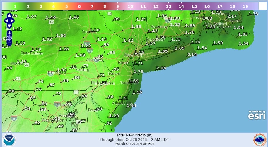
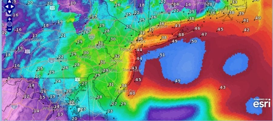
Stormy conditions are underway now with rain that arrived overnight. Rainfall amounts will total 1 to 2 inches but the map above in areas to the west doesn’t include rain that has already fallen. Winds are increasing and will reach their peek this morning between now and noon with gusts over 50 mph at times along the New Jersey coast and over Long Island especially Eastern Long Island. High wind warnings continue in these areas.
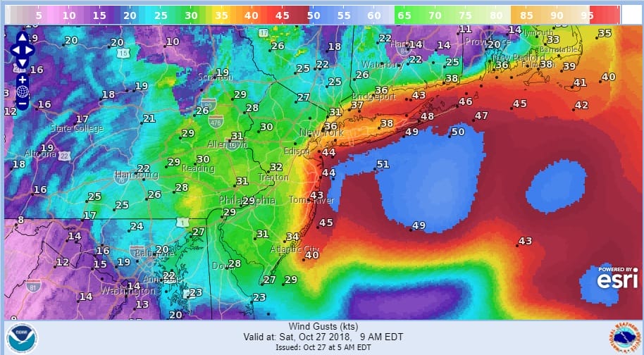
Everything seems to be moving along this morning as we have low pressure moving up the coast to near the New Jersey shore later this morning and a strong high over Nova Scotia and to the East with the very tight pressure gradient into midday. After that the gradient relaxes and the winds begin to die off. Rain lasts into mid and late after noon though it will taper off and end in areas south of NYC as we move through the afternoon.
There are no important changes to the forecast for tonight as the rains move to the north and skies rain cloudy with lows in the upper 40s and lower 50s. Sunday looks ok but not perfect with clouds and some breaks of sun with highs in the 50s to near 60. We could see a few showers early Monday morning as a weak system goes by. Otherwise we will be sitting in clouds for most of Monday with highs in the 50s to near 60.
EASTERN SATELLITE

REGIONAL RADAR

LOCAL RADAR NEW YORK CITY

LOCAL RADAR PHILADELPHIA


SUBSCRIBE TO PATREON FOR A WEATHER EXPERIENCE FREE OF ADS, EXCLUSIVE VIDEOS FOR MEMBERS ONLY AND MUCH MORE…STARTS AT $2 A MONTH..MESSAGE ME AT ANY TIME

MANY THANKS TO TROPICAL TIDBITS FOR THE USE OF MAPS
Please note that with regards to any tropical storms or hurricanes, should a storm be threatening, please consult your local National Weather Service office or your local government officials about what action you should be taking to protect life and property.
LATEST JOESTRADAMUS ON THE LONG RANGE

