
Noreaster Threat Late Week Still Unclear

MENTION JOE CIOFFI AND GET A 5% DISCOUNT
With all the models in for the afternoon with the exception of the Euro Model (it will be done by 3pm) there is still not much clarity on how things evolve regarding a noreaster threat later this week. We can say that the week appears to be a gloomy one overall with lots of clouds, an onshore flow, and occasional rounds of rain. The northern half of this rain area today did not hold together and rainfall amounts in general were under a quarter of an inch in most areas. This longer term trend of models over performing reality continues so we need to bear that in mind as we watch what happens during this coming week.
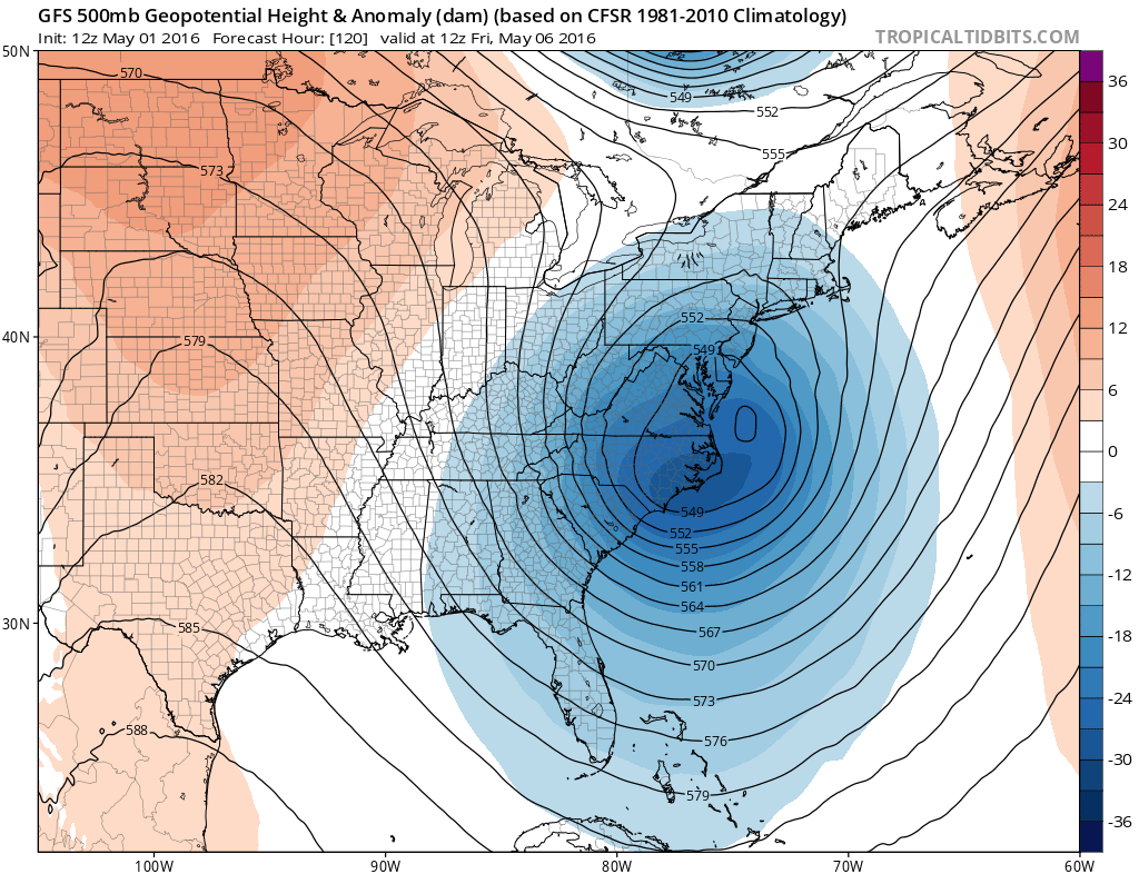
Both the gfs model and the Canadian weather model show a dynamic upper air system heading for the Middle Atlantic Coast. The GFS is actually quite impressive with this. It brings the upper air storm to the coast and then very slowly moves it away to the east and a system upstream is shown to come down and kick it along. All the while the surface system that develops seems to rotate around it before it all moves away offshore by next Sunday.
Noreaster Threat Late Week Still Unclear
GFS UPPER AIR FRIDAY
Noreaster Threat Late Week Still Unclear
Canadian Upper Air Friday

Yet with all this energy there are some things that are not quite right. For one thing the model picks out several low pressure areas and can’t seem to decide which one is the more dominant feature. This results in weak surface lows with not really much rain with each, and not much of a pressure gradient either so other than the fact that we will be in clouds and occasional rain, this is going to be not much of a big deal. The Canadian takes a low off the Middle Atlantic Coast and just kicks it out to the northeast and done.
Noreaster Threat Late Week Still Unclear
GFS SURFACE MAP FRIDAY & SATURDAY
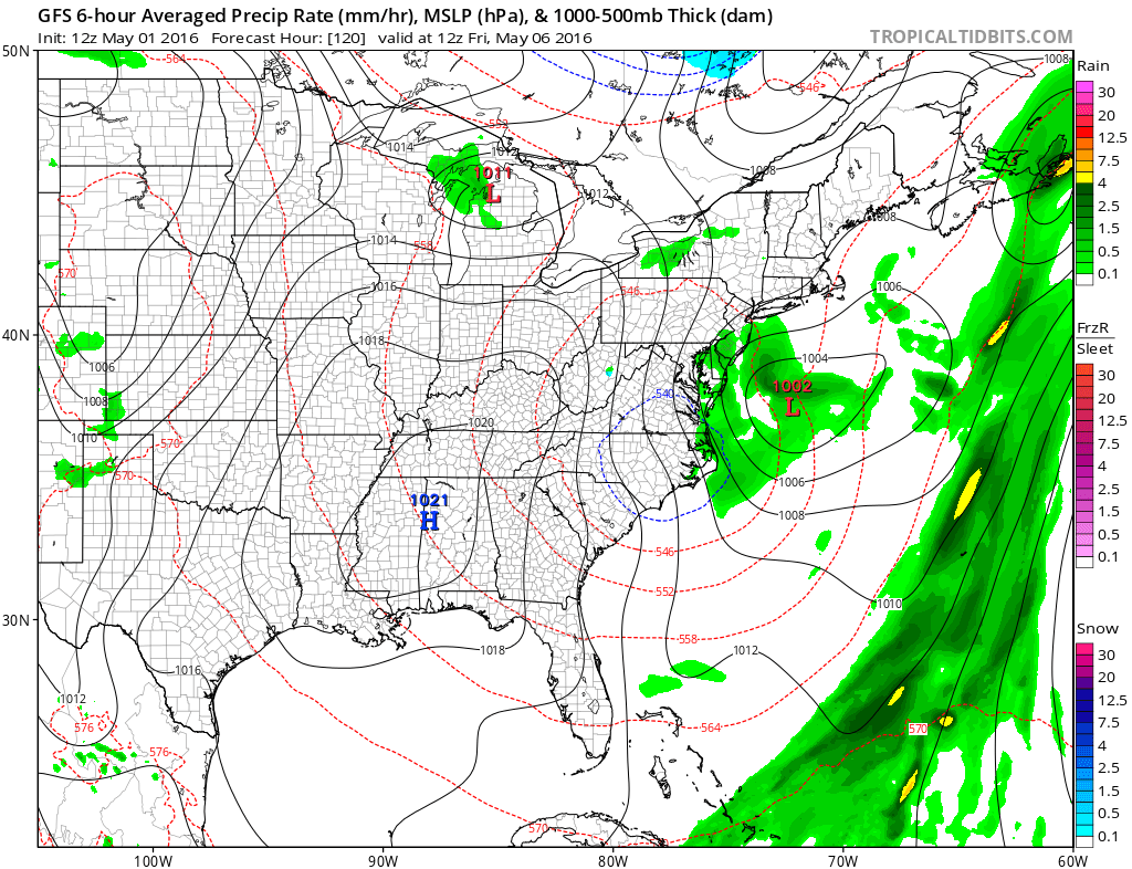
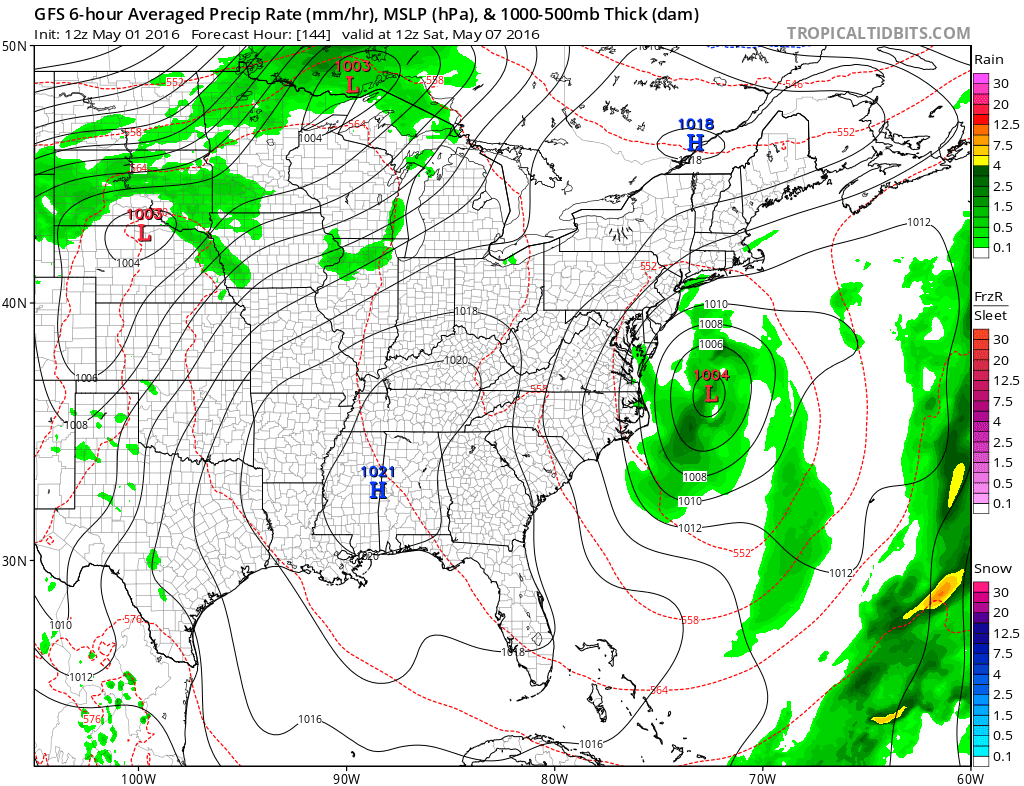
You can see on the GFS model that the surface low is pretty much in the same spot Friday and Saturday mornings and again not much rain. There is some wind but more of it offshore than onshore. So from a forecast standpoint here we are left with uncertainty at a lot of levels. Certainly we do not have the Euro model’s look from several runs ago which showed a huge low sitting just offshore and pounding the coast. This is not to say that it still can’t happen. On the contrary, the ingredients remain in place for a more developed system for the end of the week. We have to at this point continue to wait to see how models resolve all the dilemmas and issues. The Euro model is beginning shortly to tell its story. Last night’s model backed off on the strength so lets see if it backs off yet again.
FiOS1 News Weather Forecast For Long Island
FiOS1 News Weather Forecast For New Jersey
FiOS1 News Weather Forecast For Hudson Valley
NATIONAL WEATHER SERVICE SNOW FORECASTS
LATEST JOESTRADAMUS ON THE LONG RANGE

NOMINATED FOR AN APPY AWARD FOR BEST WEATHER APP!!
Weather App

Don’t be without Meteorologist Joe Cioffi’s weather app. It is really a meteorologist app because you get my forecasts and my analysis and not some automated computer generated forecast based on the GFS model. This is why your app forecast changes every 6 hours. It is model driven with no human input at all. It gives you an icon, a temperature and no insight whatsoever.
It is a complete weather app to suit your forecast needs. All the weather information you need is right on your phone. Android or I-phone, use it to keep track of all the latest weather information and forecasts. This weather app is also free of advertising so you don’t have to worry about security issues with your device. An accurate forecast and no worries that your device is being compromised.
Use it in conjunction with my website and my facebook and twitter and you have complete weather coverage of all the latest weather and the long range outlook. The website has been redone and upgraded. Its easy to use and everything is archived so you can see how well Joe does or doesn’t do when it comes to forecasts and outlooks.
Just click on the google play button or the apple store button on the sidebar for my app which is on My Weather Concierge. Download the app for free. Subscribe to my forecasts on an ad free environment for just 99 cents a month.
Get my forecasts in the palm of your hand for less than the cost of a cup of Joe!
![]()

