Nice Start To August Unsettled Wednesday Through Friday

Weather in 5/Joe & Joe Weather Show Latest Podcast
Nice Start To August Unsettled Wednesday Through Friday
A cold front is moving offshore this morning and pushing far enough out east to allow another nice dry air mass to build into the Northeast and Middle Atlantic states. This will be another day of sunshine with low humidity. Temperatures this afternoon will top in the mid 70s to around 80 degrees. There are no weather issues today other than some passing leftover clouds early on and the radars today will stay silent.
SATELLITE

WEATHER RADAR
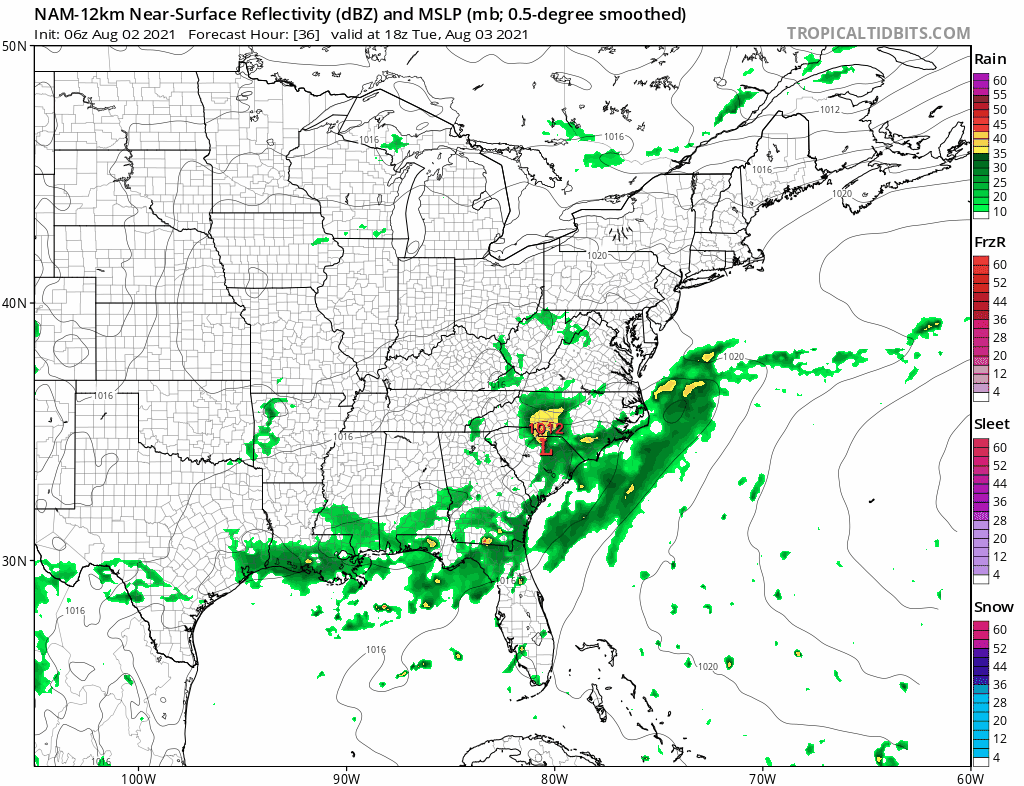
There is some leftover rain going on in Northern New England but across the rest of the region, the radars are all on the quiet side. There should be no shower or thunderstorm activity to worry about probably into the first part of Wednesday.

Tonight will be nice and clear with lows by morning in the low to mid 60s in coastal and warmer urban areas and 50s everywhere else. Some 40s are likely in outlying areas and in pine barrens. Tuesday will be sunny day with low humidity and highs reaching into the lower 80s. Again humidity levels will remain low. Some high clouds from a wave developing to our south could move in during the afternoon but no rain is forecast.
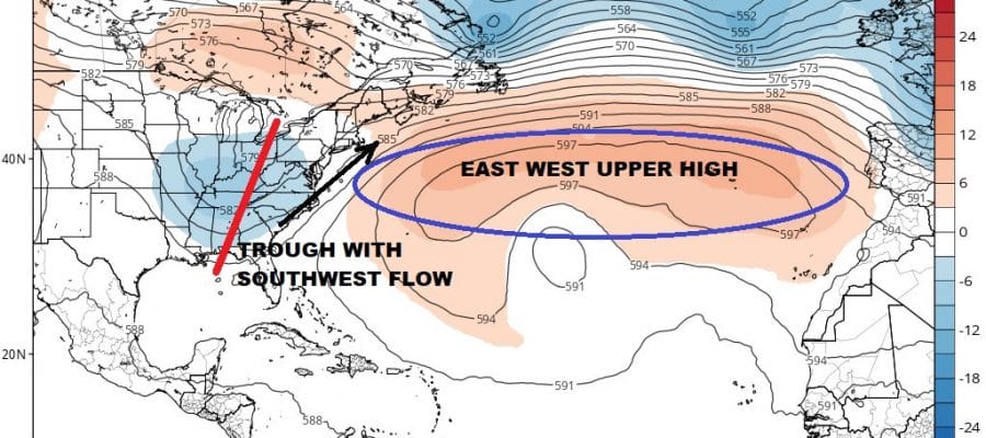
The cold front moving through today will extend northeast to southwest from southeast of Cape Cod to the Carolina coast. A southwest flow sets up and that develops a couple of waves of low pressure as the NAM indicates. The position of that front will hinge on an upper high in the Atlantic near Bermuda and a trough to our west.
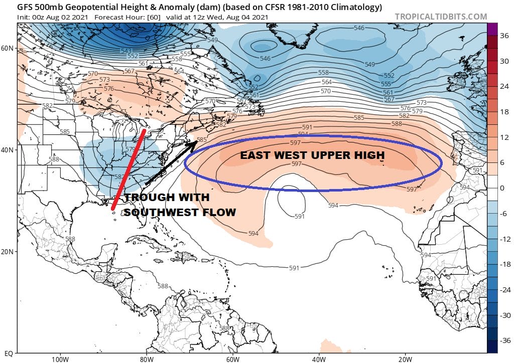
The southwest flow keeps us on the edge of that buckling frontal boundary as opposed to a southerly flow which will be more problematic bring clouds and rain. The NAM above shows those waves pushing rain up to coastal areas beginning later Wednesday and lasting on and off into Friday. Inland areas would be in clouds but miss out on most of the rain. For now we will forecast clouds Wednesday with showers possible along coastal areas of Delaware, New Jersey to Southern New England and Long Island; leaving rain out of the forecast for areas north and west of the coast. Wednesday highs will be in the upper 70s to lower 80s and in the 70s to near 80 Thursday and Friday with warmer temperatures inland.
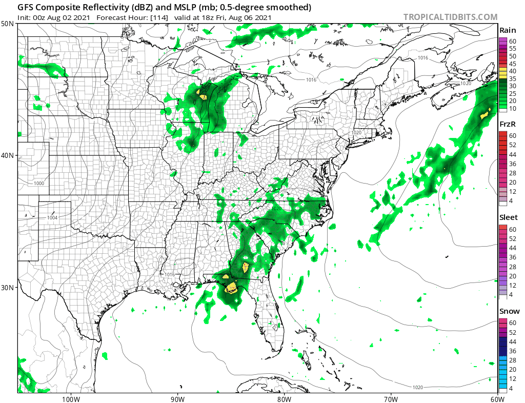
The European model brings up one single wave for later Thursday into Friday leaving rain out for Wednesday and also has it all done before the weekend arrives while the GFS has one last wave coming up for Saturday with more widespread rain and leaving Sunday dry. We are going to lean more toward the European’s idea that the late week wave comes up and pushes the frontal boundary out further east and leaving us with an ok weekend. No heat is in the forecast this week and also no severe weather is forecast (tornadoes, severe thunderstorms) are in the cards for the work week ahead.
BE SURE TO DOWNLOAD THE FREE METEOROLOGIST JOE CIOFFI WEATHER APP &
ANGRY BEN’S FREE WEATHER APP “THE ANGRY WEATHERMAN!

MANY THANKS TO TROPICAL TIDBITS & F5 WEATHER FOR THE USE OF MAPS
Please note that with regards to any severe weather, tropical storms, or hurricanes, should a storm be threatening, please consult your local National Weather Service office or your local government officials about what action you should be taking to protect life and property.


