
Severe Weather Risk Parts of Pennsylvania New Jersey
Another Dry Air Mass Arrives Monday

Weather in 5/Joe & Joe Weather Show Latest Podcast
Severe Weather Risk Parts of Pennsylvania New Jersey Another Dry Air Mass Arrives Monday
Central and Southern New Jersey are probably on some sensitive tender hooks today as well as Eastern Pennsylvania after last Thursday’s round of severe weather. 8 confirmed tornadoes and an EF3 were confirmed and needless to say we don’t want to see that happen again. Fortunately the set up is a little different today.

The risk areas today are less robust than Thursday and the tornado risk is less than 2% even in the area of slight risk. We do not have the screaming high dew points into the 70s and there is a bit of a marine layer that is wedged in at the coast which is why we have the two designated areas separated by an area of general thunderstorm risk.
SATELLITE

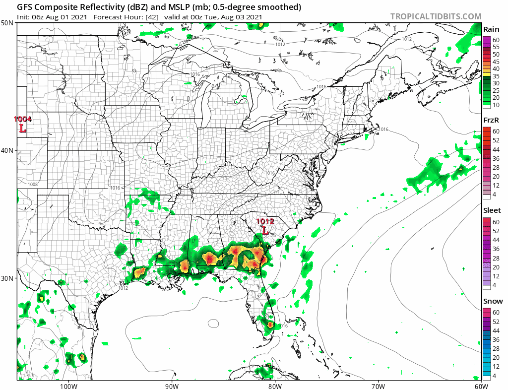
In the meantime we do have clouds building on the satellite views and the radars are picking up some light scattered showers developing ahead of a cold front that will arrive this evening. With that front there will be some heavier downpours and some thunderstorms as the front passes. Temperatures today will be in the 70s to around 80 degrees.
WEATHER RADAR


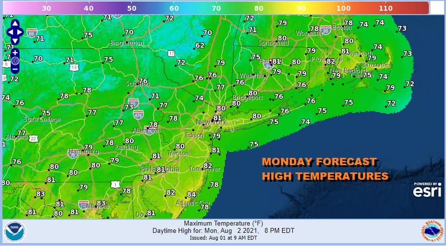
Once the front passes offshore tonight it will stall to our south and east but it will be far enough offshore to allow another dry air mass to build for the first part of next week. Skies should clear out tonight. Lows by morning will be in the upper 50s to mid 60s. Monday will be mostly sunny and the humidity levels will be low. Highs will reach the upper 70s to around or just over 80 degrees.
The front stalled offshore has a strong ridge to its east and a trough to its west with a southwest flow that sets up over the course of the week. 2 waves will develop on that front. The first one Tuesday will be offshore but clouds will likely back westward and rain will come close to coastal areas Tuesday afternoon and evening before that low pulls away.
Temperatures Tuesday will likely be in the 70s with some 80s well inland where the sun has a chance to shine for awhile before high clouds take over. Wednesday appears dry as the first wave pulls out and we should see sunshine. Highs will reach into the lower 80s in most places. The second wave comes up Thursday into Friday and could skirt the coast with another round of rain but it could be also pushed a little further east. For now we will leave the chance for rain in the forecast for later Thursday into Friday. Temperatures Thursday will be in the 70s to near 80 and we should be into the 80s on Friday. Dew points this week will be mostly on the low side keeping things reasonably comfortable and that should also keep us out of the zone for severe weather.
BE SURE TO DOWNLOAD THE FREE METEOROLOGIST JOE CIOFFI WEATHER APP &
ANGRY BEN’S FREE WEATHER APP “THE ANGRY WEATHERMAN!

MANY THANKS TO TROPICAL TIDBITS & F5 WEATHER FOR THE USE OF MAPS
Please note that with regards to any severe weather, tropical storms, or hurricanes, should a storm be threatening, please consult your local National Weather Service office or your local government officials about what action you should be taking to protect life and property.


