
DOWNLOAD MY NEW FREE JOESTRADAMUS WEATHER APP FOR ALL DEVICES
THE APP IS ABSOLUTELY FREE TO ALL BUT CONSIDERING SUBSCRIBING TO PATREON FOR A WEATHER EXPERIENCE FREE OF ADS, EXCLUSIVE VIDEOS FOR MEMBERS ONLY AND MUCH MORE…STARTS AT $2 A MONTH..MESSAGE ME AT ANY TIME
Nice March Day No Rain Until Thursday Night
We cleared out nicely this morning and we are seeing some nice weather for the next 3 days and possibly most of a fourth day (Thursday). There are some high clouds streaming to the south of us and they could sneak in parts of the area today but that is really all that we have to worry about. Temperatures should reach into the 50s before colder air starts to come in tonight and for Tuesday into Wednesday morning. Radars are mostly silent with the exception of snow snow showers in upstate NY & New England.
REGIONAL RADAR

REGIONAL RADAR

Tonight should be nice and clear but cold with lows in the 20s in most places with lower 30s in the warmer urban areas and along the coast. Tuesday we will see sunshine but it will be colder with highs just in the low to mid 40s and then we will be clear with lows in the teens and lower 20s for Wednesday morning.
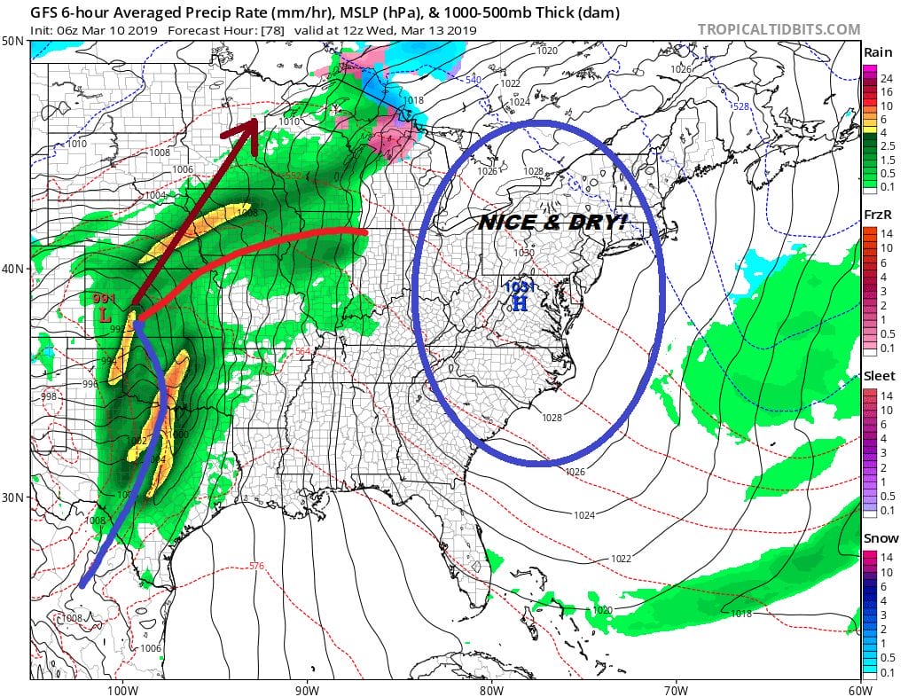
Wednesday brings the center of a slow moving high overhead. We should see lots of sunshine with highs in the 40s after a cold morning start. The large high is taking its time moving east and a storm in the Plains is headed northward toward the upper Mississippi Valley bringing the potential for flooding rains there. The track of the low is so far west that its impact here won’t arrive until Thursday night. This means Thursday we should see sunshine giving way to arriving clouds with highs reaching the 50s away from the ocean. Then we could see some showers Thursday night and Friday as a cold front approaches and slowly moves through.
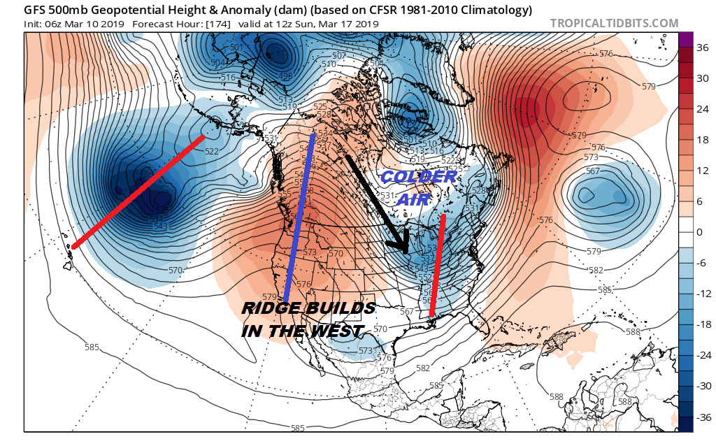
The upper air pattern changes over the weekend with a flow opening up from Canada and a strong ridge of high pressure aloft building in the west. This brings a colder pattern over the weekend and into next week. For now it looks to be cold and dry Saturday through early next week. Saturday we will see some sunshine with highs in the 40s. Saint Patrick’s day will be cold but dry with sunshine with temperatures just into the 40s for an early look. There will be no issues with parades and celebrations next weekend on either day.
MANY THANKS TO TROPICAL TIDBITS FOR THE USE OF MAPS
Please note that with regards to any tropical storms or hurricanes, should a storm be threatening, please consult your local National Weather Service office or your local government officials about what action you should be taking to protect life and property.


