DOWNLOAD MY NEW FREE JOESTRADAMUS WEATHER APP FOR ALL DEVICES
THE APP IS ABSOLUTELY FREE TO ALL BUT CONSIDERING SUBSCRIBING TO PATREON FOR A WEATHER EXPERIENCE FREE OF ADS, EXCLUSIVE VIDEOS FOR MEMBERS ONLY AND MUCH MORE…STARTS AT $2 A MONTH..MESSAGE ME AT ANY TIME
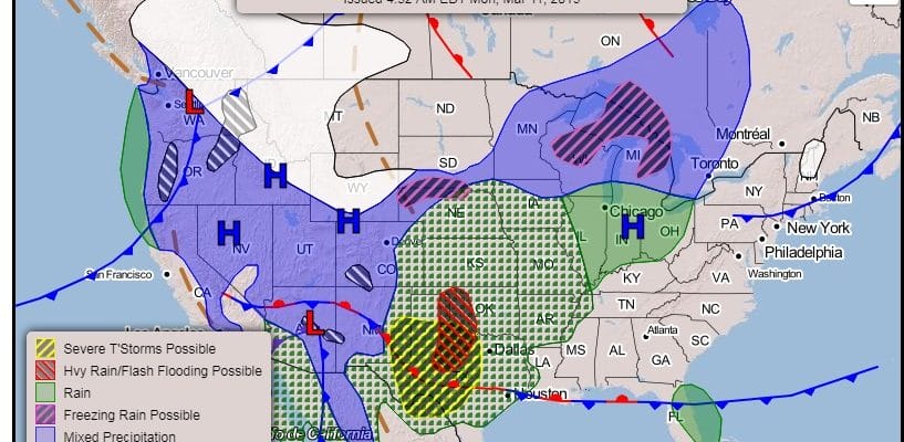
Major Storm Plains Upper Midwest Means Nice Weather Here
Our weather here will be nice into Thursday which is in direct contrast to the Central & Northern Plains and the upper Midwest which will experience a major rain storm. The issue for the Central & Northern Plains is the deep snow cover that exists and now we have the potential of putting 2 inches or more of rain on top of this. The result could be significant flooding and runoff as everything is still frozen solid up there. Severe weather will break out on Tuesday in West Texas and shift eastward on Wednesday. While all that is going on well to the west, we are under high pressure which protects us at least into the daytime Thursday.
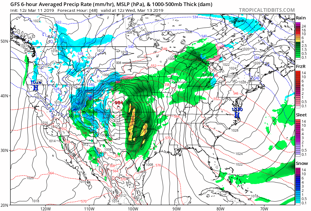
Meanwhile notice on the loop of the GFS, high pressure holds along the East Coast into Thursday. As long as that high is there the western storm can’t make eastward progress. Tuesday Wednesday and the daytime Thursday will be dry and nice most of the time. Temperatures are about where they should be for this time of year. Low to mid 40s will do it for Tuesday, upper 40s to lower 50s look likely for Wednesday and 50s in most places on Thursday.
SATELLITE

MANY THANKS TO TROPICAL TIDBITS FOR THE USE OF MAPS
Please note that with regards to any tropical storms or hurricanes, should a storm be threatening, please consult your local National Weather Service office or your local government officials about what action you should be taking to protect life and property.