Nice Friday Afternoon Weekend Looks Decent with
Shower Thunderstorm Risk Early & Late Sunday

Weather in 5/Joe & Joe Weather Show Latest Podcast
Nice Friday Afternoon Weekend Looks Decent with
Shower Thunderstorm Risk Early & Late Sunday
Here we are at the end of a another summer week and we are finishing it off with plenty of sunshine, reasonable temperatures and reasonable humidity. The radar is quiet and we see no issues there through Saturday evening so we just remain on cruise control. Highs this afternoon will be in the low to mid 80s. Judging from the satellite pictures and loops today the smoke issue has mostly disappeared thanks to the northerly upper air flow from Canada.
SATELLITE

A nice night lies ahead with lows mostly in the mid to upper 60s in coastal and warmer urban centers and in the 50s in the cooler more rural locations inland. Saturday starts mostly sunny and probably finishes with some high clouds coming into the mix. Dew points will still hold mostly below 60 which means reasonable humidity. Highs Saturday will be mostly in the 80s.
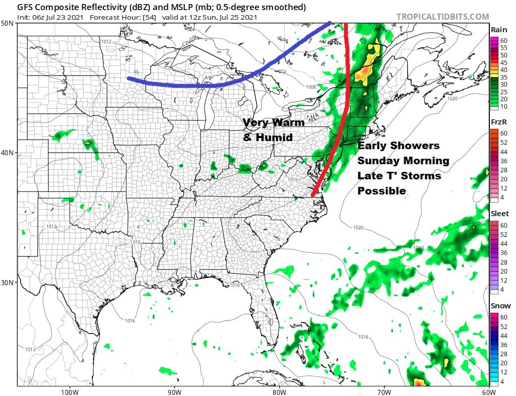
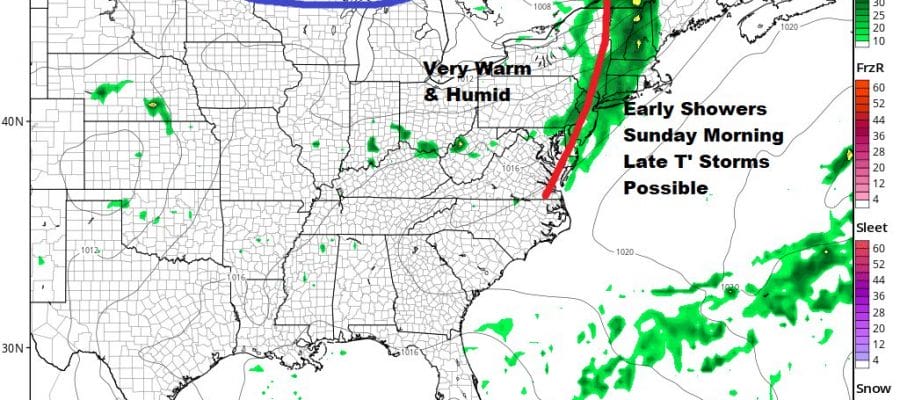
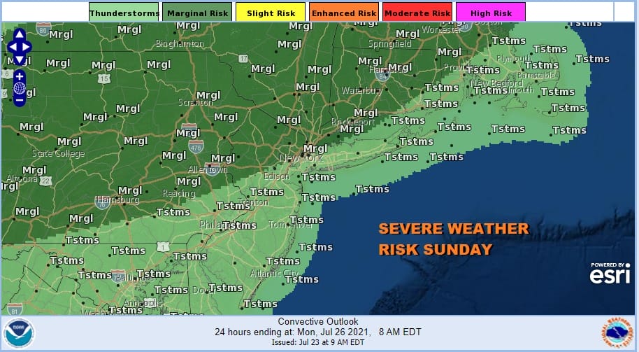
The next round of fronts and changes start Saturday night with a warm front going by Sunday morning. Ahead of this we will have a few showers or possibly a thunderstorm. Then we switch to very warm and humid conditions Sunday afternoon with clouds and some sun. There is the chance for thunderstorms popping up late in the day and the Storm Prediction Center has a marginal risk for severe weather. Sunday’s highs will be in the mid 80s to around 90 degrees.
Next week we see the northwest flow from Canada continuing which means we have cold fronts coming through every couple of days. One is lingering nearby Monday. Another approaches late Wednesday. The late Wednesday front looks like it could be an active one. Otherwise each day looks no worse than partly sunny. We are looking at high temperatures Monday through Wednesday in the mid 80s to lower 90s. Wednesday sees the best chance for thunderstorms. A slight easing of humidity occurs Monday into early Tuesday before it rises into Wednesday. Late next week we get another decent shot of dry comfortable air.
BE SURE TO DOWNLOAD THE FREE METEOROLOGIST JOE CIOFFI WEATHER APP &
ANGRY BEN’S FREE WEATHER APP “THE ANGRY WEATHERMAN!

MANY THANKS TO TROPICAL TIDBITS & F5 WEATHER FOR THE USE OF MAPS
Please note that with regards to any severe weather, tropical storms, or hurricanes, should a storm be threatening, please consult your local National Weather Service office or your local government officials about what action you should be taking to protect life and property.


