Warm Front Showers Sunday Morning
More Humid Evening Scattered Storms Sunday

Weather in 5/Joe & Joe Weather Show Latest Podcast
Warm Front Showers Sunday Morning
More Humid Evening Scattered Storms Sunday
We are holding on to reasonable humidity for a little while longer as the satellite shows the Northeast in sunshine. Highs this afternoon will be in the 80s with temperatures a little cooler at the shore. To the west we see high clouds and those are ahead of a warm front that extends southward from the Central Great Lakes. Ahead of the front some showers will develop later in the day so the high clouds will start to arrive during this afternoon. For the vast majority of the rest of today should be mostly to at worst partly sunny.
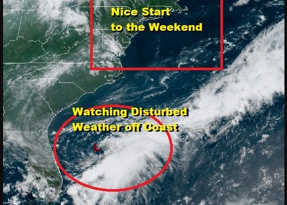
SATELLITE

Off the Southeast coast of the US is an old frontal trough that continues to produce a concentrated area of showers and thundertorms. On the west side of the cloud band there appears to be a swirl of lower clouds indicating that a low level circulation may be developing here. The National Hurricane Center has a 60 percent chance of tropical cyclone formation occurring over the weekend and we will monitor developments. More on this system in the long range below.
WEATHER RADAR


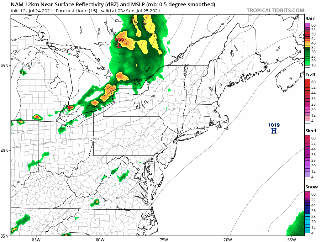
Meanwhile back to the short term, the approaching warm front will have some showers and possibly a thunderstorm ahead of it and we will see a line of those showers move through early Sunday morning from west to east. The band will be narrow and it won’t last long. The map loop below is from 11am tonight to 11am Sunday morning. Temperatures overnight will hold in the mid 60s to lower 70s in most places.
Once the showers pass Sunday morning skies should slowly go partly sunny and the humidity quickly rises. It will be much more humid Sunday with dew points climbing through the 60s and temperatures reaching the mid 80s to near 90 Sunday afternoon. Sunday evening as a cold front nears, the chance for scattered thunderstorms becomes part of the equation. While the Storm Prediction Center has a marginal risk for severe weather thunderstorms look to be scattered in nature at this point and severe thunderstorms if they develop should be isolated and not organized.

The week ahead is all about a northwest flow in the upper atmosphere and cold fronts passing from time to time. Sunday’s front isn’t anything to write home about and temperatures Monday will be very warm. The humidity may edge a little lower only to go higher on Tuesday. Look for partly to mostly sunny skies Monday and Tuesday with highs in the 80s to near 90. Another front approaches Wednesday with a shower or thunderstorm possible with that. Late Thursday brings the strongest front of the bunch and this one might produce more widespread shower and thunderstorm late in the day Thursday. This will be followed by a nice dry shot of air for Friday and next weekend.

Back now to the system off the Florida and Southeast US coast. First off the upper flow in the Northeast and Mid Atlantic states is from the northwest so this has no chance to move up the east coast. It seems this system will miss the trough moving offshore today and will probably either meander around off the coast for the next few days, or it will be forced west or west southwest toward Florida and into the Gulf of Mexico. While conditions are favorable for some develop they are not ideal at the moment. We will monitor satellite loops this afternoon as it does appear that a low level center is forming or has formed. An Air Force Plane is on stand by ready to investigate if necessary. Otherwise enjoy your weekend.
BE SURE TO DOWNLOAD THE FREE METEOROLOGIST JOE CIOFFI WEATHER APP &
ANGRY BEN’S FREE WEATHER APP “THE ANGRY WEATHERMAN!

MANY THANKS TO TROPICAL TIDBITS & F5 WEATHER FOR THE USE OF MAPS
Please note that with regards to any severe weather, tropical storms, or hurricanes, should a storm be threatening, please consult your local National Weather Service office or your local government officials about what action you should be taking to protect life and property.


