Nice Day Overall Clouds Hanging Near The Coast
Weekend Outlook Thunderstorms Monday

Nice Day Overall Clouds Hanging Near The Coast
Weekend Outlook Thunderstorms Monday
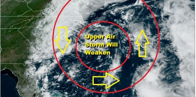
The old coastal storm has become this large sprawling disorganized mess offshore. We have the center of the low sitting off the coast but the upper air circulation is large and it has brought in an arc of clouds from Southern New England to Southern New Jersey and points south. Thin spots are developing in those clouds so there is a good chance some areas will go partly sunny this afternoon. Inland north and west skies are mostly sunny and there temperatures will climb much faster. Inland highs will be in the mid 70s to near 80. Coastal highs because of the clouds will be in the mid 60s to lower 70s.Though we have clouds, the radars are nice and quiet.
SATELLITE

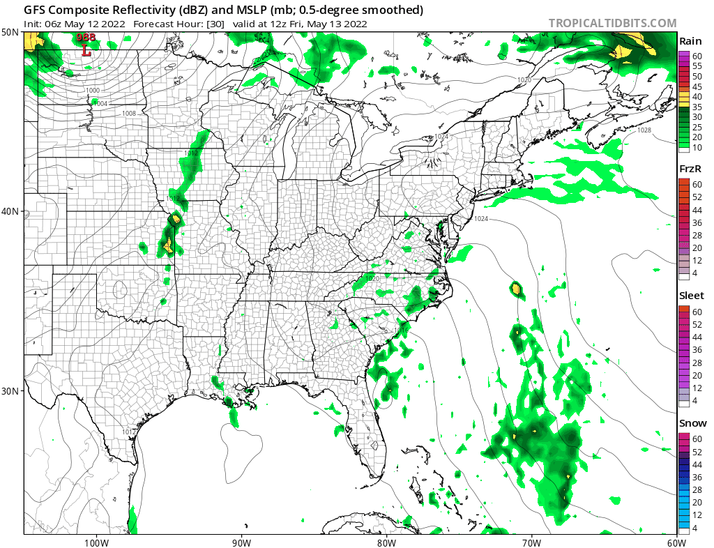
WEATHER RADAR

The features at the surface and aloft begin to weaken tonight and into the weekend and that brings a change to the overall flow. Unfortunately we do have all those clouds offshore. The flow will turn southeast surface and aloft and and that will bring those clouds in tonight. Lows will be mostly in the 50s. There might even be some spotty light rain or drizzle offshore that might start to move inland by daybreak.

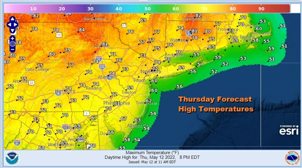
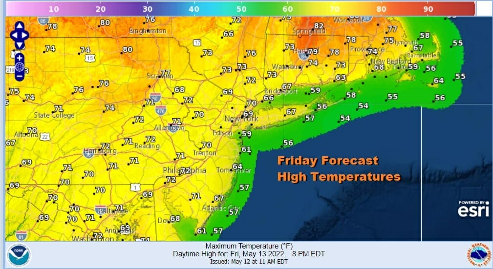
Friday will be a mostly cloudy type of day with changeable sky conditions. The further inland you go the better chance you might see some sun. There temperatures will again be warmer but clouds will be a dominant feature and that will keep temperatures from rising much. Most highs will be in the upper 60s and lower 70s. We will include the chance that there could be some scattered showers or some patches of rain or drizzle.
On to the weekend where the upper low will be gone and it will move up to our west as a weak trough. This is going to keep us with some cloud issues over the weekend. I think Sunday will be a better day than Saturday overall however it will by no means be a washout. There will be an area of rain offshore Saturday that will pass just barely to the east so as long as that remains the case we should be okay overall.
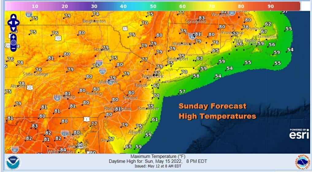
Clouds will once again impact temperatures Saturday with highs in the upper 60s along the coast and low to mid 70s inland and north. Sunday however with the remnants of the old storm finally all gone and the next cold front not due until Monday, we should have a partly sunny day and as a result we should warm up nicely. Highs Sunday will be in the mid 70s coast and upper 70s and lower 80s inland.
Monday we have an approaching cold front There will be a strong short wave trough that will be swinging out of the Great Lakes and into the Eastern US. This often times can lead to showers and thunderstorms Monday afternoon and evening and there is a chance that there could be some isolated strong thunderstorms. Before the showers arrive there should be some sunshine and daytime heating will take highs to the upper 70s to some lower 80s. Dew points will be high so it will be humid.

We should be drier and cooler Tuesday into Wednesday before the next cold front arrives later next week. There is no indication of a blocking pattern coming back anytime soon. Instead we will be in a more normalized pattern of west to east moving systems and cold fronts coming through every couple of days
BE SURE TO DOWNLOAD THE FREE METEOROLOGIST JOE CIOFFI WEATHER APP &
ANGRY BEN’S FREE WEATHER APP “THE ANGRY WEATHERMAN!
MANY THANKS TO TROPICAL TIDBITS & F5 WEATHER FOR THE USE OF MAPS
Please note that with regards to any severe weather, tropical storms, or hurricanes, should a storm be threatening, please consult your local National Weather Service office or your local government officials about what action you should be taking to protect life and property.


