
Clouds Patchy Rain And Breaks Of Sun Friday
Weekend Outlook Thunderstorms Later Monday

Clouds Patchy Rain And Breaks Of Sun Friday
Weekend Outlook Thunderstorms Later Monday
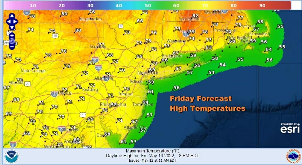
Judging from satellite views, radars, and surface observations we have a little bit of everything for everyone’s weather preferences. We are seeing clouds but some places are getting breaks of sun. Others are in a more overcast condition and the radar is picking up on small patches of light rain over parts of New Jersey and Long Island. Such is the nature of our weather today as winds surface and aloft have turned more southeast and eventually they will turn more to the south. This is bringing in some of the “junky” moisture offshore that is leftover from the old coastal storm and its parent upper air storm system. In the meantime you can look for changeable sky conditions for the afternoon, that patchy or two of light rain and that break or two of sun. Highs will be generally in the mid 60s to lower 70s.
SATELLITE

WEATHER RADAR

Not much changes tonight or Saturday as this flow off the ocean continues. Temperatures overnight will be in the 50s to near 60. Look for clouds, fog, and some patchy light rain in a some places. Saturday will be a repeat performance of today as we continue to sit in clouds with changeable skies and a few patches of light rain or drizzle. There might be a few steadier showers scattered around in the afternoon and evening. Highs will be in the mid 60s to lower 70s again.
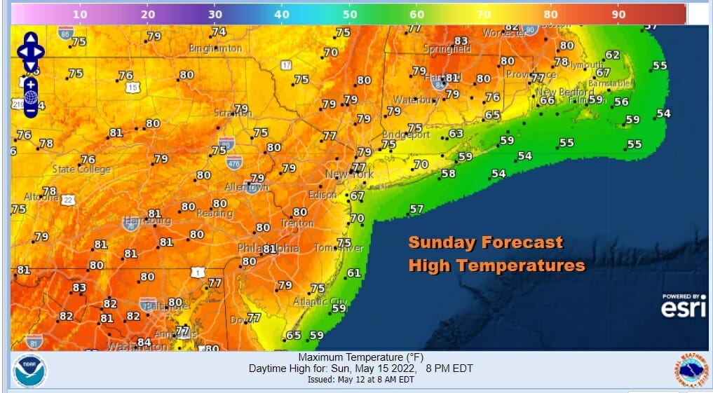
Sunday will be the better of the two weekend days. We will start with clouds early and go to sunshine. Winds will be more southwesterly so that will allow for more of a general warm up. Highs will be in the mid 70s to lower 80s. A trough approaches with showers and thunderstorms from Pennsylvania but as they move east they should start to die off before reaching the coast.

Monday we see a stronger cold front that will head our way from the Great Lakes along with a strong upper trough. Some sunshine should take highs into the 80s inland and 70s to near 80 along the coast. Dew points will be into the 60s. Combining these factors we could see some isolated stronger thunderstorms in the mix late in the into Monday evening. Tuesday and Wednesday look dry and seasonal. Thursday we have another front and another chance for showers or a possible thunderstorm. We may follow that with some nice weather Friday and next weekend.
BE SURE TO DOWNLOAD THE FREE METEOROLOGIST JOE CIOFFI WEATHER APP &
ANGRY BEN’S FREE WEATHER APP “THE ANGRY WEATHERMAN!
MANY THANKS TO TROPICAL TIDBITS & F5 WEATHER FOR THE USE OF MAPS
Please note that with regards to any severe weather, tropical storms, or hurricanes, should a storm be threatening, please consult your local National Weather Service office or your local government officials about what action you should be taking to protect life and property.


