Nice Day Of Sunshine Warmer Wednesday Thursday
Late Day Showers Thunderstorms

Weather in 5/Joe & Joe Weather Show Latest Podcast
Nice Day Of Sunshine Warmer Wednesday Thursday
Late Day Showers Thunderstorms
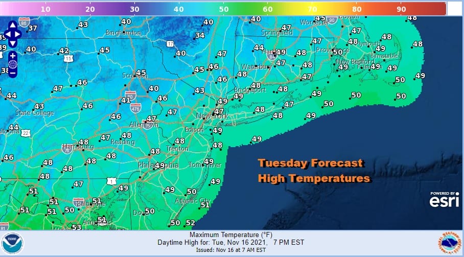
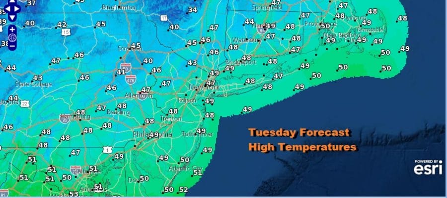
This latest shot of cold air will hit bottom today and the core of the air mass will move off the South Atlantic coast late today. This leaves us with a nice day of sunshine. Temperatures this afternoon will top out in the mid to upper 40s in most places. There are no radar issues to concern ourselves with. The satellite shows mostly cloud free conditions with the exception of some patchy clouds around in some inland areas. Overall it will be a good day and we can start to warm things up over the next couple of days.
SATELLITE

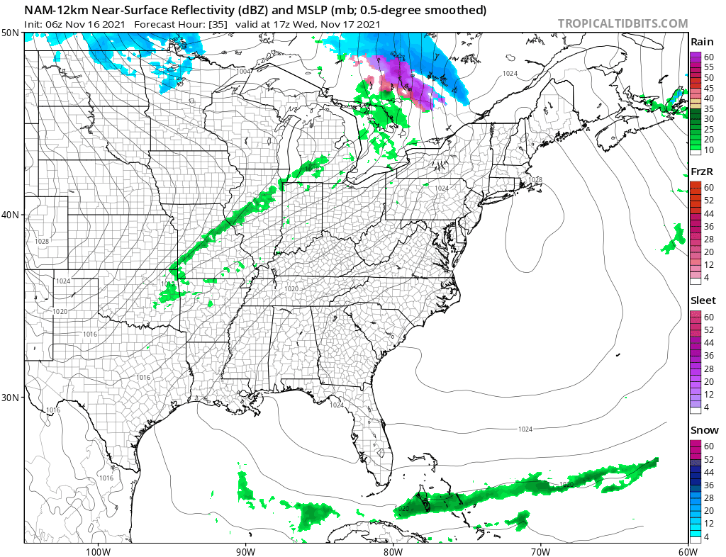
WEATHER RADAR

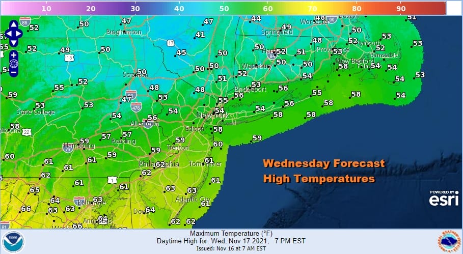
Tonight should be mostly clear with most lows in the 20s inland and in cold spots and low to mid 30s everywhere else. Wednesday looks to be a partly sunny day with a southwest flow developing and that should boost highs into the 50S in most places. Areas ot the south across Southern Pennsylvania and Southern New Jersey southward should see highs reach 60 or better in some places.
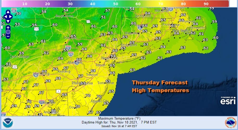
Thursday will be the warmest day of the week with sunshine for most of the day. Some clouds will probably arrive later in the day ahead of the next cold front. We expect showers from this front to hold off until after sunset so the dayside will be dry. Highs will reach the middle to upper 60s and some of the warmest spots could approach 70 degrees.
We are going to throw in the chance for a rumble or two of thunder Thursday night but we do not expect another severe weather outbreak and certainly nothing on the level of what happened Saturday. Rain Thursday night into Friday morning will produce quarter of an inch or so of rain.
Another shot of cold air comes in for Friday and Saturday. Some sunshine and clouds plus a gusty wind is the outlook for Friday with highs in the 40s. Saturday we will start the weekend off with some sunshine with most highs in the low to mid 40s. Sunday looks good with no rain. The next storm system will intensify Monday as it moves across the Great Lakes to Southern Canada. This brings another cold front and another round of showers and possible thunderstorms to kick off Thanksgiving week.
BE SURE TO DOWNLOAD THE FREE METEOROLOGIST JOE CIOFFI WEATHER APP &
ANGRY BEN’S FREE WEATHER APP “THE ANGRY WEATHERMAN!

MANY THANKS TO TROPICAL TIDBITS & F5 WEATHER FOR THE USE OF MAPS
Please note that with regards to any severe weather, tropical storms, or hurricanes, should a storm be threatening, please consult your local National Weather Service office or your local government officials about what action you should be taking to protect life and property.


