
Another Cold Front Passes Breezy Cold Into Tuesday Warmer Wednesday Thursday

Weather in 5/Joe & Joe Weather Show Latest Podcast
Another Cold Front Passes Breezy Cold Into Tuesday Warmer Wednesday Thursday
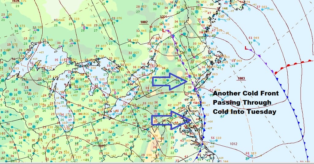
Finally the last cold front in a series of 3 has passed through this morning and that now puts us into cold breezy conditions for today into Tuesday. Overnight showers have also moved to the east. The last of those are clearing Long Island. Clouds remain with some breaks of sun that should develop this afternoon but temperatures will hold in the 40s with a gusty west northwest wind. This will lead us to a cold night as skies partially clear. Most lows by Tuesday morning will be in the upper 20s to mid 30s.
SATELLITE

WEATHER RADAR

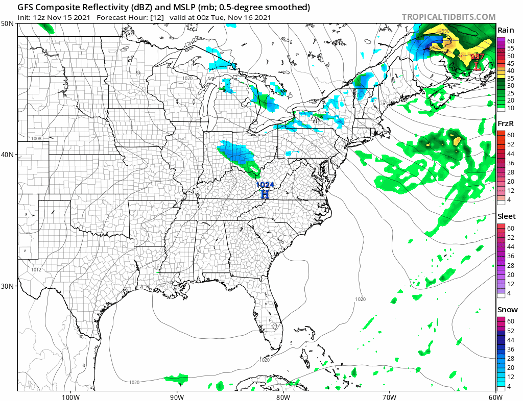
High pressure from South Central Canada will move quickly toward the South Atlantic Coast Tuesday. It should be a day of sunshine but it will still be breezy until the high reaches the coast. It will also be cold with most highs in the 40s to around 50. Then a warmup begins taking us through the middle of the week.
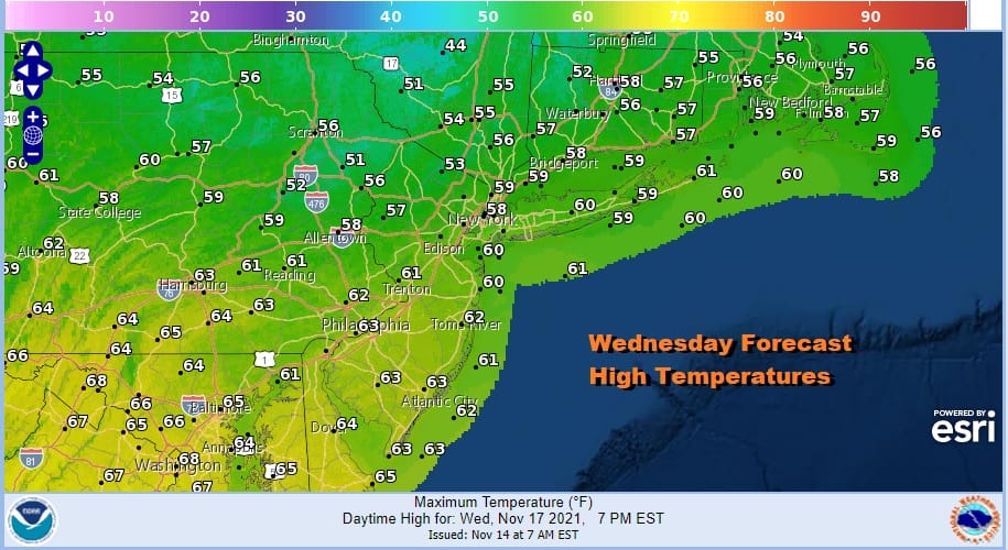
Temperatures should move up quickly Wednesday as a warm front passes well to our north and southwest winds take temperatures up to the upper 50s to around 60 or so Wednesday afternoon. We should see plenty of sunshine.
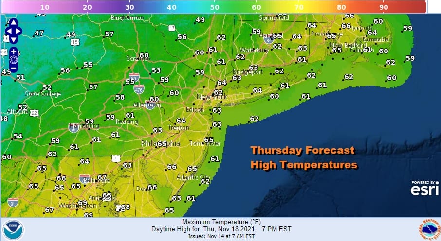
Thursday we have a cold front that will be approaching late in the day. Ahead of it we will have sunshine into the afternoon. Highs will likely reach the low and middle 60s. The front will move through Thursday evening and there will be showers and perhaps a few thunderstorms.
Everyone is probably on tenterhooks after Saturday’s extraordinary severe weather event but the upper trough is not nearly as potent as Saturday’s so for now we will lean on the idea that thunderstorms will not be severe but that could change as we draw closer. Friday will be breezy and cold with sunshine and clouds. High will likely just be in the low to mid 40s and cold air from Canada sweeps into the east behind the front. Next weekend will bring another cold front late Sunday into Monday and that sets us up for a rather interesting Thanksgiving week of weather. Colder air will be setting up across Canada and making a run into the Eastern US at some point. We also have indications that some energy from the west will head eastward. We will sort all this out in the coming days.
BE SURE TO DOWNLOAD THE FREE METEOROLOGIST JOE CIOFFI WEATHER APP &
ANGRY BEN’S FREE WEATHER APP “THE ANGRY WEATHERMAN!

MANY THANKS TO TROPICAL TIDBITS & F5 WEATHER FOR THE USE OF MAPS
Please note that with regards to any severe weather, tropical storms, or hurricanes, should a storm be threatening, please consult your local National Weather Service office or your local government officials about what action you should be taking to protect life and property.


