Clouds Will Arrive Ahead of Next Upper Trough
Showers Overnight Into Monday Snow Well Inland
Weather in 5/Joe & Joe Weather Show Latest Podcast
Clouds Will Arrive Ahead of Next Upper Trough
Showers Overnight Into Monday Snow Well Inland
Yesterday’s sharp upper trough and cold front that produced widespread severe weather across New Jersey to Southern New England, the Hudson Valley and Long Island is now long gone and another upper trough is approaching. This one will not be the powerhouse we saw yesterday so now severe weather this time. Sunshine today will give way to arriving clouds and we can already see those clouds to the west. Temperatures today will top out in the 40s to around 50 degrees.
SATELLITE
Regional radar is showing what appears to be a stick of rain and wet snow to the west and crawling eastward. Some of the precip is aloft, that is it is not reaching the ground. That will change some later today as the Great Lakes upper trough shifts eastward.
WEATHER RADAR
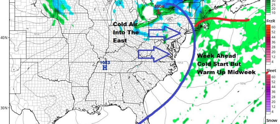
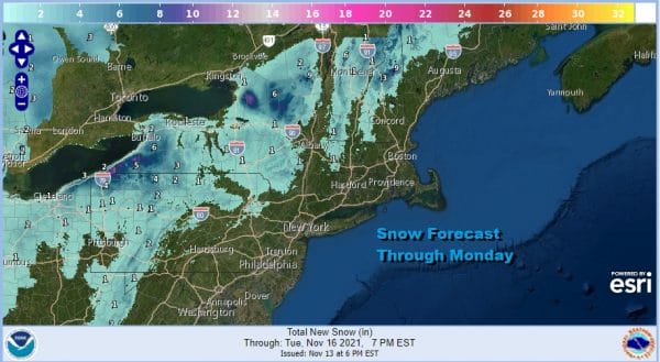
During tonight we will see some rain showers move across the coastal plain. It won’t amount to much rainfall wise; we are talking mostly a tenth of an inch or less. It certainly won’t come with the melodramatics of yesterday. Across Northern Pennsylvania to Western Pennsylvania and then north into Upstate NY to about Interstate 81 there will be wet snow on the order of a coating to a couple of inches and most of that will be elevation driven.
It will be breezy and chilly overnight with lows mostly in the 30s. Monday will be a breezy cold day with some sunshine and clouds, a gusty breeze with highs just in the 40s and then down to the upper 20s to mid 30s Tuesday morning. Tuesday will be a sunny but chilly day with highs in the 40s.
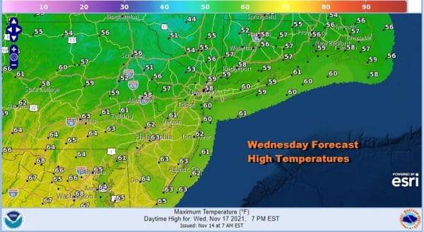
Wednesday begins the temperature rebound and we will rebound quickly. Sunshine and a west wind will take highs through the 50s to around 60. The warm up will peak on Thursday with sunshine giving way to arriving clouds. Highs Thursday will be in the low to mid 60s.
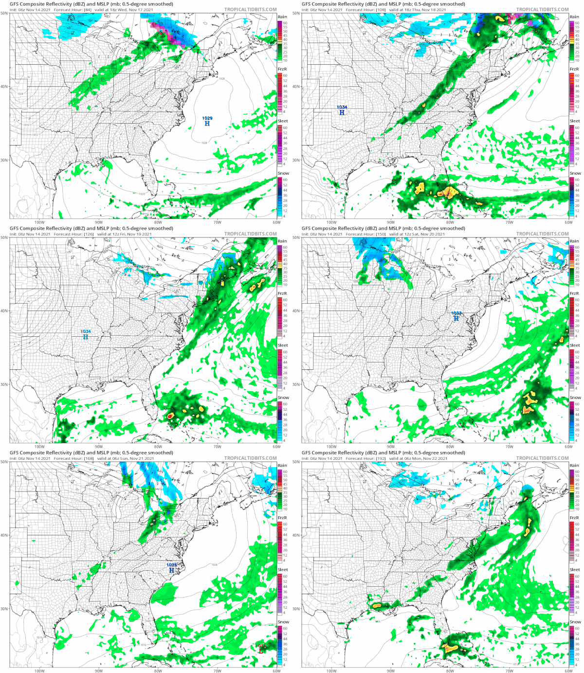
The next cold front will move along and move through Thursday taking us back down in temperatures Friday into next weekend. Models continue to struggle for Thanksgiving week painting two ideas that are polar opposites. We have a major storm to the Great Lakes on the European and we have simple cold fronts on the GFS. This is the issue for the long range in a rather confusing pattern.
BE SURE TO DOWNLOAD THE FREE METEOROLOGIST JOE CIOFFI WEATHER APP &
ANGRY BEN’S FREE WEATHER APP “THE ANGRY WEATHERMAN!
MANY THANKS TO TROPICAL TIDBITS & F5 WEATHER FOR THE USE OF MAPS
Please note that with regards to any severe weather, tropical storms, or hurricanes, should a storm be threatening, please consult your local National Weather Service office or your local government officials about what action you should be taking to protect life and property.


