Nice Day Dry Week No Major Storms Just Quiet And Chilly

Weather in 5/Joe & Joe Weather Show Latest Podcast
Nice Day Dry Week No Major Storms Just Quiet And Chilly
Our week begins quiet with the surface features in about the same places they were yesterday. Low pressure is sitting in Eastern Canada. A series of weak cold fronts and upper troughs will be driving the weather this week. Temperatures are chilly but not overly cold. Storms are lacking across much of the US. This will be the story all week along and about the only issues this week will be how much sun we get each day and temperatures which will taking a slow move down in stairstep fashion.
SATELLITE

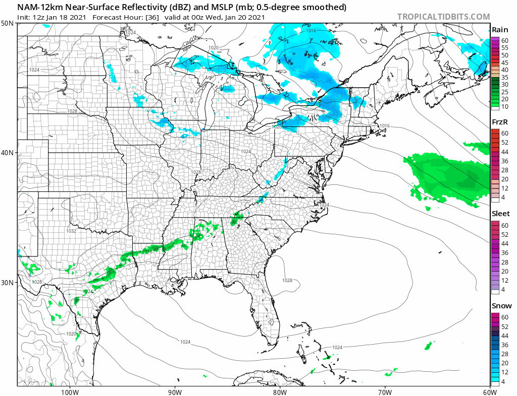
The satellite is showing clear skies along the coastal plain with clouds mostly to the west and north as the lake effect snow machine is still working overtime. We are seeing bands of snow in Upstate NY as well as some bands to the south in the Central Appalachians thanks to an upper trough. None of this is a bother to us other than occasional clouds that will move through from time to time.


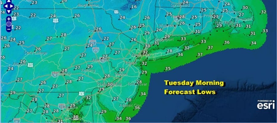
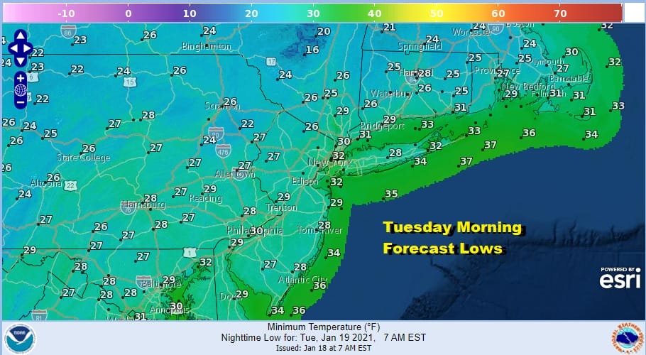
Temperatures today will be mainly in the low to mid 40s. A weak cold front to the north moves through and brings slightly colder air in tonight. Skies should at least partially clear. By Tuesday morning lows will be in the 20s to near 30.
Tuesday will be like today except that temperatures will be a few degrees lower. Look for sunshine and a few clouds Highs will be in the lower 40s. Then it turns a little colder Tuesday night into Wednesday morning with lows in the 20s to near 30. Wednesday will be cold and at least close to average for this time of year. Highs will be in the 30s under partly sunny to mostly cloudy skies. Another little push of colder air comes in and takes us down to the teens to mid 20s Thursday morning.

Thursday will be the coldest day of the week with clouds and some sun but probably more clouds than anything else as another upper trough moves through. Highs will be in the low to mid 30s in most places.
Friday sees a bump up in temperatures to the lower 40s before another cold front passes. The front is weak so no precipitation is forecast. It will just bring another shot of cold air with high pressure for the weekend. Look for clouds and sun Friday and sunshine for the weekend. Highs Saturday and Sunday will just be in the low to mid 30s. Next week could finally bring a break to this latest string of dry weather as a storm comes out of the Rockies and heads east. The block will determine where this goes. If the block relaxes too much it heads to our west. If it stays strong it could get suppressed well to the south. It will have to thread a very fine needle regarding any snow threat here.
BE SURE TO DOWNLOAD THE FREE METEOROLOGIST JOE CIOFFI WEATHER APP &
ANGRY BEN’S FREE WEATHER APP “THE ANGRY WEATHERMAN!
MANY THANKS TO TROPICAL TIDBITS FOR THE USE OF MAPS
Please note that with regards to any severe weather, tropical storms, or hurricanes, should a storm be threatening, please consult your local National Weather Service office or your local government officials about what action you should be taking to protect life and property.


