Clouds Sun Chance Snow Showers Wednesday Morning Dry Through Sunday

Weather in 5/Joe & Joe Weather Show Latest Podcast
Clouds Sun Chance Snow Showers Wednesday Morning Dry Through Sunday
Not much has changed since yesterday. Low pressure is in Eastern Canada. The northwest flow continues. That is a relatively dry flow but we do have a few weak upper troughs coming through from time to time over the next couple of days. One such upper trough will be moving through Wednesday morning and we could see some scattered snow showers with that. Otherwise today it is a mix of sun and clouds. Most highs today will be in the lower 40s on average.
SATELLITE

Lake effect snows continue in Western NY and Western and Central Pennsylvania and those bands are moving east. Other areas of snow are on the Mid Atlantic regional radar and they are concentrated in the Central Appalachians and they are also moving to the east.


Some clouds will be around tonight into Wednesday morning with temperatures in the upper 20s and lower 30s. Wednesday morning there could be a few scattered snow showers as an upper trough moves by and low pressure develops well offshore. Otherwise clouds will give way to sunshine as the day wears on and winds will be picking up as well. Highs will be in the upper 30s to near 40.
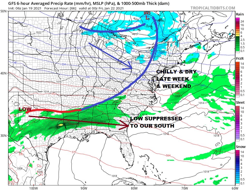
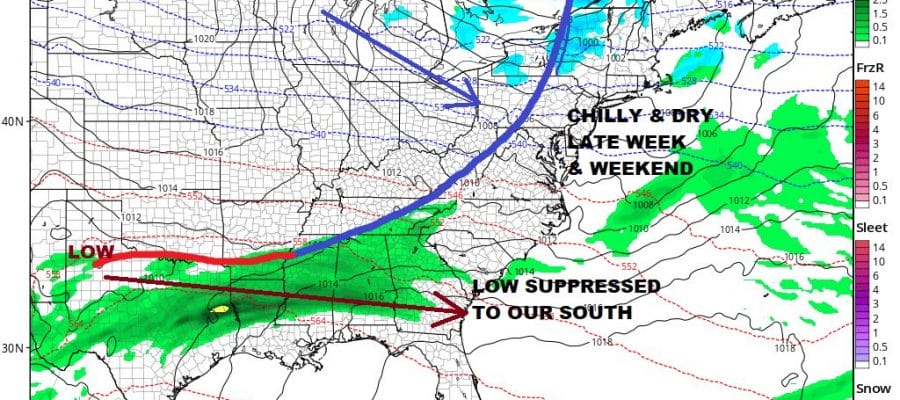
The blocking pattern remains in full force. The stair step decline in temperatures will continue into and through the weekend. Weak low pressure moves across the lower Gulf States and is not an issue here. So we see more of the same with sun and clouds Thursday. Highs will be in the 30s to near 40. Friday will see some sunshine and highs in the 30s.
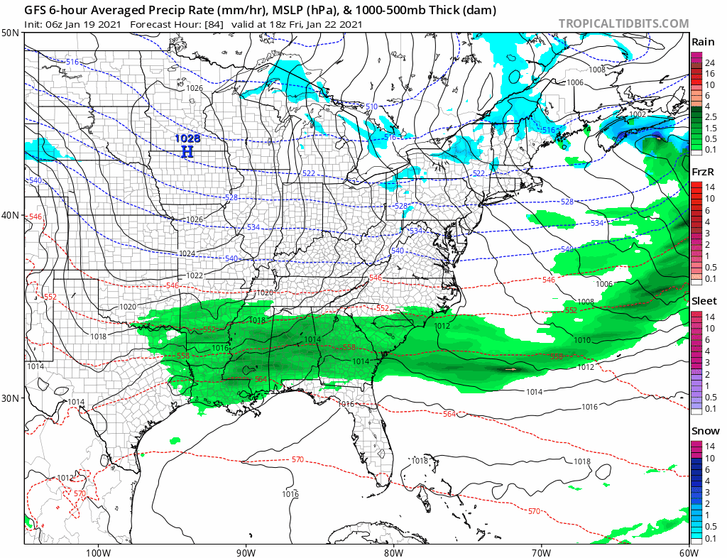
HIgh pressure builds in for the weekend which will be cold and dry with sunshine for both Saturday and Sunday. Most highs will be in the low to mid 30s. Then attention turns to the Southern Plains as low pressure starts to move east. The block is showing signs that it may start relaxing somewhat over the weekend and early next week allowing this low to move east across the Lower Ohio Valley. There should be enough blocking to keep this low on a track to our south but the question will be how far to the south? Models continue to struggle with the block to the east and other changes going on in the Pacific. We would like to see more in coming model runs to determine just exactly what the block is going to do.

This system is now on the radar of the Weather Prediction Center in their long range snow forecast and they have the Mid Atlantic and the Northeast under a risk for at least an inch of snow. This is on their day 8 forecast so to see it here means WPC thinks there is something to this set up. Still it is 8 days away and we have plenty of time to see how it plays.
BE SURE TO DOWNLOAD THE FREE METEOROLOGIST JOE CIOFFI WEATHER APP &
ANGRY BEN’S FREE WEATHER APP “THE ANGRY WEATHERMAN!
MANY THANKS TO TROPICAL TIDBITS FOR THE USE OF MAPS
Please note that with regards to any severe weather, tropical storms, or hurricanes, should a storm be threatening, please consult your local National Weather Service office or your local government officials about what action you should be taking to protect life and property.


