Nice Cold Sunday Week Ahead Outlook Stormy Gloomy Start To New Year

Weather in 5/Joe & Joe Weather Show Latest Podcast
Nice Cold Sunday Week Ahead Outlook Stormy Gloomy Start To New Year
We have a nice day ahead to finish off the last weekend of 2020. Temperatures this morning bottomed in the teens and lower 20s in most places with middle 20s in the warmer urban centers. We should see a good deal of sunshine today, less wind, and highs generally in the upper 30s to near 40 degrees. The satellite picture just shows a few clouds inland and the radars are for the most part nice and quiet across the Northeast with the exception of some leftover lake effect going on this morning in upstate New York.
SATELLITE

Temperatures tonight won’t drop far. We have a cold front arriving Monday. There are no changes with the outlook here as the front comes through with little fanfare other than clouds. Highs will be in the 40s. Then it turns colder again for Tuesday into Wednesday.
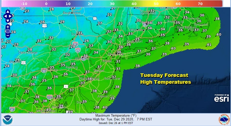
The next cold high builds in for Tuesday and moves offshore later Wednesday. Both days feature sunshine with highs in the low to mid 30s Tuesday and upper 30s to near or just over 40 on Wednesday. The high moving offshore begins the process of bringing the next storm system to the East.
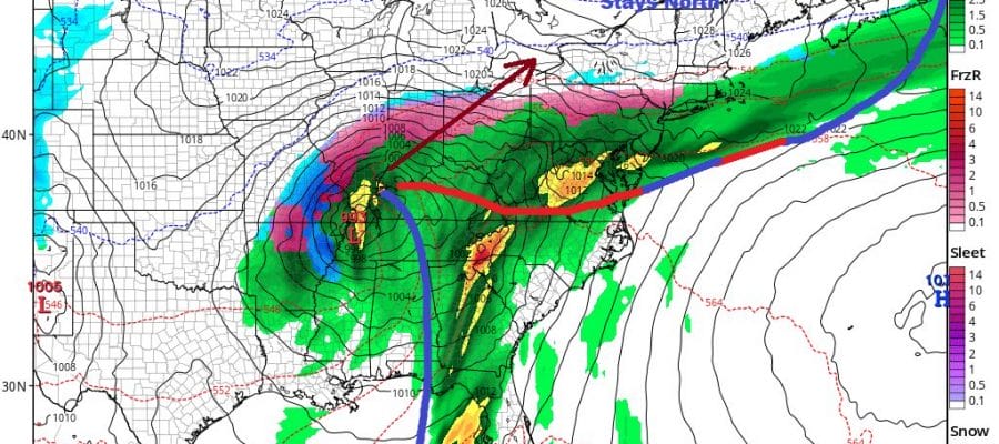
SOME CHANGES IN THURSDAY FRIDAY SYSTEM FOR NEW YEAR’S EVE & DAY
It seems things have changed somewhat for the Thursday Friday system as the lead low that heads to the Great Lakes on Wednesday runs out way ahead of follow up energy so it looks as if we could see a cold front pass through here Thursday morning and put us in a raw northeast flow.
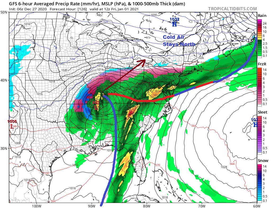
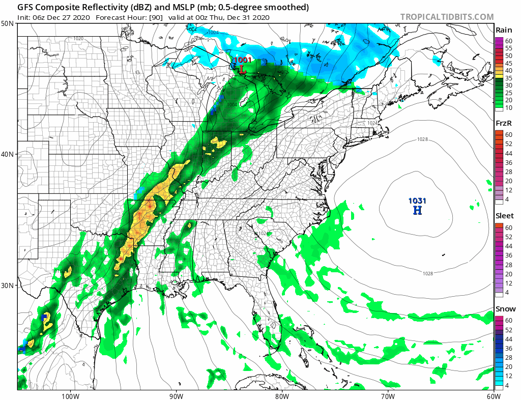
This changes the character of the late week storm system making it less like the Christmas Eve Christmas Day scenario regarding the wind part of the equation at least. Thursday will be cloudy with some rain late in the day and Thursday night with a northeast winds. Highs will likely be in the upper 30s and lower 40s with a very raw feel to things. Low pressure tracks west of the Appalachians and that will attempt to push a warm front through without much success and finally a cold front later Friday as the low goes by. Some rain is likely for Friday before it ends later in the day. The weekend that follows will be dry and cold as we kick off 2021.
BE SURE TO DOWNLOAD THE FREE METEOROLOGIST JOE CIOFFI WEATHER APP &
ANGRY BEN’S FREE WEATHER APP “THE ANGRY WEATHERMAN!
MANY THANKS TO TROPICAL TIDBITS FOR THE USE OF MAPS
Please note that with regards to any severe weather, tropical storms, or hurricanes, should a storm be threatening, please consult your local National Weather Service office or your local government officials about what action you should be taking to protect life and property.


