New Week Begins With Sunshine Ocean Wind No Major Systems This Week
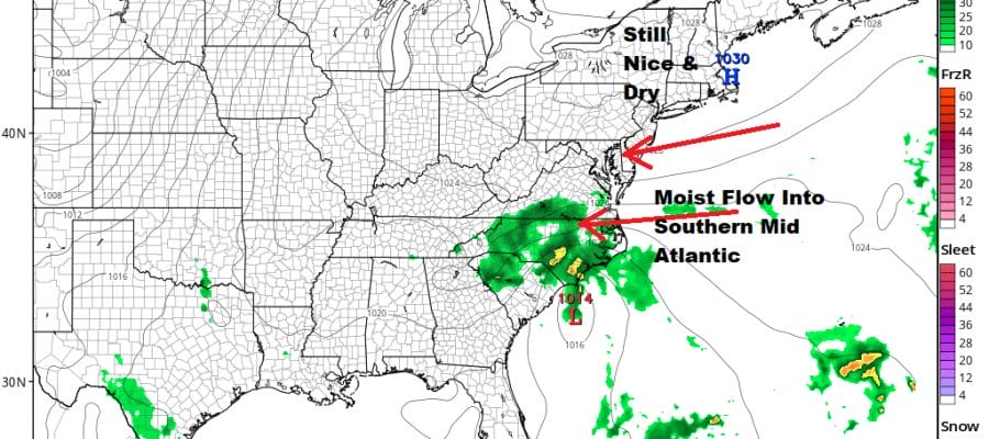
We finished off a nice weekend and now a new week begins. We are starting off the day with some sunshine and we should finish off with sunshine. The wind today will be from the east which will hold temperatures down. To the south and west we have an upper low that will be dropping southward. This will likely put the cloud line across Delaware and Southern New Jersey westward into Southern Pennsylvania and points south. The upper low dropping south means that rain from a weak low developing off the North Carolina coast will likely stay to the south for the next few days with no impact here. Temperatures today will be in the 70s with cooler 60s right along the coast. No issues will develop on the radars as they should remain quiet locally into midweek.
SATELLITE
 wi
wi
 wi
wiREGIONAL RADAR

Monday night should be clear or no worse than partially clear with most lows in the 50s to lower 60s. Tuesday large high pressure will still remain in charge with sunshine. The cloud line will remain in areas to the south again and rain will remain confined to Southern Virginia and North Carolina. Highs again will be in the 70s.
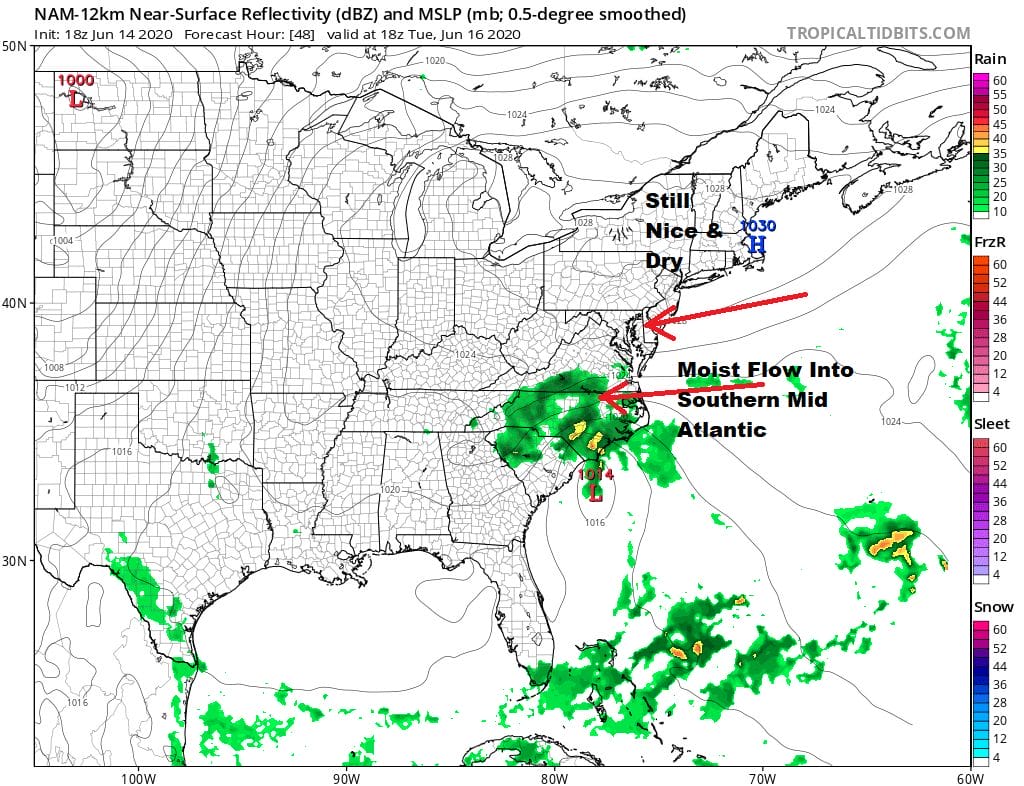
Not much changes on Wednesday with the high still holding offshore and low pressure to the south remaining weak and feeding rain into Virginia. So look for another day of sunshine and some clouds. Southern areas from Delaware to Maryland might see a pop up shower. North of NYC it remains nice and sunny. Highs will be in the 70s to near 80.

Starting Thursday it begins to turn a little warmer and a little more humid. The system to the south will get kicked away to the northeast with no impact here. Pop up showers or a thunderstorm are possible each afternoon from Thursday through the weekend but the days should feature partly sunny skies. Highs will be getting back into the 80s away from the coast. Nights will be warmer and more humid with most lows in the 60s. We see no weather issues for the Father’s Day weekend.
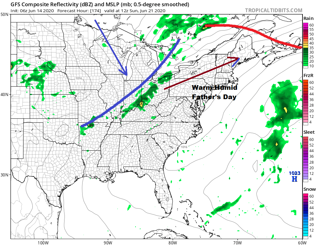
The next cold front doesn’t look like much to write home about. We may have to wait until next Tuesday for it to arrive with a few showers or a thunderstorm when it goes by. Meanwhile it is the last week of spring with the weather relatively tranquil so enjoy it while it lasts.
BE SURE TO DOWNLOAD THE FREE METEOROLOGIST JOE CIOFFI WEATHER APP &
ANGRY BEN’S FREE WEATHER APP “THE ANGRY WEATHERMAN!
MANY THANKS TO TROPICAL TIDBITS FOR THE USE OF MAPS
Please note that with regards to any severe weather, tropical storms, or hurricanes, should a storm be threatening, please consult your local National Weather Service office or your local government officials about what action you should be taking to protect life and property.


