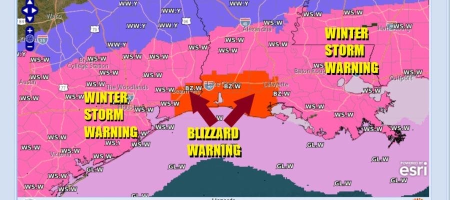
Never before seen Blizzard Warning SE Texas & South Louisiana
as Gulf Coast snow & ice storm expands
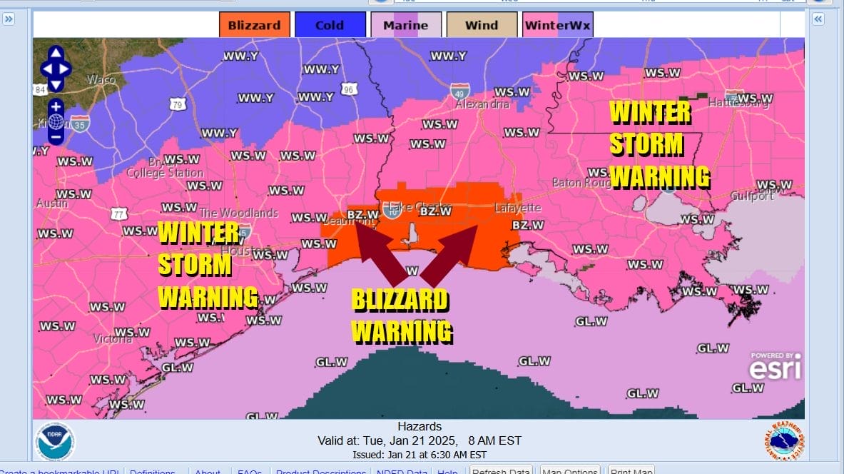
The National Weather Service has never issued a blizzard warning for the Gulf Coast until now. A never before seen Blizzard Warning is posted for Souheast Texas and much of Southwest Louisiana including cities like Beaumont and Port Arthur Texas and Lake Charles Louisiana. These are cities that are used to seeing hurricane warnings but never a blizzard warning. Winter Storm Warnings for snow and ice extend from Texas to Georgia and have been expanded northward into Coastal Georgia and the Carolinas.

Bear in mind that this area sees accumulating snow once every 10 years or so and can often times go decades without seeing an accumulating snow fall. Also the definition of a blizzard is 3 hours of heavy snow combined with winds over 35 mph and that is what we are seeing today in the Blizzard warning zone. Snow amounts will total 4 to 6 inches in an east west band from Houston to New Orleans and areas 50 miles to the north and south of this line. Interstate 10 across the Gulf Coast will be impassable as the day wears on.
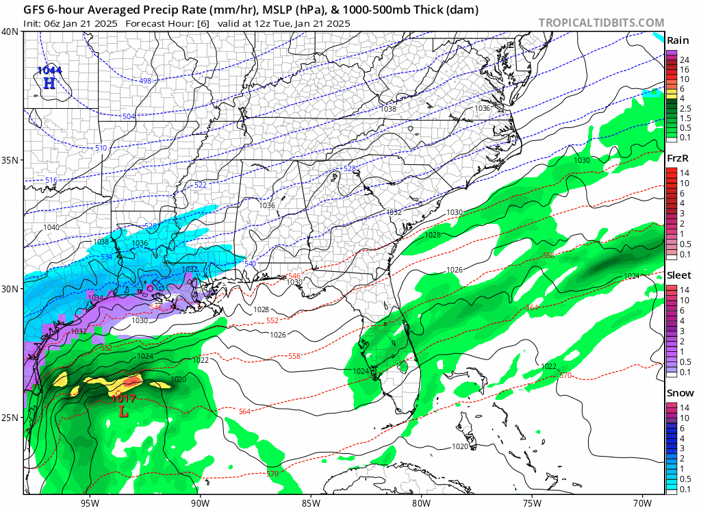
Snow will spread across the Gulf States today and tonight as low pressure develops in the Northwest Gulf of Mexico and slides eastward. The pressure gradient between the low pressure to the south and high pressure to the north is very tight and that creates a strong northeast wind along and just inland of the coast. Snow will spread across Southern Alabama and Georgia later today and snow could reach north of Atlanta Georgia late today and tonight. Freezing rain with heavy ice accretion is likely from the Florida Panhandle to the Southeast US coast including cities like Savannah Georgia, and Charleston South Carolina. This will occur tonight and Wednesday as this once in a generation snow and ice storm exits to the east and moves offshore the Southeast Coast. This storm is not a threat to the Mid Atlantic and Northeast as it will head eastward out to sea.