Very Cold Days Bitter Cold Nights Continue Through Thursday
as Storms Stay South

Very Cold Days Bitter Cold Nights Continue Through Thursday
as Storms Stay South
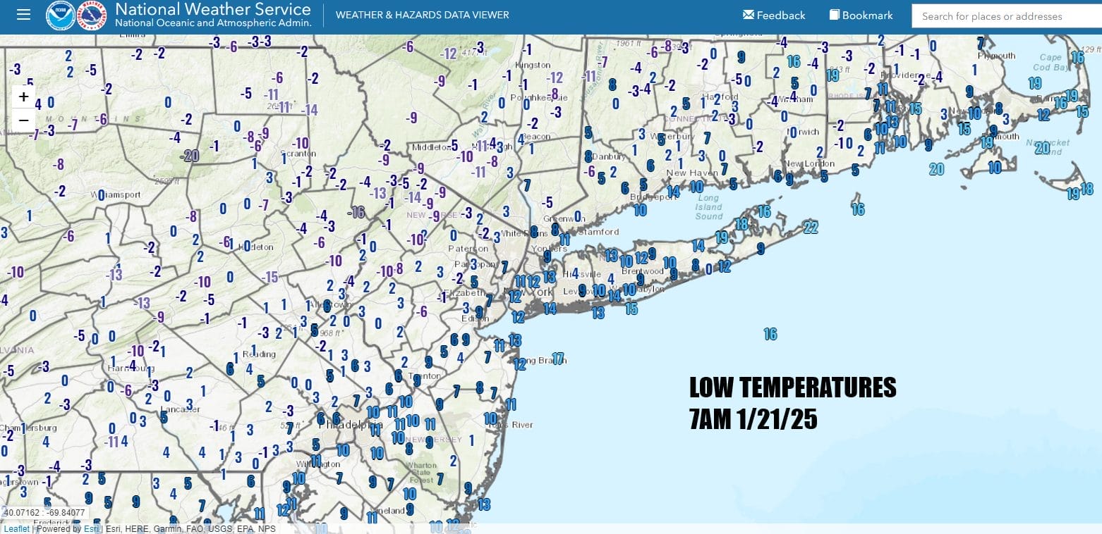
It was a bitter cold morning across Eastern Pennsylvania to Southern New England. Local effects such as snow cover and the lack of wind has taken temperatures down to double digit below zero readings in parts of Northwest New Jersey and the Hudson Valley. Most lows were in the single digits to near 10 in the warmest urban locations.
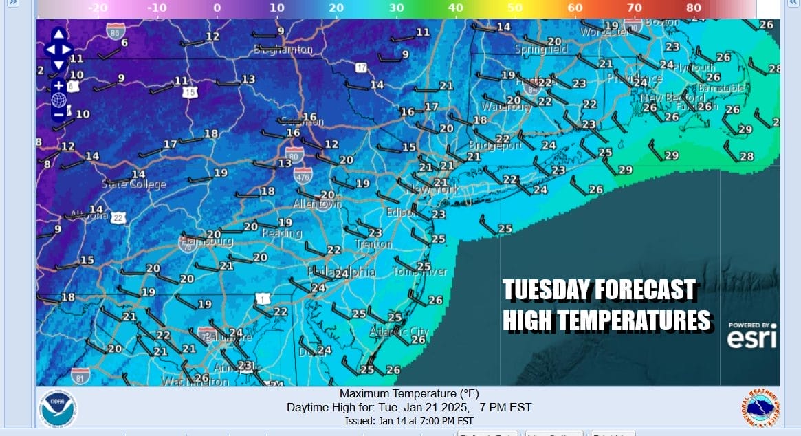
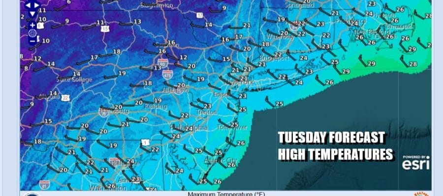
Don’t expect much in the way of a warm up today and for the next 3 days. Arctic air is trapped along the East Coast thanks to a frontal boundary offshore and a storm in the Gulf of Mexico. You know its cold when you have blizzard warnings up for parts of the Gulf Coast and Winter Storm Warnings from East Texas to the Carolinas. We will have no worse than partly sunny skies today but highs won’t get out of the teens in most places.
SATELLITE WITH LIGHTNING STRIKES

WEATHER RADAR

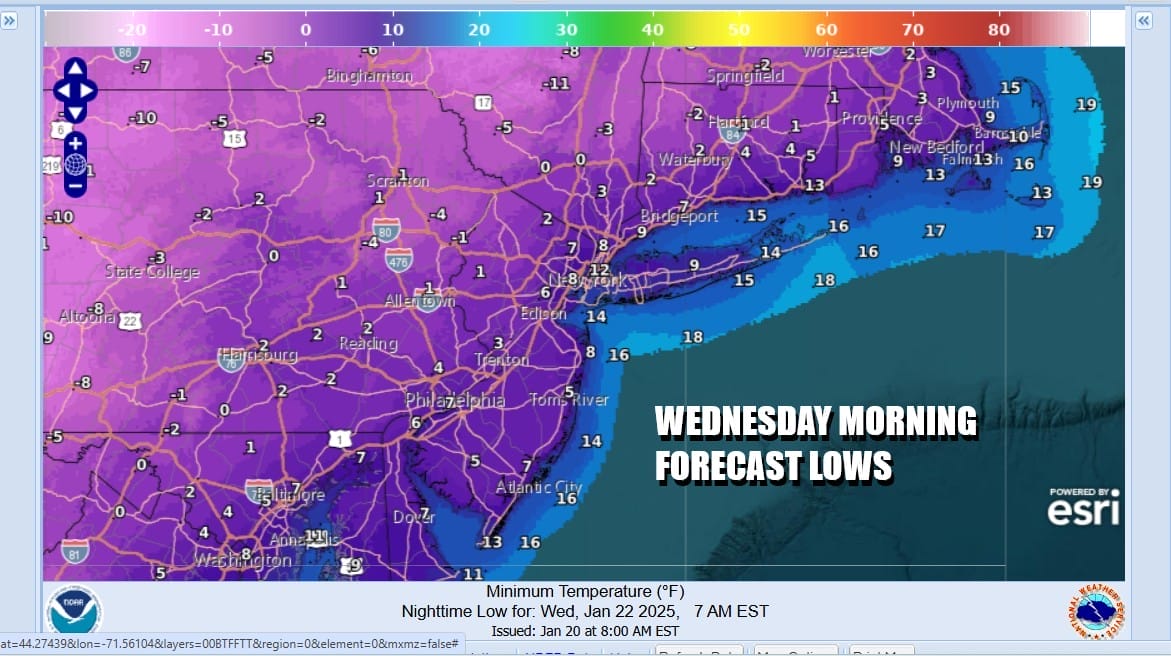
Other than the usual lake effect suspect snow areas in Upstate NY, radars are nice and quiet and should stay that way for the most part. Tonight will be another cold night with lows in the single digits to near 10 in most places. Cold spots again to the north will try to break zero and go below it but a lot will depend on cloud cover. That could hold temperatures up a bit.
Wednesday we see the Gulf of Mexico storm off the Southeast US coast. Given that the flow along the East Coast in the upper atmosphere is rather “flat” meaning it is more west to east, this storm pushes off the Southeast US coast and then out to sea. Clouds will probably reach Southern New England but the storm and the snow will remain offshore.

Wednesday remains very cold with clouds and some sunshine. Highs will only be in the teens to near 20 again and then back down to the the single digits and low teens Wednesday night. Thursday will be sunny but cold with highs in the upper teens and lower 20s. Look for temperatures to bounce higher Friday back into the lower 30s. No storms are on the horizon so it should be dry through the weekend as temperatures get back closer to average.
BE SURE TO DOWNLOAD THE FREE METEOROLOGIST JOE CIOFFI WEATHER APP &
ANGRY BEN’S FREE WEATHER APP “THE ANGRY WEATHERMAN!
MANY THANKS TO TROPICAL TIDBITS FOR THE USE OF MAPS
Please note that with regards to any severe weather, tropical storms, or hurricanes, should a storm be threatening, please consult your local National Weather Service office or your local government officials about what action you should be taking to protect life and property.


