Another Brutally Cold Day But Finally Temperatures Bounce Higher
Friday Through Sunday

Another Brutally Cold Day But Finally Temperatures Bounce Higher
Friday Through Sunday
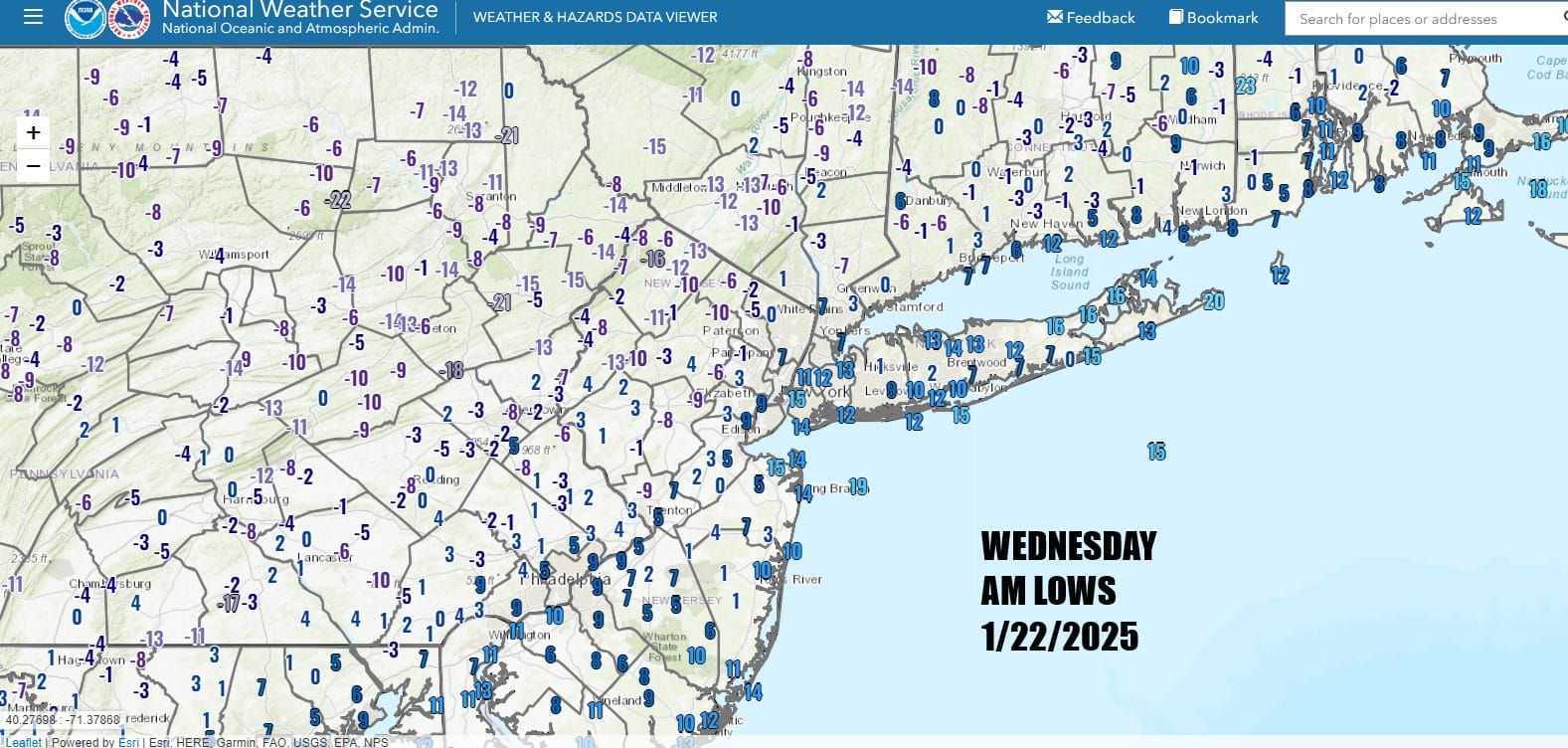
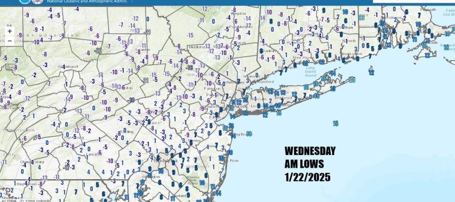
The last two mornings are a good example of when you have a very cold air mass and snow cover. Temperatures drop off the wall. For the second day in a row we have low temperatures this morning in the single digits while areas inland in Connecticut, Hudson Valley, Northwest New Jersey and Northeast Pennsylvania are seeing double digit below zero lows.

The Gulf Coast storm that produced blizzard conditions from Houston Texas to Pensacola Florida as well as snow and ice in Georgia and the Eastern Carolinas is now heading out to the east. Dry cold air covers the Northeast and Great Lakes so at least we will see plenty of sunshine today. However once again temperatures will struggle and highs will only be in the teens with the warmest urban areas perhaps touching 20 degrees.
SATELLITE WITH LIGHTNING STRIKES

WEATHER RADAR

Arctic air remains pinned along the East Coast and we are set up for another night of bitter cold temperatures. Thursday morning lows will once again be in the single digits and we will likely see temperatures below zero again in the colder spots inland. Warmer urban areas will likely bottom near 10 or in the low teens.

Temperatures Thursday are likely to rise back into the 20s to near 30 for highs with sunshine as we bounce off the extreme cold. However we do have another storm system that will develop offshore and head out to the northeast. This storm will not have any impact as far as precipitation is concerned but it will re-enforce the cold air in the Northeast and Mid Atlantic. It won’t be extreme however it will mean below average temperatures will be with us into the weekend.

The overall pattern is dry and we have no major storms or even minor ones to deal with through the weekend. Friday will be a mainly sunny day with most highs in the 20s. Saturday we will see sunshine and temperatures will inch a little higher. We should reach the upper 20s and lower 30s. By Sunday however we will finally break out above freezing for everybody as highs reach the mid to upper 30s.
BE SURE TO DOWNLOAD THE FREE METEOROLOGIST JOE CIOFFI WEATHER APP &
ANGRY BEN’S FREE WEATHER APP “THE ANGRY WEATHERMAN!
MANY THANKS TO TROPICAL TIDBITS FOR THE USE OF MAPS
Please note that with regards to any severe weather, tropical storms, or hurricanes, should a storm be threatening, please consult your local National Weather Service office or your local government officials about what action you should be taking to protect life and property.


