
Temperatures Recover Somewhat Next Several Day As Dry Cold Pattern Continues

Temperatures Recover Somewhat Next Several Day
As Dry Cold Pattern Continues
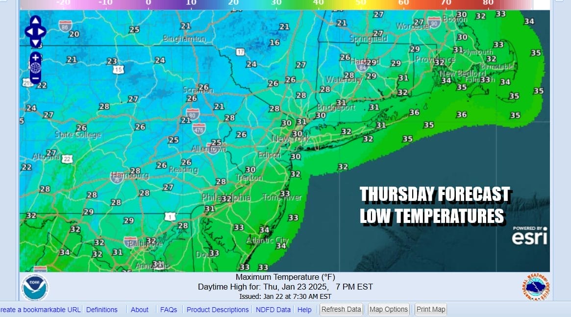
We start the day with another round of bitter cold temperatures in the single digits and below zero lows but they are a shade less cold then they were the last two night. It is still very cold however the core of the cold air is moving out today so that should allow temperatures to rise into and through the 20s in most places. We should see no worse than partly sunny skies today. Upper troughs are moving west to east across the Great Lakes and we will also have a developing storm system offshore. That storm moves to the northeast and we will get a re-enforcement of cold air going into the weekend.
SATELLITE WITH LIGHTNING STRIKES

WEATHER RADAR

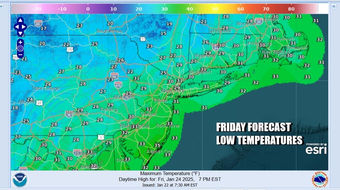
Tonight’s lows will be higher than the last two nights but we will still bottom in the single digits and teens Friday morning. We will have a mix of clear skies and some clouds overnight. Friday and Saturday should be no worse than partly sunny and at times mostly sunny. Most highs both days will be in the 20s to around 30 degrees with nights in the teens and single digits.

Sunday should actually be a nice day and we will be above freezing for the first time in over a week. Sunday looks to be sunny and high temperatures will be in the mid 30s to around 40 degrees or so. It might be a little higher than that in South Jersey and points south and east. At least we will see some melting of snow cover.

We will be under a northwest flow from Canada next week and that puts in in the flow of colder air masses moving southeast from Canada but more on the edge of that cold air rather than in the heart of it. This will keep temperatures near or a little below average all week long. We also see some weak systems in that flow that will be moving through. The first one will be Tuesday in the form of an arctic front and a strong upper trough. That could set off some snow showers or even a heavier snow squall as it passes late Tuesday.

The second system in the northwest flow is one that will be diving southeast from the Great Lakes and that could bring a period of snow or flurries sometime late Wednesday into early Thursday. Late next week a system coming into Southern California will be kicked eastward into the Gulf States. That system could bring a more significant snow and rain system into the Eastern US but much will depend on whether we see something in the northerly jet getting involved. It is more than a week a way so we’ll monitor how this plays out on the models in the coming days.
BE SURE TO DOWNLOAD THE FREE METEOROLOGIST JOE CIOFFI WEATHER APP &
ANGRY BEN’S FREE WEATHER APP “THE ANGRY WEATHERMAN!
MANY THANKS TO TROPICAL TIDBITS FOR THE USE OF MAPS
Please note that with regards to any severe weather, tropical storms, or hurricanes, should a storm be threatening, please consult your local National Weather Service office or your local government officials about what action you should be taking to protect life and property.


