Bitter Cold Next Few Days As Gulf Storm Passes Well South

Bitter Cold Next Few Days As Gulf Storm Passes Well South
Yesterday’s storm system is now well away to the northeast and in comes the arctic air which took temperatures down to the teens this morning. This is going to be a very cold day with ineffective sunshine, a gusty wind, and temperatures that will hover in the upper teens and lower 20s. Anything that fell last night is now frozen solid so good luck trying to get rid of it. We won’t be anywhere close to freezing this week and the coldest air is about to move in.

Tonight it is going to be bitter cold under clear skies. There will be enough of a wind overnight to keep temperatures from falling to off the wall readings but morning lows will likely be in the single digits. The warmest spots will urban areas where it may be closer to 10 above. Colder inland areas to the north, northeast and northwest will be closer to or even a few degrees below zero. At least radars are quiet and we will not see any additional snow over the next 2 days other than the odd snow shower that could always pop up especially near the coast.
SATELLITE WITH LIGHTNING STRIKES

WEATHER RADAR

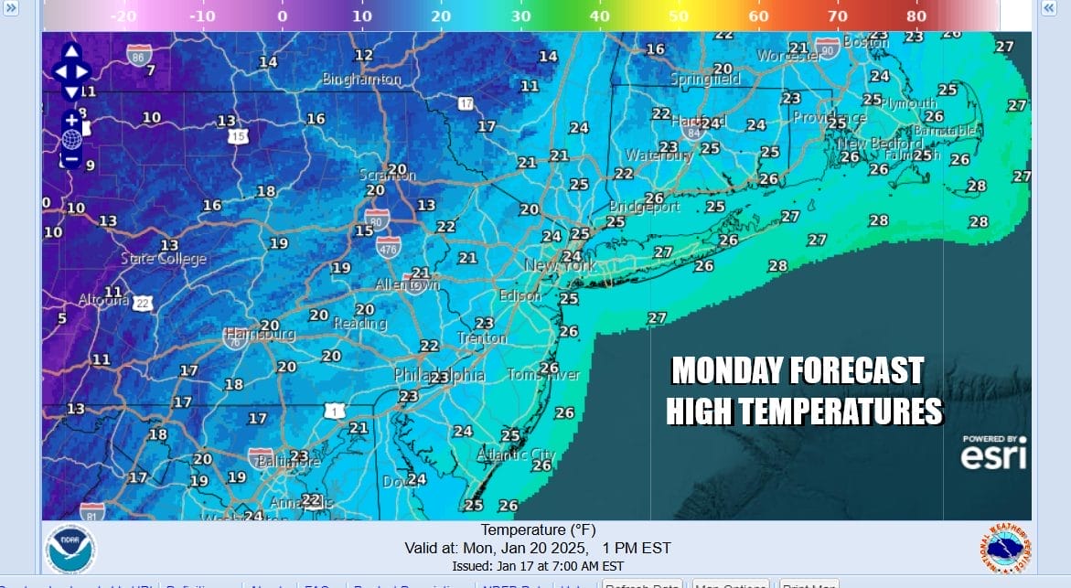
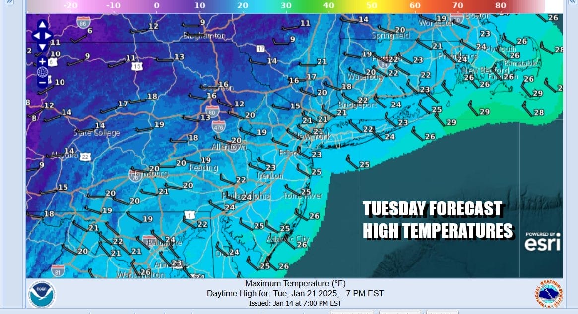
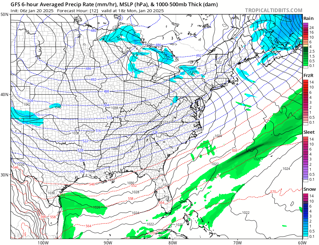
Tuesday sees a tough day temperature wise and the thermometer struggles back to the upper teens to near 20 at best. We should see a fair amount of sunshine but some high clouds may burst onto the scene later in the day as low pressure develops in the Gulf of Mexico and brings a rare snow and ice storm to the Gulf Coastal States from Texas to the Florida Panhandle.
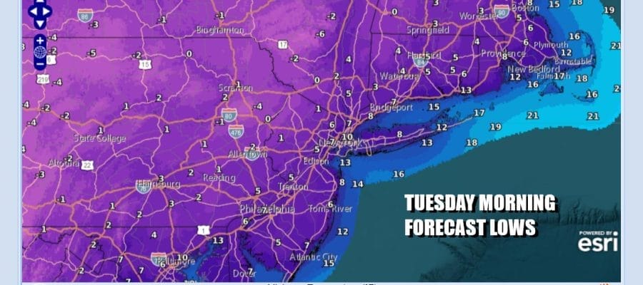
Tuesday night into Wednesday morning will be another night of bitter cold temperatures with lows in the single digits to around 10. Again cold spots inland will be closer to or below zero while warmer urban areas may finish closer to 10. Skies should be partially clear though high clouds will be around as the Gulf Coast snow and ice storm heads to the Southeast US coast.
The storm system to the south doesn’t have any mechanism to take it up the East Coast. Snow and ice will fall into the Coastal Carolinas and Virginia but we expect that storm system to slide east and pass well to the south of Eastern Pennsylvania to Southern New England. Wednesday may start with some high clouds but some sunshine should take hold. High temperatures once again will not get out of the teens to near 20 at best.

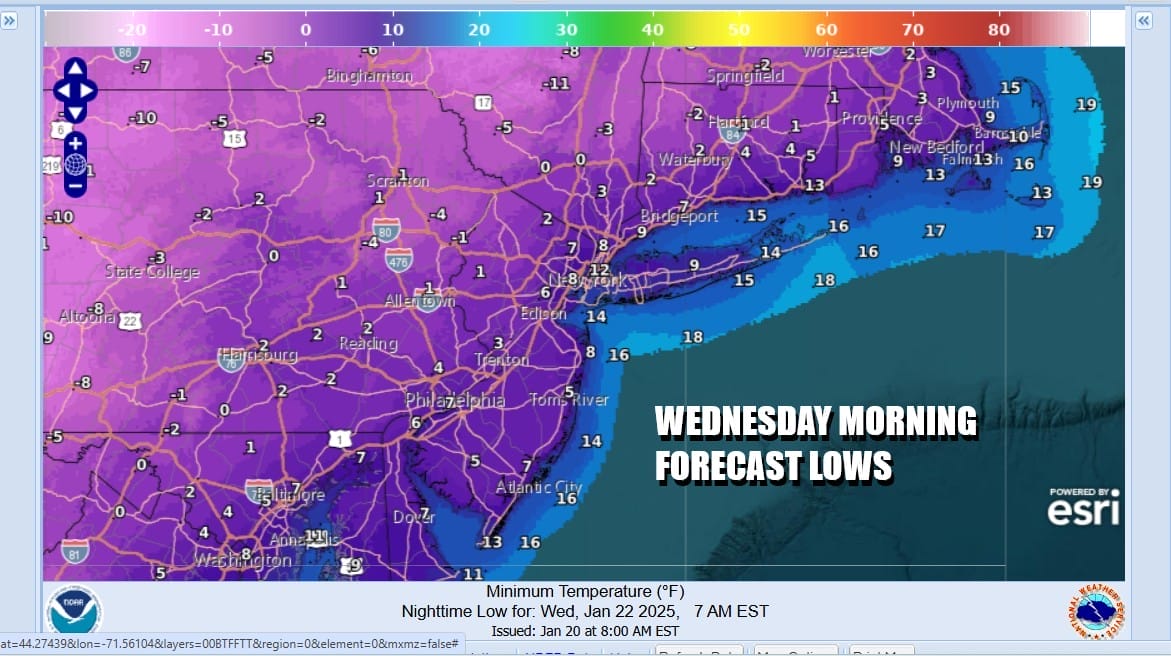
Wednesday night into Thursday morning will be another very cold night with most lows in the single digits to lower teens. Depending on the wind, if it completely drops off we could see some radiational cooling conditions that will take inland and rural areas down to near zero or even below zero. This will be helped along by the snow and ice cover that is going nowhere. Temperatures should bounce into the 20s Thursday. Models are forecasting another low to develop off the Southeast US coast which right now seems to want to slide eastward and well offshore with no impact to the US east coast. As long as that is the case, Friday will be the first day this week where after a very cold start, temperatures could make a run for the freezing mark.
BE SURE TO DOWNLOAD THE FREE METEOROLOGIST JOE CIOFFI WEATHER APP &
ANGRY BEN’S FREE WEATHER APP “THE ANGRY WEATHERMAN!
MANY THANKS TO TROPICAL TIDBITS FOR THE USE OF MAPS
Please note that with regards to any severe weather, tropical storms, or hurricanes, should a storm be threatening, please consult your local National Weather Service office or your local government officials about what action you should be taking to protect life and property.


