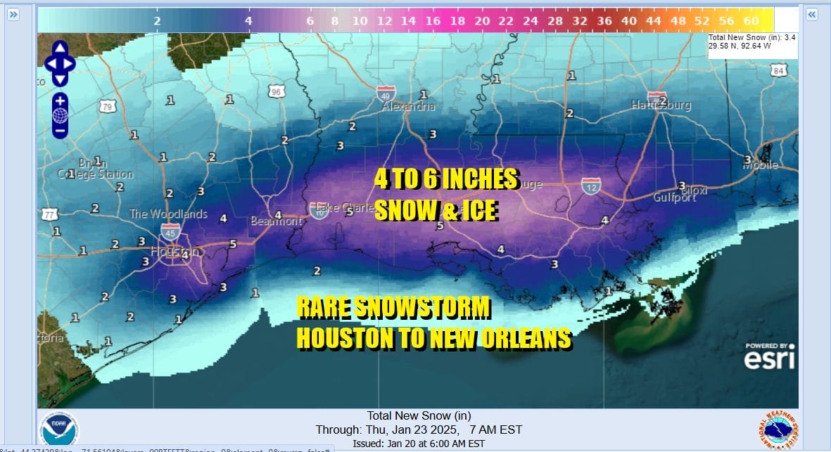
Once in a generation snow & ice storm
Texas to Alabama I-10 corridor Houston to New Orleans

Once in a generation snow & ice storm
Texas to Alabama I-10 corridor Houston to New Orleans

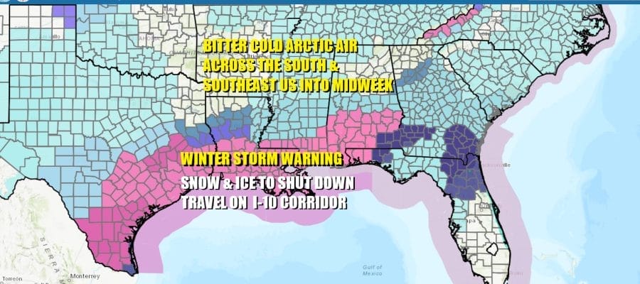
Areas from East Texas from San Antonio and Corpus Christi northeast to the major cities of Houston and New Orleans are about to experience what could be a crippling snow and ice storm over the next 2 days. Winter Storm Warnings are posted from the National Weather Service in places where you can go 10 or 20 years without ever seeing a snow flake or an ice pellet. Many of these cities and towns along the I-10 corridor have no means of removing snow from roadways. Given the bitter cold arctic air that covers the Deep South, this certainly shut down normal travel along the I-10 corridor from Houston to New Orleans and possibly eastward to the Florida Panhandle. Some airports in this are like Houston for example have already pre announced they will be shutting down ahead of this storm system.
SATELLITE LOOP

An arctic cold front has passed throught the Deep South and lies across the Gulf of Mexico. Easterly winds from the Bahamas to Texas over relatively warm Gulf of Mexico waters will be overrunning bitter cold arctic air that lies all across the South and Southeast US. Preciptation breaks out in South Texas tonight and spreads northward into that cold air. Snow develops in Southeast Texas. To the south to San Antonio, Austin, and Corpus Christi it will be a wintry mix of snow ice and freezing rain.
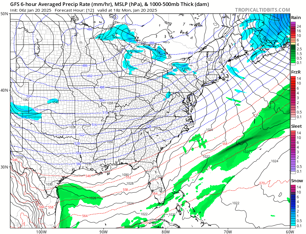
Snow and ice spread eastward across the lower portion of the Gulf States Tuesday from Louisiana to South Georgia and North Florida. Eventually the snow and ice will move into the Southeast US coast from Georgia to the Carolinas Tuesday night into Wednesday before exitiing to the east. Winter Storm Watches are posted in these areas and we will likely see the National Weather Service issue additional warnings for this developing sytem. We can expect travel across the entire South and Southeast US to be extremely difficult and in some cases impossible with numerous disruptions and delays across most airports. Road travel in the Winter Storm Warning zone will be nearly impossible so it is wise to prepare ahead of time.
BE SURE TO DOWNLOAD THE FREE METEOROLOGIST JOE CIOFFI WEATHER APP &
ANGRY BEN’S FREE WEATHER APP “THE ANGRY WEATHERMAN!
MANY THANKS TO TROPICAL TIDBITS FOR THE USE OF MAPS
Please note that with regards to any severe weather, tropical storms, or hurricanes, should a storm be threatening, please consult your local National Weather Service office or your local government officials about what action you should be taking to protect life and property.