
Nate Rains Moving Northeast Mostly Inland
SHOP THE JOESTRADAMUS STORE
Nate Rains Moving Northeast Mostly Inland
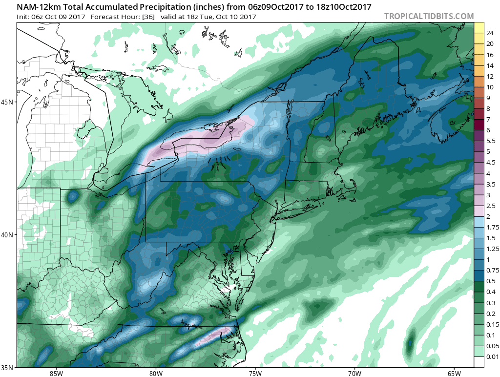
We are watching the remnants of Nate this morning moving across the Northeast & Middle Atlantic States. With the track of the remnant low north and west of the coast the bulk of the rain so far has been across much of Central & Western Pennsylvania & Upstate New York. There is a second surge that is moving across Southern Pennsylvania & Maryland and that will be swinging across New Jersey, New York City Southern New England and Long Island later today. In the meantime it remains rather warm and muggy with temperatures in the 70s once again today with very high humidity.
SATELLITE LOOP

REGIONAL RADAR

The rainfall from this will be greater north and west of the coast and amounts in coastal areas won’t amount to much more than a 1/2 inch to at most and there will be some areas that will get under a 1/2 inch. The pattern remains very dry.
LOCAL RADAR NEW YORK CITY

LOCAL RADAR PHILADELPHIA


Above average temperatures will be with us all week though there will be a bit of a downtrend setting in thanks to an onshore flow (such as it is). Tuesday we will be in the 70s to near 80 again with some sun and clouds. Wednesday more clouds and the chance for showers is in the forecast as we have weak low pressure coming eastward and an ocean flow. Temperatures will probably be in the 60s to near 70s. The rest of the week looks to be on the warm side with no real break in the warm weather pattern in the Eastern US anytime soon.
 GET JOE A CIGAR IF YOU LIKE

FiOS1 News Weather Forecast For Long Island
FiOS1 News Weather Forecast For New Jersey
FiOS1 News Weather Forecast For Hudson Valley


