NAM Model Analysis On Developing Noreaster

NAM Model Analysis On Developing Noreaster
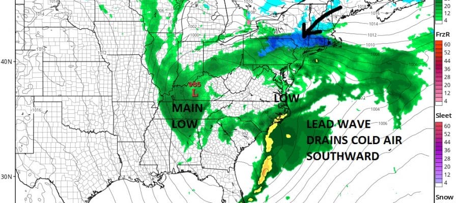
Today’s late afternoon NAM model run illustrates the issue regarding the problem for Sunday night into Tuesday. All weather models are pointing to a noreaster developing with strong winds and heavy rains beginning Sunday night and lasting into Tuesday afternoon. However there are a few issues to consider.
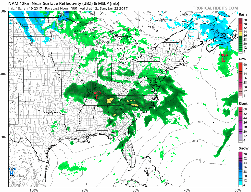
NAM MODEL LATE THIS AFTERNOON
The NAM model from above shows on the last frame early Monday morning 1am the effect of some cold air bleeding southward from Eastern Canada. This is a situation where there is no real arctic air and the atmosphere from bottom to top is in a borderline state. Small scale factors will play a role. Intensity of precipitation and vertical motion in the atmosphere will effectively cool things down in some areas. This is why the NAM shows an area of snow and sleet on the northern fringe of the precipitation.
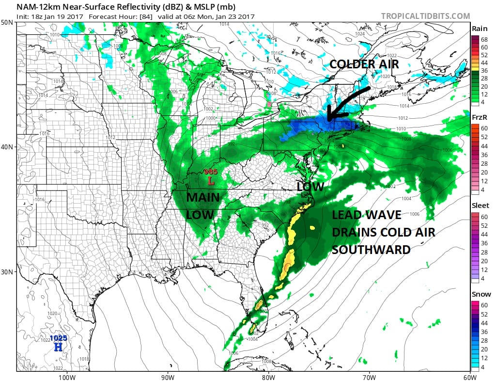
That lead wave and whether it maintains identity is important in what happens with this event. If the lead wave holds itself it will drag down more cold air. I still think that cold air getting south to the coast is a long shot but it is a more critical question for inland areas as you go north, northeast and northwest.
NEW NAM MODEL CLICK TO ANIMATE
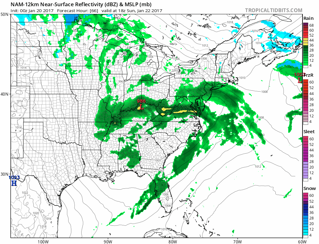
The new NAM model brings rain in faster on Sunday and it has rain going to snow/sleet inland north and northwest of route 84. We can’t see what happens after Monday morning. Regardless of any snow/sleet issues, the noreaster issue continues with strong winds and heavy rains for Monday. We wait now for the other models as they come in over the next few hours.
MANY THANKS TO TROPICAL TIDBITS FOR THE WONDERFUL USE OF THE MAPS
SNOW REMOVAL COMPANIES FOR YOUR WINTER NEEDS
LONG ISLAND ROCKLAND COUNTY Connecticut

![]()

ROCKLAND COUNTY TRI STATE SNOW REMOVAL JOHNSTOWN PA


FiOS1 News Weather Forecast For Long Island
FiOS1 News Weather Forecast For New Jersey
FiOS1 News Weather Forecast For Hudson Valley
NATIONAL WEATHER SERVICE SNOW FORECASTS
LATEST JOESTRADAMUS ON THE LONG RANGE
Weather App

Don’t be without Meteorologist Joe Cioffi’s weather app. It is really a meteorologist app because you get my forecasts and my analysis and not some automated computer generated forecast based on the GFS model. This is why your app forecast changes every 6 hours. It is model driven with no human input at all. It gives you an icon, a temperature and no insight whatsoever.
It is a complete weather app to suit your forecast needs. All the weather information you need is right on your phone. Android or I-phone, use it to keep track of all the latest weather information and forecasts. This weather app is also free of advertising so you don’t have to worry about security issues with your device. An accurate forecast and no worries that your device is being compromised.
Use it in conjunction with my website and my facebook and twitter and you have complete weather coverage of all the latest weather and the long range outlook. The website has been redone and upgraded. Its easy to use and everything is archived so you can see how well Joe does or doesn’t do when it comes to forecasts and outlooks.
Just click on the google play button or the apple store button on the sidebar for my app which is on My Weather Concierge. Download the app for free. Subscribe to my forecasts on an ad free environment for just 99 cents a month.
Get my forecasts in the palm of your hand for less than the cost of a cup of Joe!
![]()
