
More Rounds Of Snow But Where?

WINTER STORM WARNING EASTERN HALF OF SUFFOLK
WINTER STORM WARNING EASTERN CONNECTICUT EAST OF I-91
WINTER WEATHER ADVISORY WESTERN SUFFOLK & NASSAU COUNTY
WINTER WEATHER ADVISORY COASTAL CONNECTICUT FROM I-91 WEST
ADVISORIES FOR NYC HUDSON VALLEY AND NE NEW JERSEY DISCONTINUED
SNOW IS CONTINUING OVER SUFFOLK COUNTY
The first round from the deep coastal storm has pulled out of New York City, Hudson Valley and Westernmost Long Island however the snow continues through Suffolk County.4 TO 5 inches have accumulated so far. Latest radar and satellite loops show the back edge seems to have come to a halt for a moment. Super short term models show another burst of snow developing this evening over Western Long Island,
MORE ROUNDS OF SNOW

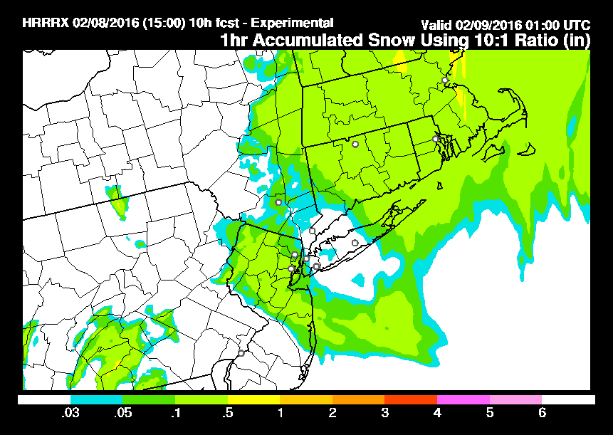
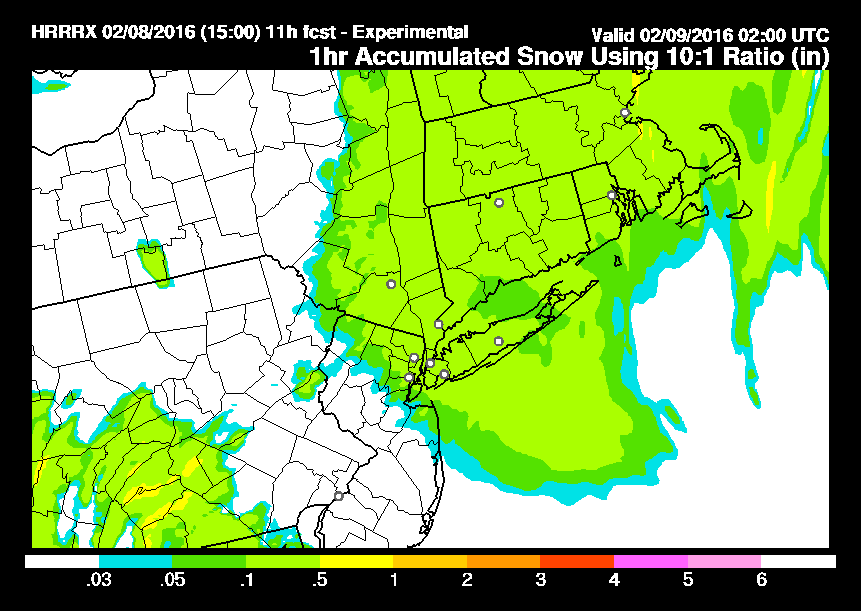
The maps above are the HRRR model for the time between 6pm to 9pm. This area crosses Northern New Jersey and then seems to merge with the area left from the coastal storm into Southern New England. This area could put down a coating to a couple of inches anywhere from Northern New Jersey northeastward to Southwest Connecticut and Long Island including the Hudson Valley. For Long Island this will add to snow totals from this morning so there should be 6 inch plus amounts in total in some areas especially in Suffolk County.
To the southwest you can see an area coming out of South Central Pennsylvania on the last map there ending at 9pm. That area is forecast to move into Central and Southern New Jersey and lift northeastward. We will be monitoring the radars closely. The satellite loop shows the first storm offshore with the second large upper air disturbance dropping southeastward. Lobes of moisture are rotating around that upper low which is going to not only make forecasting and timing these areas difficult, but measuring the magnitude of the precipitation is going to become a challenge as well. This will continue to lead to varying amounts from as little as a coating to a couple of inches in some places with each lobe.
MORE ROUNDS OF SNOW SATELLITE & RADAR LOOPS


Its never easy. We will continue to monitor this of course as we move into the evening hours.
NATIONAL WEATHER SERVICE SNOW FORECASTS
LATEST JOESTRADAMUS ON THE LONG RANGE
Weather App

Winter is here! Don’t be without Meteorologist Joe Cioffi’s weather app. It is a complete weather app to suit your forecast needs. All the weather information you need is right on your phone. Android or I-phone, use it to keep track of all the latest weather information and forecasts. This weather app is also free of advertising so you don’t have to worry about security issues with your device. An accurate forecast and no worries that your device is being compromised.
Use it in conjunction with my website and my facebook and twitterand you have complete weather coverage of all the latest weather and the long range outlook. The website has been redone and upgraded. Its easy to use and everything is archived so you can see how well Joe does or doesn’t do when it comes to forecasts and outlooks.
Just click on the google play button or the apple store button on the sidebar for my app which is onMy Weather Concierge. Download the app for free. Subscribe to my forecasts on an ad free environment for just 99 cents a month.
Get my forecasts in the palm of your hand for less than the cost of a cup of Joe!

![]()


