DOWNLOAD MY NEW FREE JOESTRADAMUS WEATHER APP FOR ALL DEVICES
THE APP IS ABSOLUTELY FREE TO ALL BUT CONSIDERING SUBSCRIBING TO PATREON FOR A WEATHER EXPERIENCE FREE OF ADS, EXCLUSIVE VIDEOS FOR MEMBERS ONLY AND MUCH MORE…STARTS AT $2 A MONTH..MESSAGE ME AT ANY TIME
Miserable Start Some Late Showers Gusty Winds Tonight Saturday
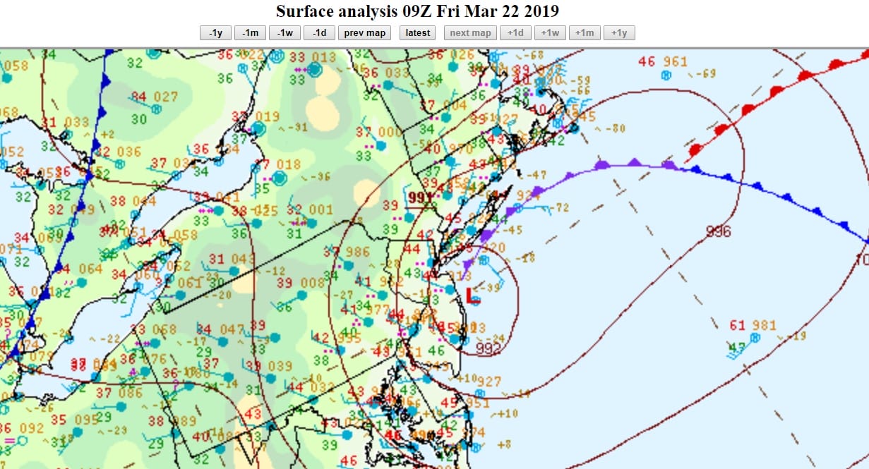
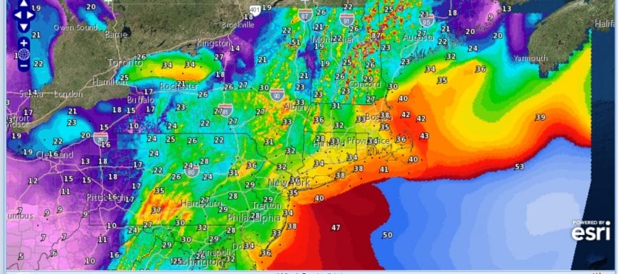
Overnight rains were on the heavy side with rainfall amounts of 1 to 2 inches total in most areas. Low pressure this morning is sitting just off the coast. The strong upper air low and trough are also sitting just offshore this morning and we can see the rotation clearly on the satellite loop spinning away. That is keeping rain going in some areas this morning. Gradually this low will work its way north northeastward into New England and the storm will continue to strengthen.
SATELLITE

REGIONAL RADAR

Regional radar as well as the local radar still showing bands of rain moving northwestward in Southern New England and moving southeastward over New Jersey. There are still some heavier downpours inside some of these bands. Gradually all of this will lift up to the northeast later this morning.
LOCAL RADAR NEW YORK CITY

LOCAL RADAR PHILADELPHIA


A strong upper trough to the west which is lifting this storm northward will swing through late this afternoon with another round of showers possible in some areas. Temperatures today will be in the 40s for the most part though we could push the envelop to 50 if sky conditions improve for a few hours late this morning or early this afternoon. Once the trough moves through we will start to see winds pick up with clouds tonight and lows in the 30s. A few snow showers are possible overnight in the Hudson Valley & Connecticut tonight on the backside of this storm. Winds will start picking up from the northwest overnight.

Winds will be strong and gusty during the day on Saturday. They may fall just below wind advisory criteria but there will be gusts to 30 to 40 mph into Saturday afternoon especially along the coast. We will see some sunshine on Saturday with highs in the low to mid 50s. Sunday looks very good with sunshine and less wind. Highs will reach the 50s to near 60 Sunday afternoon.
Monday brings the next front and a wave on the front that is getting suppressed to the southeast. There will be a stick of precipitation this. Some rain showers will develop later Monday morning and afternoon with some rain showers that could change to a few snow showers. The upper feature suppresses this to the south so there really isn’t anything here to support something more problematic. Monday’s highs will be into the 50s. Much colder weather moves in Monday night and Tuesday with lows Monday night in the 20s to lower 30s and highs Tuesday with some sunshine just into the 40s.
MANY THANKS TO TROPICAL TIDBITS FOR THE USE OF MAPS
Please note that with regards to any tropical storms or hurricanes, should a storm be threatening, please consult your local National Weather Service office or your local government officials about what action you should be taking to protect life and property.


