March Bitter Cold Continues
March Bitter Cold Continues
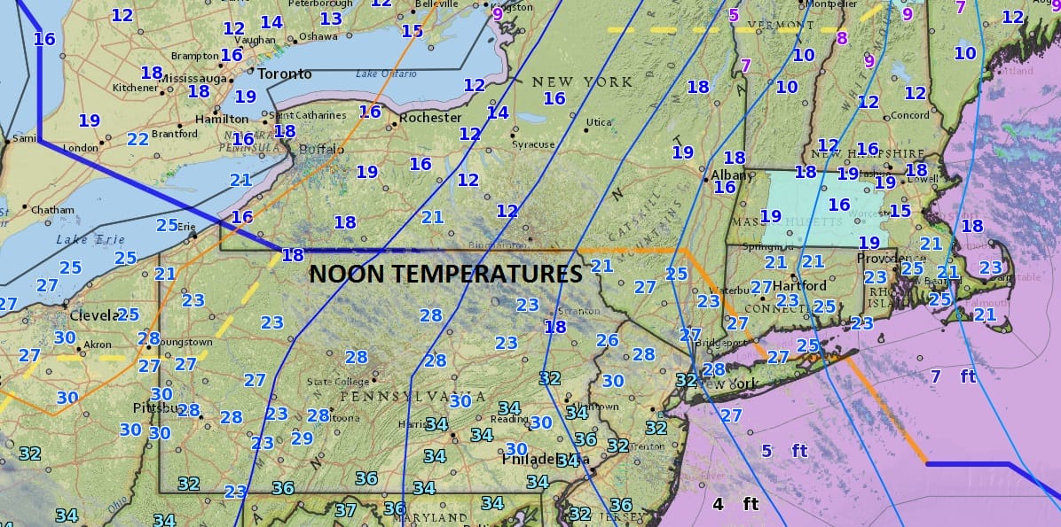
Everything is relative to the time of year. We are seeing temperatures in this March bitter cold atmosphere in the upper 20s to near 30 at midday. Remember that this time of year average daytime highs area in the mid to upper 40s so we are running 15 or more degrees below average. Adjusted for January this would be a day where temperatures would be sitting close the upper teens and low 20s at midday. So indeed this is bitter cold for this time of year.
The satellite loop does show some clouds continuing to rotate through some areas and gradually we should see skies clear out later this afternoon. This will set us up for a very cold night ahead with clear skies and a north wind blowing down the Hudson Valley. This should lead to lows Sunday morning in the single digits to mid teens.
SATELLITE LOOP

REGIONAL RADAR

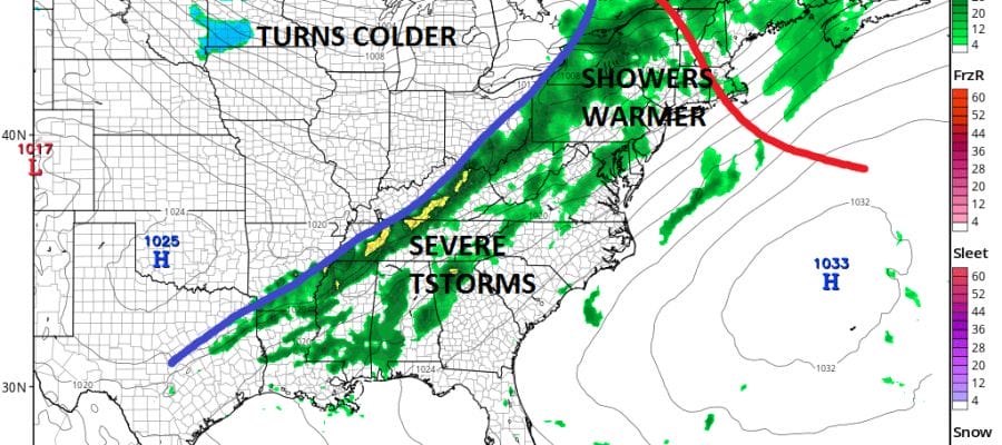
Radars are free of snow except offshore and they will remain quiet for the rest of the weekend. Sunday we should see plenty of sunshine with temperatures at least making it above freezing though most highs will be in the 30s. A warm up begins Monday with some sunshine and arriving clouds as we climb back into and in some places through the 40s.

Tuesday the next cold front approaches with warmer air and showers and possibly a thunderstorm though I think the severe weather threat this time sets up south of our area. Temperatures will be back n the 50s to near 60 or so and then it dries out for mid and late week. Long range we have models battling over blocking and whether the winter time pattern of storms in the west make a radical change to the east coast. The European in particular for the last two runs and to a lesser extent the Canadian are pushing this idea while the GFS model continues more of the same high level volatility. We will have more on this later today.
EUROPEAN MODEL VS GFS ON MAJOR PATTERN CHANGE AND STORM FOR NEXT WEEKEND
LATEST WEATHER VIDEO ANALYSIS
 GET JOE A CIGAR IF YOU LIKE

SNOW REMOVAL COMPANIES FOR YOUR WINTER NEEDS
LONG ISLAND ROCKLAND COUNTY Connecticut

![]()

ROCKLAND COUNTY TRI STATE SNOW REMOVAL JOHNSTOWN PA


FiOS1 News Weather Forecast For Long Island
FiOS1 News Weather Forecast For New Jersey
FiOS1 News Weather Forecast For Hudson Valley
NATIONAL WEATHER SERVICE SNOW FORECASTS
LATEST JOESTRADAMUS ON THE LONG RANGE
Weather App

Don’t be without Meteorologist Joe Cioffi’s weather app. It is really a meteorologist app because you get my forecasts and my analysis and not some automated computer generated forecast based on the GFS model. This is why your app forecast changes every 6 hours. It is model driven with no human input at all. It gives you an icon, a temperature and no insight whatsoever.
It is a complete weather app to suit your forecast needs. All the weather information you need is right on your phone. Android or I-phone, use it to keep track of all the latest weather information and forecasts. This weather app is also free of advertising so you don’t have to worry about security issues with your device. An accurate forecast and no worries that your device is being compromised.
Use it in conjunction with my website and my facebook and twitter and you have complete weather coverage of all the latest weather and the long range outlook. The website has been redone and upgraded. Its easy to use and everything is archived so you can see how well Joe does or doesn’t do when it comes to forecasts and outlooks.
Just click on the google play button or the apple store button on the sidebar for my app which is on My Weather Concierge. Download the app for free. Subscribe to my forecasts on an ad free environment for just 99 cents a month.
Get my forecasts in the palm of your hand for less than the cost of a cup of Joe!


