March Begins Benign Mostly Dry Pattern Lies Ahead

March Begins Benign Mostly Dry Pattern Lies Ahead
Here we are at the first of March. This is the month that is part of the three spring months of March April and May where average temperatures rise at their fastest rate. We start the month with average highs in the mid 40s and finish the month with average highs in the mid 50s. When we look at today’s forecast highs of upper 40s to mid 50s we are above normal. This is due to an approaching cold front so we are warming ahead of it. Look for sunshine and some arriving clouds sky wise. Radars are quiet locally for now and we don’t expect anything to happen until tonight when the front passes. That passage might trigger off some scattered showers but they won’t amount to much. Most lows will be in the upper 20s to mid 30s.
SATELLITE

WEATHER RADAR

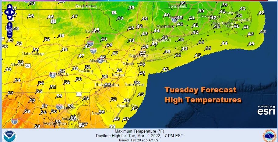
Wednesday we will be sitting ahead of another cold front that will come through later Wednesday night or early Thursday morning. So once again we will see sunshine and some clouds. Highs will be in the upper 40s to mid 50s and we will not see any precipitation until the front comes through Wednesday night.
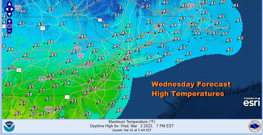
Much like tonight, a cold front will trigger off a couple of scattered rain showers Wednesday night into Thursday morning. Then a colder air mass builds as as high pressure heads out of the Plains and into the Eastern US. Look for clouds giving way to sunshine Thursday. Most highs will be in the 40s as temperatures ease. Friday will be a cold day with some sunshine and highs in the upper 30s to lower 40s.
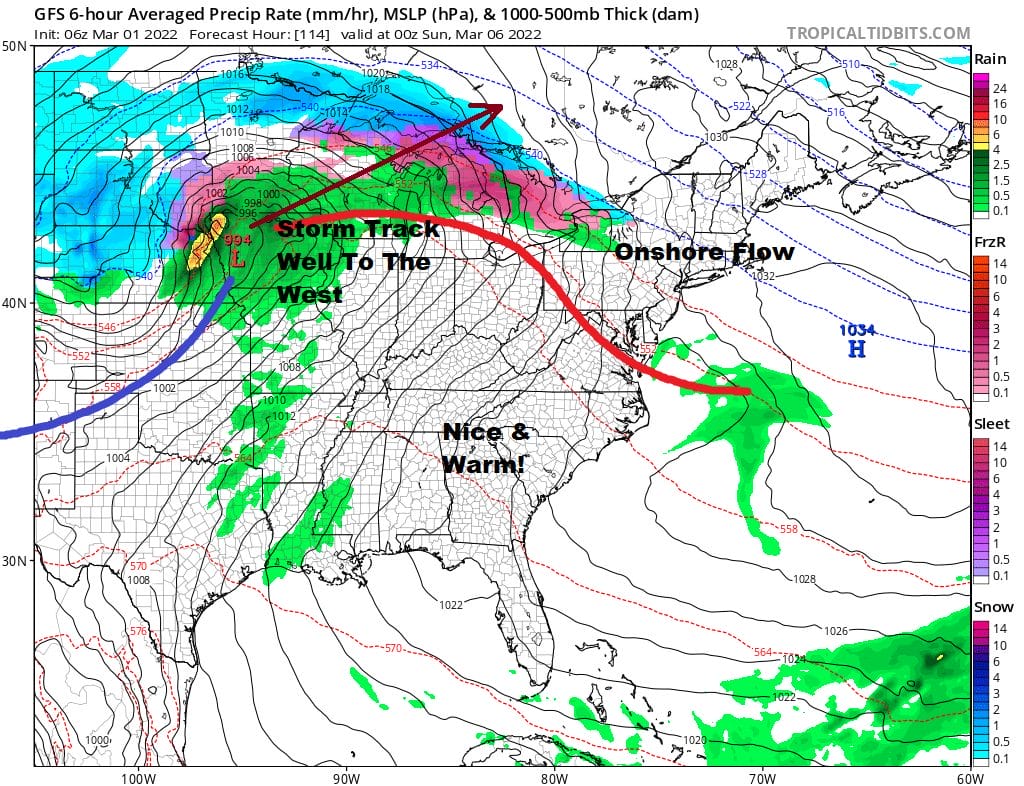
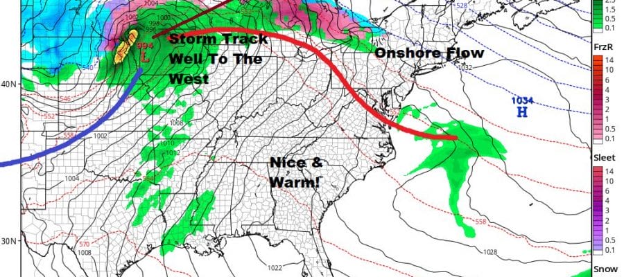
The weekend sees a storm heading from the Rockies to the Plains and the track of the low is well to the west. There is a warm front that will extend from the low to the Mid Atlantic coast so the struggle this weekend will be with a moist flow at low levels from off the ocean and possibly not much in the way of rain. Weather models have backed off on the idea of some rain for Saturday night into Sunday. I haven’t completely thrown it out of the forecast. Regardless of weather it rains, it may just be a doom and gloom time weekend with the flow off the ocean and a struggling warm front to the south. Saturday’s highs will likely just be in the raw 40s. Sunday we could see the warm front go to our north and a set up for showers later in the day when a cold front arrives. Highs should reach into the 50s. Again not much rain is forecast when the front goes by.
BE SURE TO DOWNLOAD THE FREE METEOROLOGIST JOE CIOFFI WEATHER APP &
ANGRY BEN’S FREE WEATHER APP “THE ANGRY WEATHERMAN!
MANY THANKS TO TROPICAL TIDBITS & F5 WEATHER FOR THE USE OF MAPS
Please note that with regards to any severe weather, tropical storms, or hurricanes, should a storm be threatening, please consult your local National Weather Service office or your local government officials about what action you should be taking to protect life and property.


