Major Storm Threat Continues For Sunday

Major Storm Threat Continues For Sunday
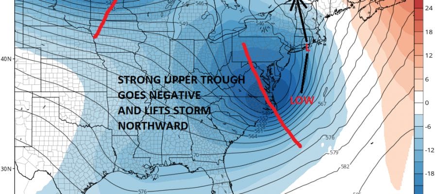
The in between model runs during the late afternoon always tend to hiccup in one direction or another and it seems that was the case this afternoon. The new model cycle run has begun and we are seeing models lining up well with the ones from midday Thursday which painted a rather stormy picture for Sunday. That cycle was led by the European which brought a major storm northward just inland of the coast for Sunday afternoon and night. Let’s begin with the new NAM model run tonight which has a very strong major storm threat from Coastal New Jersey to New England.
MAJOR STORM THREAT NAM MODEL SUNDAY 8PM UPPER AIR JET STREAM
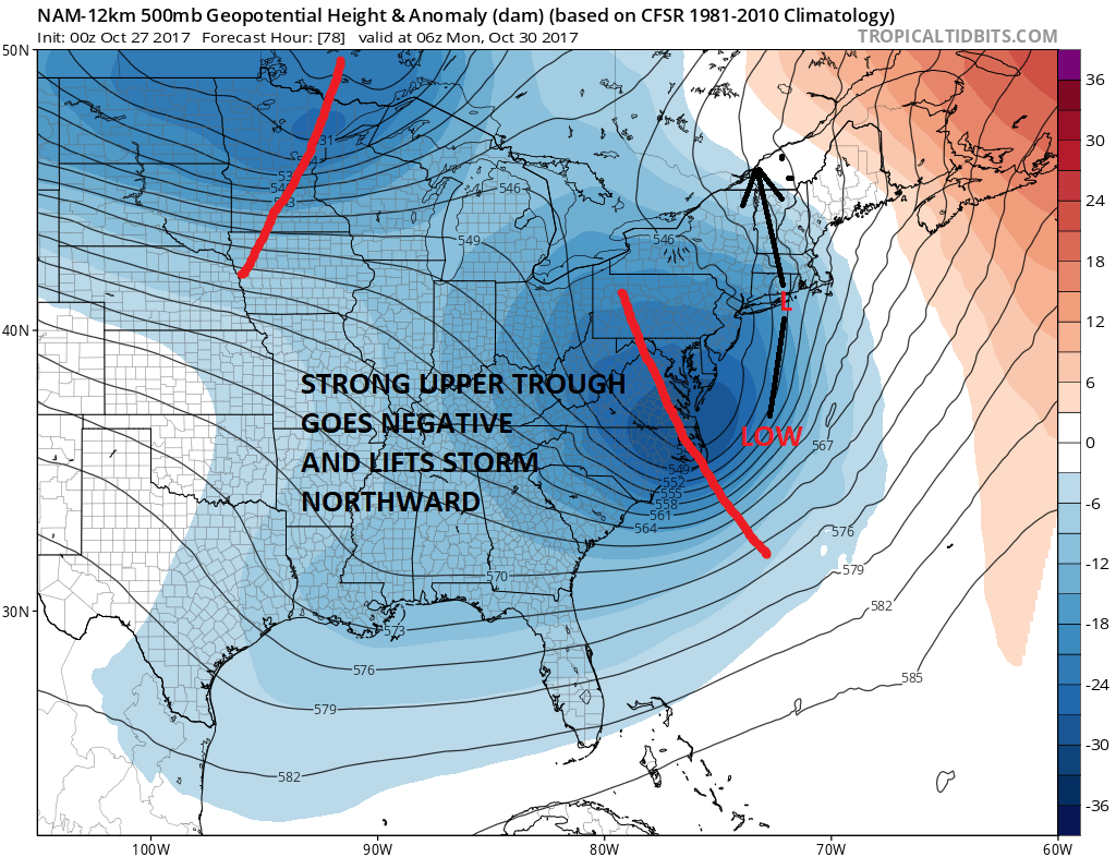
MAJOR STORM THREAT NAM MODEL SUNDAY NIGHT SURFACE MAP
CLICK TO ANIMATE
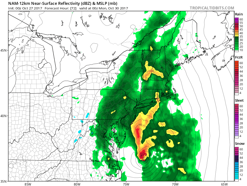
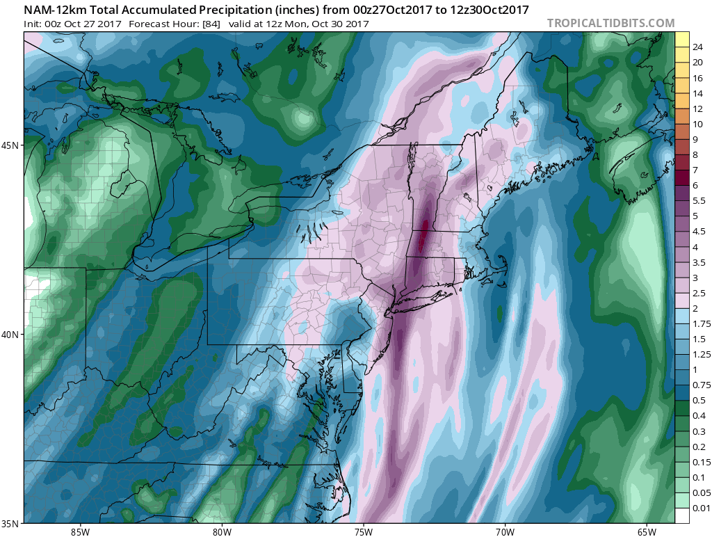
The NAM surface maps for Sunday night (click to animate) shows the storm heading for the East End of Long Island intensifying along the way. Winds there could gust past 60 mph if the NAM verifies. Rainfall amounts of 2 to 4 inches or more are being indicated as well for a large area.
MAJOR STORM NAM RAINFALL TOTALS
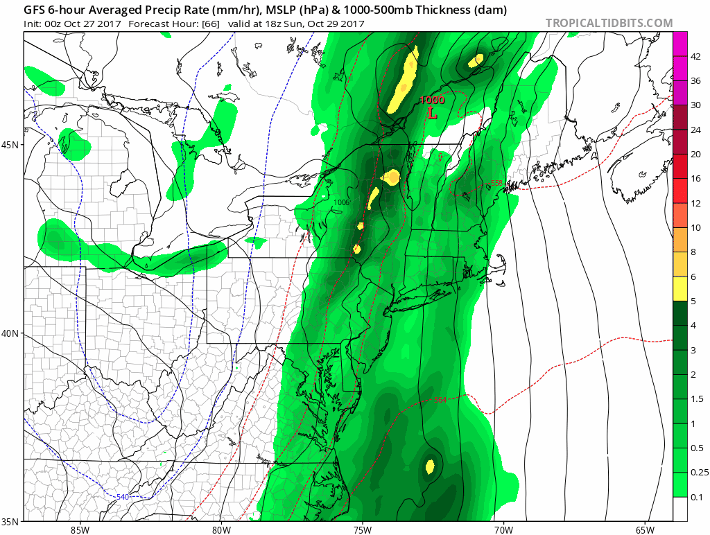
The GFS model came back somewhat but it seems to take longer to lift the trough out and would shift the main action more from Southern New England northward. The intensification takes place a bit later than the NAM or the day side European.
MAJOR STORM GFS MODEL SUNDAY NIGHT CLICK TO ANIMATE
Obviously we are going to have to wait for the European to see if it holds firm on its track just inland of the coast as a major storm. That model doesn’t come out until after 2am. We will wait until morning to figure this puzzle out.
MANY THANKS TO TROPICAL TIDBITS FOR THE WONDERFUL USE OF THE MAPS

GET JOE A CIGAR IF YOU LIKE!
FiOS1 News Weather Forecast For Long Island
FiOS1 News Weather Forecast For New Jersey
FiOS1 News Weather Forecast For Hudson Valley
NATIONAL WEATHER SERVICE SNOW FORECASTS
LATEST JOESTRADAMUS ON THE LONG RANGE
Weather App

Don’t be without Meteorologist Joe Cioffi’s weather app. It is really a meteorologist app because you get my forecasts and my analysis and not some automated computer generated forecast based on the GFS model. This is why your app forecast changes every 6 hours. It is model driven with no human input at all. It gives you an icon, a temperature and no insight whatsoever.
It is a complete weather app to suit your forecast needs. All the weather information you need is right on your phone. Android or I-phone, use it to keep track of all the latest weather information and forecasts. This weather app is also free of advertising so you don’t have to worry about security issues with your device. An accurate forecast and no worries that your device is being compromised.
Use it in conjunction with my website and my facebook and twitter and you have complete weather coverage of all the latest weather and the long range outlook. The website has been redone and upgraded. Its easy to use and everything is archived so you can see how well Joe does or doesn’t do when it comes to forecasts and outlooks.
Just click on the google play button or the apple store button on the sidebar for my app which is on My Weather Concierge. Download the app for free. Subscribe to my forecasts on an ad free environment for just 99 cents a month.
Get my forecasts in the palm of your hand for less than the cost of a cup of Joe!