DOWNLOAD MY NEW FREE JOESTRADAMUS WEATHER APP FOR ALL DEVICES
THE APP IS ABSOLUTELY FREE TO ALL BUT CONSIDERING SUBSCRIBING TO PATREON FOR A WEATHER EXPERIENCE FREE OF ADS, EXCLUSIVE VIDEOS FOR MEMBERS ONLY AND MUCH MORE…STARTS AT $2 A MONTH..MESSAGE ME AT ANY TIME
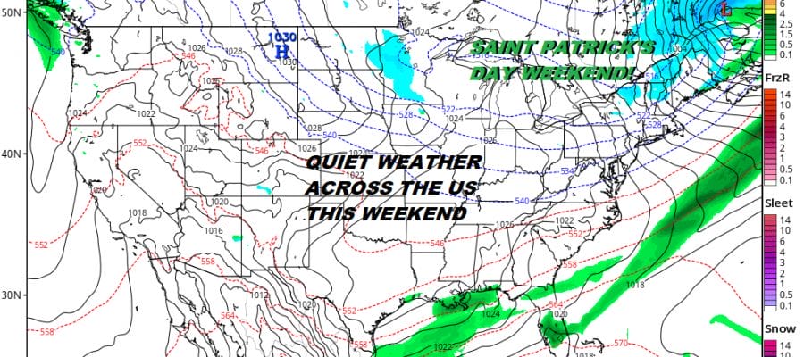
Major Storm Rages Great Plains Calm Conditions In The East
The satellite loop this morning pretty much says it all. We have a powerhouse early spring storm raging in the Plains and Central Rockies today with a large area from Eastern Colorado northeast to the Dakotas under blizzard warnings. Flood Watches continue to the east. Severe weather is occurring across parts of Texas. Here in the East it is rather big yawn at the moment with welcomed quiet. As someone mentioned to me yesterday they could not remember the last time we had three days of dry weather and sunshine consecutively. We are working on the third day in a row of relative calm and I don’t think there are too many people complaining. Skies are clear to start the day and while they might finish with some high clouds coming in from the west this afternoon, it should still be sunny enough to send temperatures up into the 50s in some areas at least.
REGIONAL RADAR

REGIONAL RADAR

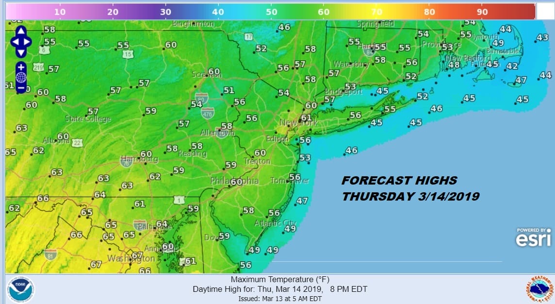
We will manage to squeeze out one more half way decent day on Thursday with clouds around and some breaks of sun at times. Wind direction is going to play a role in how how temperatures get on Thursday. Areas close to the coast will see an ocean wind which will keep temperatures closer to 50 for the highs but many areas should be able to shoot for and top the 60 degree mark.
Friday brings a cold front from the Great Plains storm which by the end of the week will be a weakening low moving across Southeastern Canada. We see clouds and the chance for some showers with highs in the 60s but it won’t be anything we can’t handle. Rainfall amounts should be on the order of a a quarter to a half an inch at most and there is some suggestion that it could be much closer to the low end than the high end.
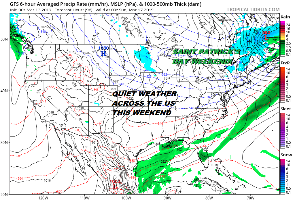
Saint Patrick’s Day this year is Sunday but parades will be going on Saturday in NYC. It doesn’t matter since both days will feature dry weather and sunshine not just here but throughout much of the US with the exception of Florida where a stalled front will be hanging around producing showers. Temperatures this weekend will be in the 50s on Saturday but it will be colder on Sunday with highs in the low to mid 40s. Both days will feature some sunshine. If you are concerned about the endless mindless chatter regarding a snowstorm for next week, here is what it looks like on most models today. Look very closely. It is there.
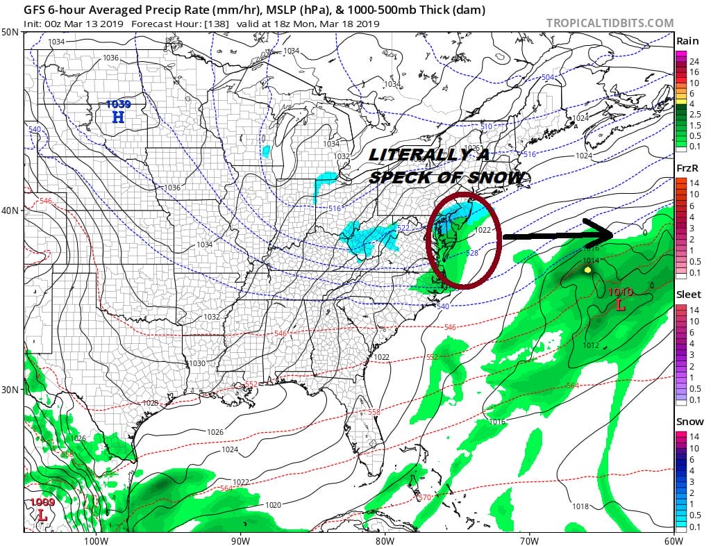
In a absolute last ditch attempt by the snow obsessed out there, this is what they are looking at. A very weak system at best comes through on Monday producing a few specks of snow or a mixed bag of nada during the daytime with no real cold air to speak of. Nothing will come of this as the upper air pattern is flat. We wrote last week that there would be a window where the pattern would turn cold enough and if something were to happen it would a short time to work up something. If this is the best that the atmosphere can offer it might be time to close the books on the winter and move on to spring.
MANY THANKS TO TROPICAL TIDBITS FOR THE USE OF MAPS
Please note that with regards to any tropical storms or hurricanes, should a storm be threatening, please consult your local National Weather Service office or your local government officials about what action you should be taking to protect life and property.


