DOWNLOAD MY NEW FREE JOESTRADAMUS WEATHER APP FOR ALL DEVICES
THE APP IS ABSOLUTELY FREE TO ALL BUT CONSIDERING SUBSCRIBING TO PATREON FOR A WEATHER EXPERIENCE FREE OF ADS, EXCLUSIVE VIDEOS FOR MEMBERS ONLY AND MUCH MORE…STARTS AT $2 A MONTH..MESSAGE ME AT ANY TIME
Cold Night Ahead Slow Warm Up Into Friday Colder Weekend
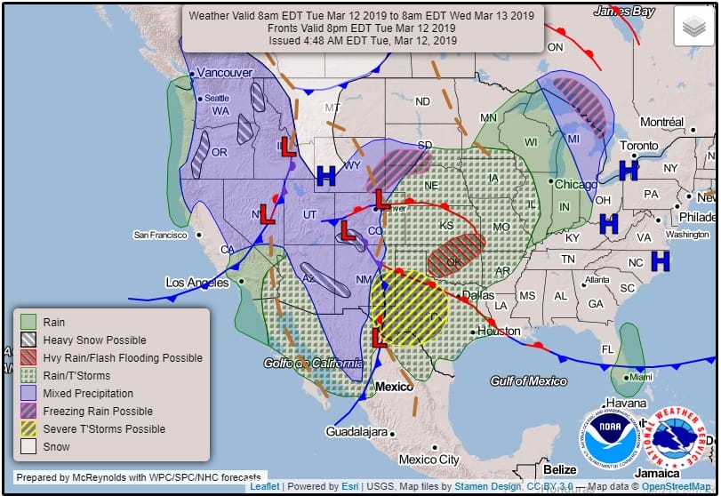
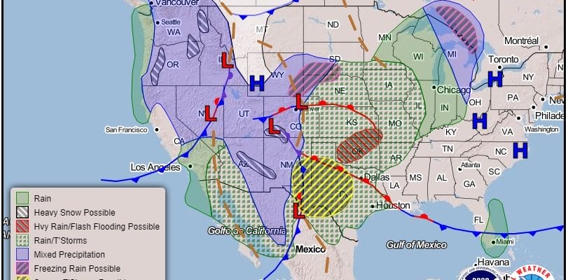
We managed to have a reasonably nice day with sunshine though there were patchy clouds and a bit of a gusty wind. This kept temperatures confined to the low and mid 40s. We are headed for a cold night under what should be mainly clear skies. Temperatures tonight will head down into the 20s with teens in areas north and west of the coast while the warmer urban centers will likely finish closer to 30 or so. The satellite loop this evening shows the developing major storm in the Great Plains and this is going to be quite a storm indeed from Texas to the Dakotas to the upper Midwest. Every watch and warning you can think of is up tonight across that part of the US.
SATELLITE LOOP

REGIONAL RADAR

The major storm in the Great Plains is so far to the west that we are going to stay nice and quiet into Thursday night. Wednesday we will see sunshine though there could be some high clouds blowing eastward later in the day and Wednesday night. Highs should reach the upper 40s to lower 50s over most areas. Then Thursday the slow rise higher continues as we should be in the 50s everywhere. Clouds and wind direction will play a big role as to whether someone is going to be on the low end of that range or on the higher end.
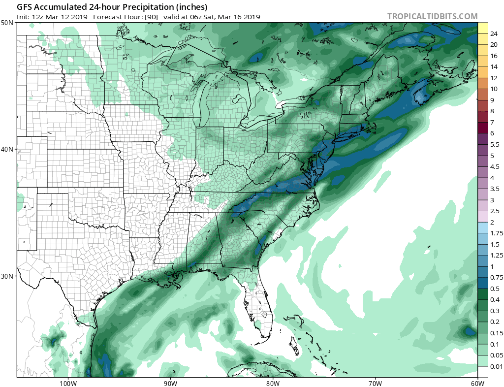
Friday brings a cold front which will be right on schedule along with some showers. Rainfall amounts on the bullish GFS run about a half inch or so but with the storm tracking so far to the north of us into Canada and weakening as it does so, you have to wonder whether these amounts are overdone. It should move through without too much fanfare. The weekend remains on course as being dry and cold. Late Sunday night into Monday we will likely see a weak system dropping southeast from the Great Lakes and heading offshore during Monday. This may be the last chance for snow lovers to see anything this season. An early look suggests the system is weak and would be nothing more than a last chance cheap thrill before a spring pattern overwhelms the Eastern US later next week. We will have more on this over the next few days.
MANY THANKS TO TROPICAL TIDBITS FOR THE USE OF MAPS
Please note that with regards to any tropical storms or hurricanes, should a storm be threatening, please consult your local National Weather Service office or your local government officials about what action you should be taking to protect life and property.


