
Major Storm Impacting Northeast High Winds Rain Severe Weather
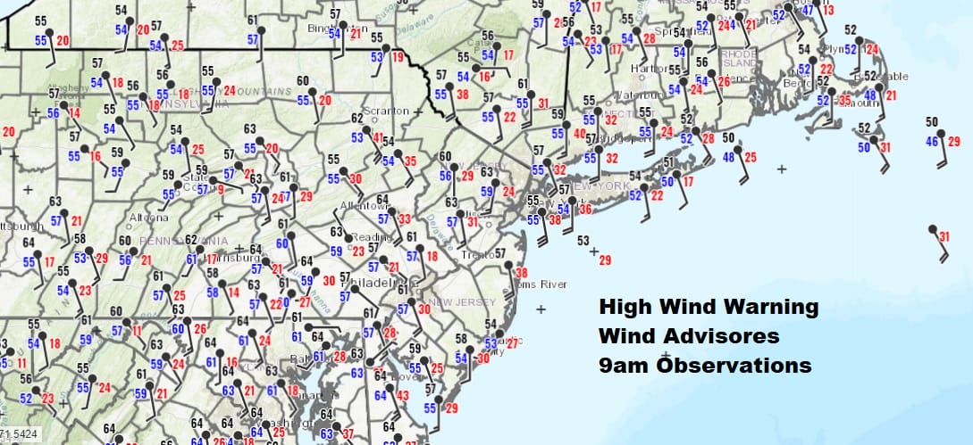
We have a major storm underway from the Great Lakes to the East Coast with strong winds, heavy rains, and severe weather all on the table. We are now entering the time frame that we will see the worst of it as far as the winds are concerned. Gusts of 50 to 60 mph will be commonplace. As of 9am winds have been gusting to 30 to 40 mph at times along the coast with less wind indicated inland.

High wind warnings continue into this evening across much of the Mid Atlantic and Northeast with wind advisories indicated further inland. In addition the Storm Prediction Center has us at risk for severe weather this afternoon when the cold front from this strong storm reaches the coast.

We had heavy downpours overnight as a warm front pushed northward. Now we are waiting for the cold front to swing east and pass through let this afternoon. In the interim it really is a matter of watching the satellites and radars regarding thunderstorm development and severe weather.
SATELLITE

REGIONAL RADAR

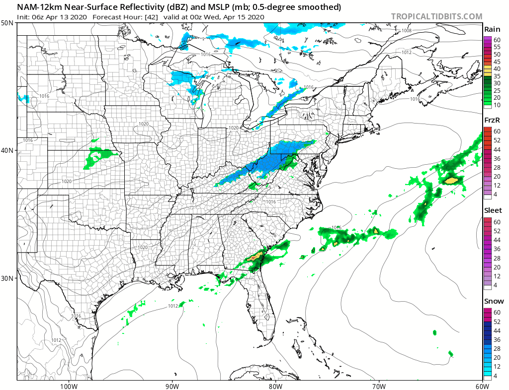
Steady rain on the radar up and down the coast continues to push east. Then to the west we see development around the short wave trough that will trigger off thunderstorms this afternoon. While all of this is going on the winds will continue to howl reaching peak intensity between noon and 5pm.
LOCAL RADAR NEW YORK CITY

LOCAL RADAR PHILADELPHIA


Weather models all have different views on how the radars will develop this afternoon with regard to severe weather. The HRRR seems to show the idea of an attempt for an organized line of thunderstorms developing and pass from west to east between 1pm and 5pm.

Once all this plays out weather conditions will improve tonight with winds dropping off rather quickly overnight and into Tuesday. However the front stalls out to the south with a wave developing the front and moving northeast for Tuesday night into Wednesday morning. Temperatures Tuesday will be in the much cooler 50s.
As the wave goes by it might be possible to see some rain and even some wet snow in the mix in colder areas later Tuesday night into Wednesday morning. It won’t amount to much of anything but at least snow lovers will see their last snow flakes until next November or December. Clouds will remain for much of the day Wednesday with highs just in the 40s to near 50. Thursday into Friday looks dry but another weather system could bring some rain or showers Friday night into Saturday.
BE SURE TO DOWNLOAD THE FREE METEOROLOGIST JOE CIOFFI WEATHER APP &
ANGRY BEN’S FREE WEATHER APP “THE ANGRY WEATHERMAN!
MANY THANKS TO TROPICAL TIDBITS FOR THE USE OF MAPS
Please note that with regards to any severe weather, tropical storms, or hurricanes, should a storm be threatening, please consult your local National Weather Service office or your local government officials about what action you should be taking to protect life and property.


