DOWNLOAD MY NEW FREE JOESTRADAMUS WEATHER APP FOR ALL DEVICES
THE APP IS ABSOLUTELY FREE TO ALL BUT CONSIDERING SUBSCRIBING TO PATREON FOR A WEATHER EXPERIENCE FREE OF ADS, EXCLUSIVE VIDEOS FOR MEMBERS ONLY AND MUCH MORE…STARTS AT $2 A MONTH..MESSAGE ME AT ANY TIME
Major Storm Great Lakes Rain Saturday Night Sunday
Strong Winds Developing Sunday Night Monday
We are beginning to see a major storm coming together that will drive the weather this weekend over a large portion of the US. The impacts have already been seen in the Southwest with all time 24 hour and single storm forecast records being set across Arizona capped by 41 inches in Flagstaff Arizona.

In anticipation of this we have Winter Storm Watches across the Plains and Upper Midwest, Flood Watches across the Mid South, High Wind Watches are starting to go up for parts of the Eastern US. We Will see impacts here beginning Saturday. Today we have high clouds and some sunshine with highs in the 40s. We can see the rain from this on the radar to the south that has been sitting there since yesterday. It won’t get here until Saturday late afternoon and evening. Tonight we will see high clouds mixed with clear skies with lows in the 30s. Then thickening clouds are forecast for Saturday after some morning sun with highs in the low to mid 40s.
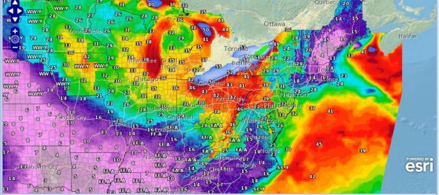
REGIONAL RADAR

Rain comes in Saturday night and continues into Sunday morning It is possible in some areas well inland in the Hudson Valley where a brief period of freezing drizzle is possible but that is minor and won’t last longer than an hour or so. Rain of an inch to an inch an quarter seems likely into Sunday morning and there could even be a thunderstorm or two in the mix as well. Weather conditions will improve with the rain ending from west to east by mid morning with some sunshine breaking out in the afternoon. We could see highs in the 50s to near 60 before colder air arrives. It will arrive on strong northwest winds.
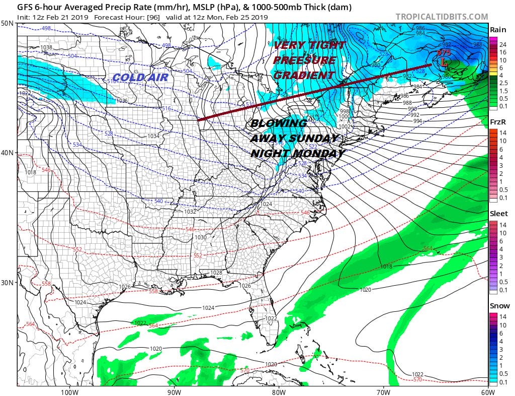
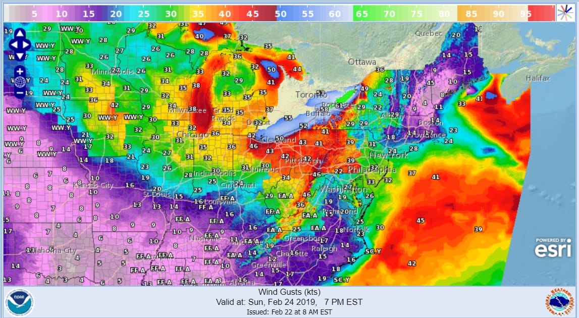
The pressure gradient is going to get very tight here Sunday afternoon into Monday morning. Anticipate winds of 20 to 35 mph from the northwest with gusts to 50 mph until the gradient loosens during Monday though it will still be rather windy. This entire storm will have a March storm feel to it.
Yesterday we discussed a pattern change in the long range that would temporarily at least break the dominating strength and impact of the Pacific Jet. We still believe this is going to be the case which means colder weather comes into the Eastern US keeping temperatures close to or a little bit below average. It doesn’t necessarily mean there will be any snow threats to speak of though if something is going to happen, there will be a 10 day to 2 week window of opportunity before the Pacific jet comes roaring back.
MANY THANKS TO TROPICAL TIDBITS FOR THE USE OF MAPS
Please note that with regards to any tropical storms or hurricanes, should a storm be threatening, please consult your local National Weather Service office or your local government officials about what action you should be taking to protect life and property.


