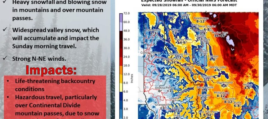
Major Snow Storm Northern Rockies Quiet Weather Continues Northeast
While September remains very quiet and on some days spectacular, the Northern Rockies are about to see a major snow storm that would be big in the winter months. This however comes in late September which even for this area is incredibly early. We are talking a major snow storm for the Northern Rockies and the National Weather Service offices there are calling it historic!
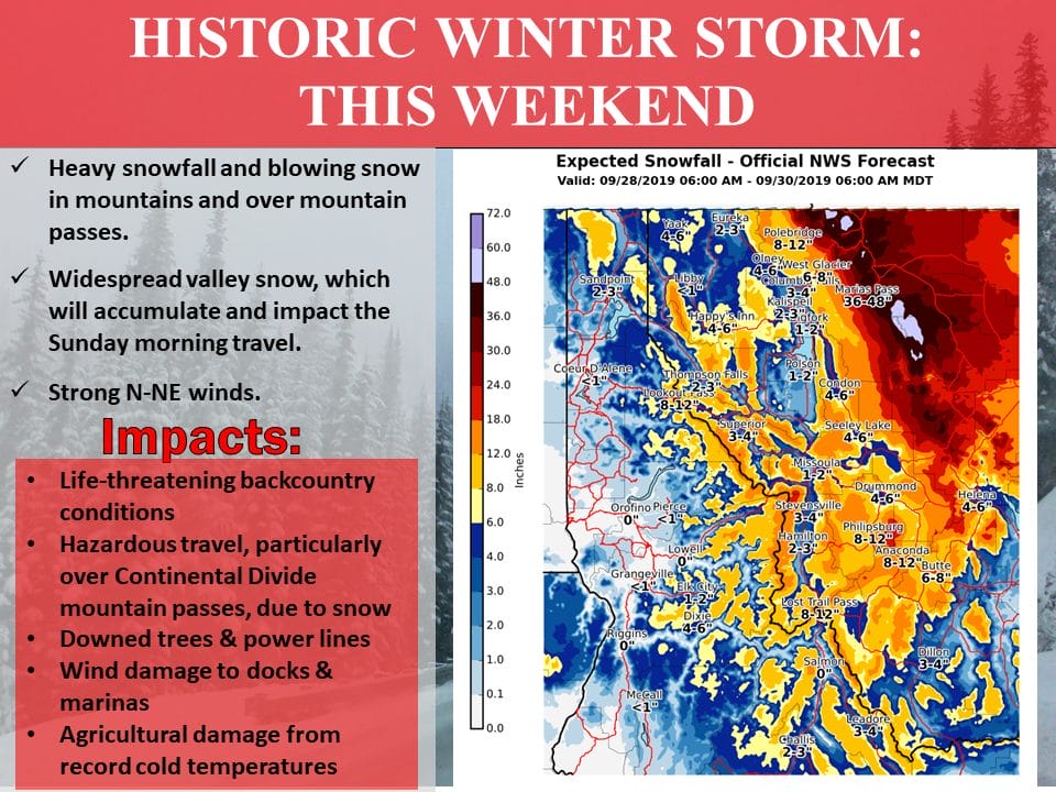
We are talking snow in feet, up to 4 feet being forecast in some areas. Even some of the cities like Butte & Helena are going to pick up 6 inches or more. It is an early arrival of winter in the Northern Rockies thanks to an unusually deep trough that has come into the Northwest US pulling down cold Canadian air in the Northern Rockies while low pressure develops over Utah and heads to North Dakota.

We all know that when it is stormy like this in the west, it is usually calm and quiet in the East and that is the case this weekend. We have another weather front approaching today from the northwest and while we will start with some sunshine today clouds will develop later on and there is the chance for a passing shower or two this evening when the cold front passes though I suspect barring any surprises that the showers should be few and far between.
SATELLITE

REGIONAL RADAR

Today we will warm up a bit from Friday as highs should reach the upper 70s and lower 80s. Then the front passes and moves to the south. Skies should clear out overnight and that sets us up for a nice Sunday of sunshine. Temperatures will be in the 70s and there will be a nice breeze from the north and northeast capping off a good weekend except for that minor interruption. Saturday evening.
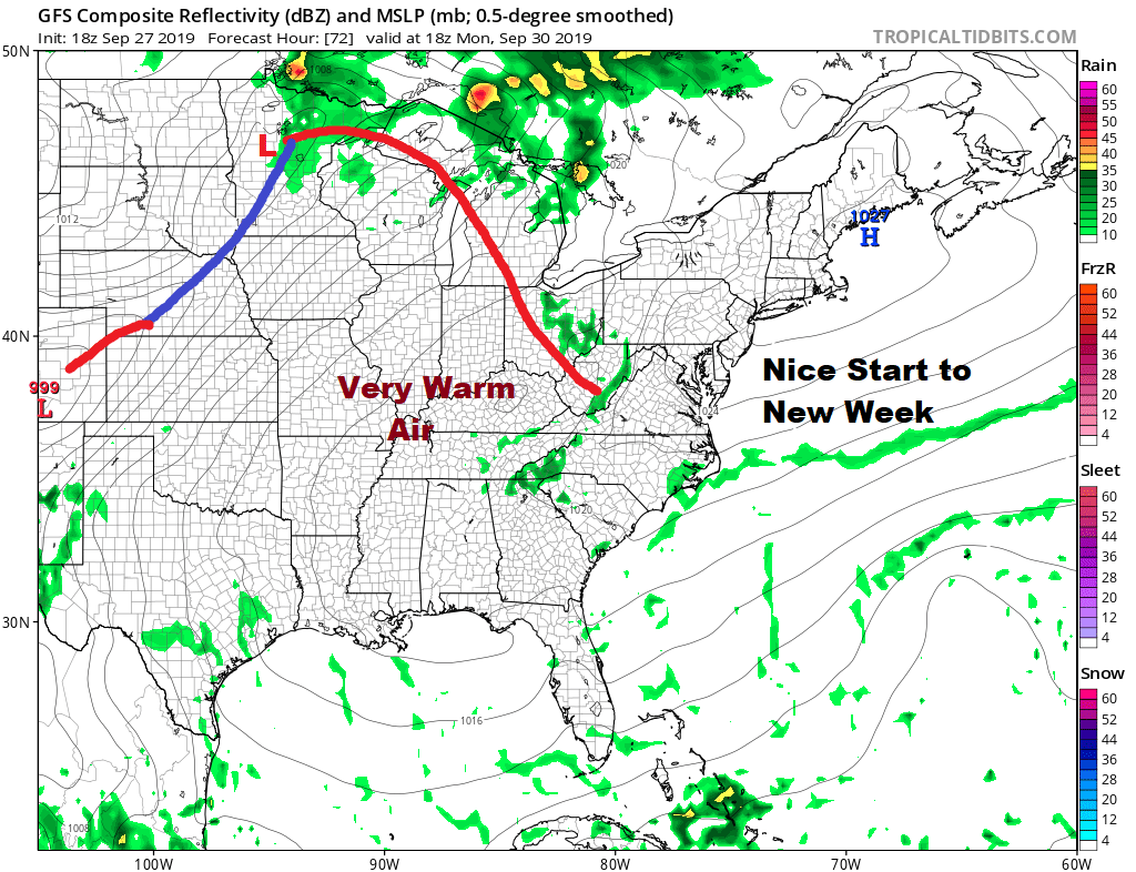
We will carry over the nice dry weather into Monday with sunshine and some high clouds as a warm front to the west begins its approach. Monday’s highs will be in the 70s. Then on Tuesday the winds will go to west southwest as we get into the warm and somewhat more humid air. Tuesday will be partly to mostly sunny and it will be warmer with October starting out with highs in the upper 70s to lower 80s.
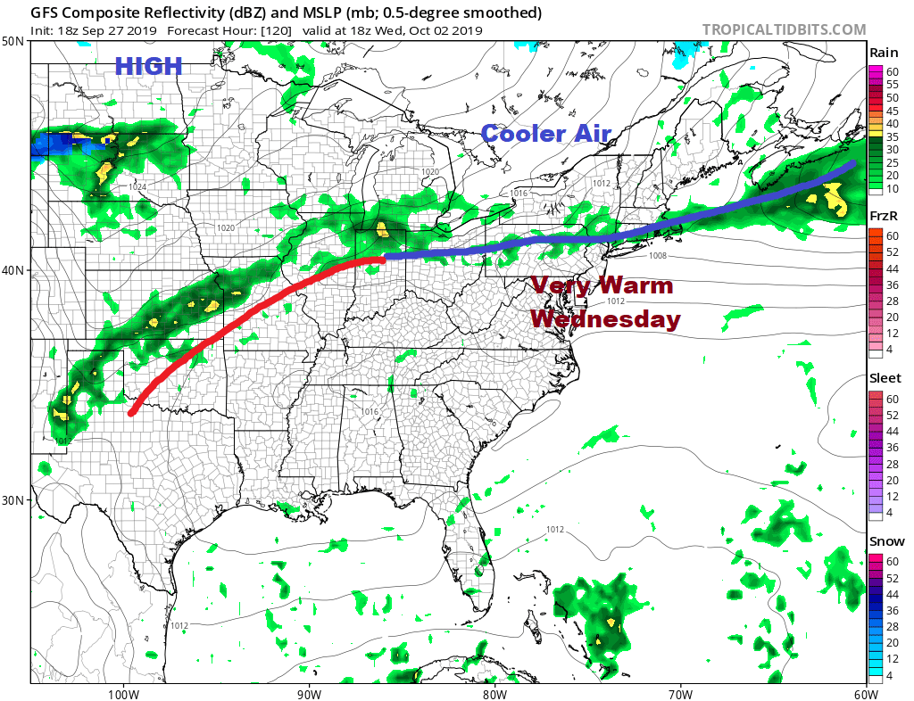
Wednesday a cold front will be pressing southward and ahead of it Wednesday it will be very warm with some sunshine. Highs will reach the mid to upper 80s. There could be some showers late in the day as this cold front passes. This begins a series of changes that is actually getting energized by Hurricane Lorenzo which by this time will be heading into Western Europe as a major storm intensifies east of Newfoundland and out in the North Atlantic.

Lorenzo will be setting off a chain reaction of changes across Europe, Asia, and North America that will allow a series of weather systems to move through the Eastern US delivering shots of cool air. Wednesday night and Thursday we will be setting up the next cold front for Friday with the first solid chance for some widespread showers followed by a cool Canadian air mass for next weekend and several more could follow down the road.
MANY THANKS TO TROPICAL TIDBITS FOR THE USE OF MAPS
Please note that with regards to any tropical storms or hurricanes, should a storm be threatening, please consult your local National Weather Service office or your local government officials about what action you should be taking to protect life and property.


