Low Pressure Heads to Southeastern New England Some Improvement Weekend

Weather in 5/Joe & Joe Weather Show Latest Podcast
Low Pressure Heads to Southeastern New England Some Improvement Weekend
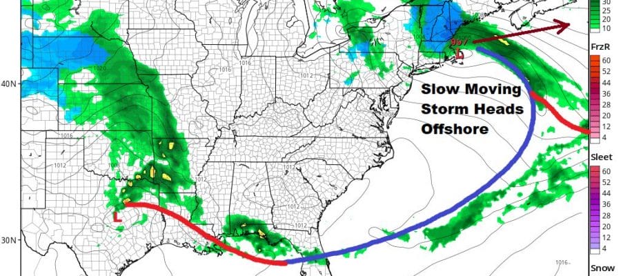
The circulation of the strong upper low remains obvious on the satellite picture as it sits on the upper left of the shot. A long fetch of clouds has brought rain from Northern New Jersey to NYC and New England this afternoon while south and west of there it has just been clouds and even some breaks of sunshine developed in parts of Southern Pennsylvania and Southern New Jersey. While temperatures were in the 60s there, where the rains are falling temperatures are in the 40s to around 50.
SATELLITE

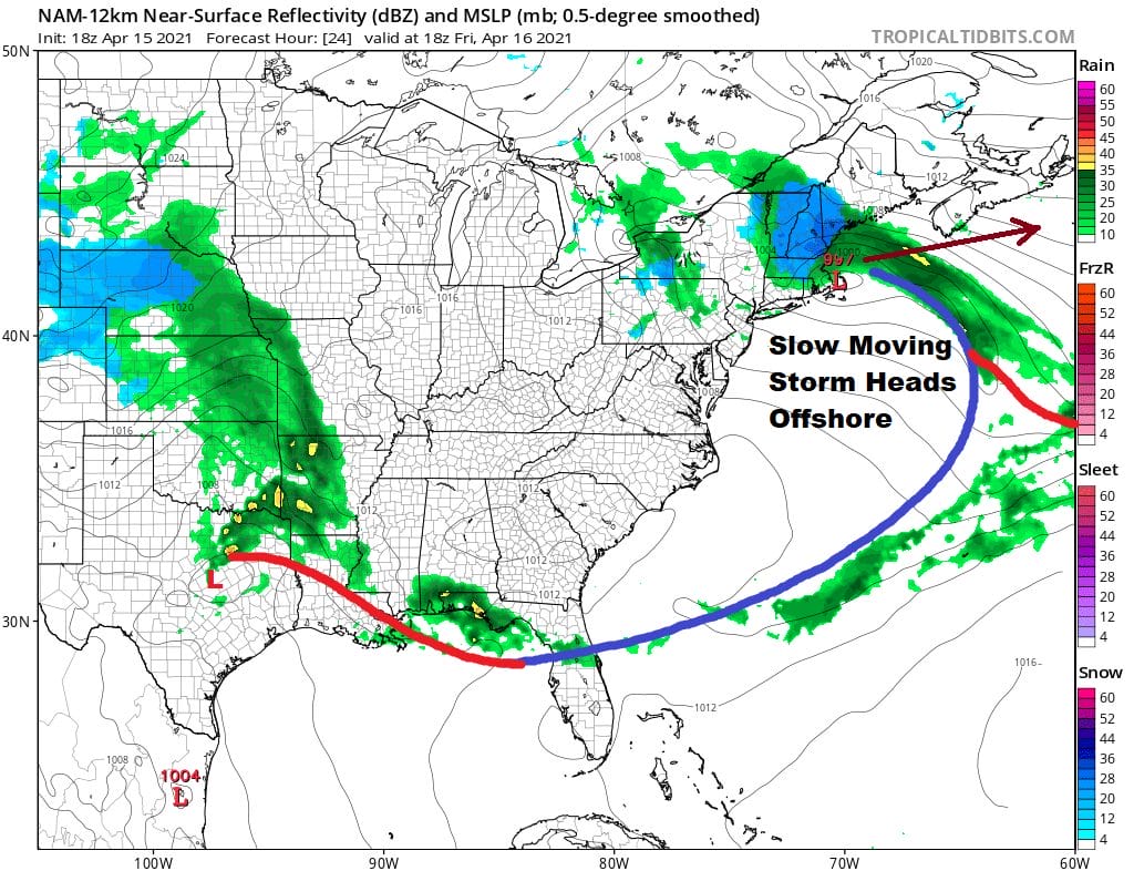
The surface low is developing on schedule. It lies well east of the Delaware coast. It will continue to move east before turning north and then northwest, arriving in Southeastern New England by Friday morning. Rains over Southern New England to New Jersey and the Hudson Valley as well as Long Island should come to an end this evening from west to east. The action shifts to interior New England as the rain changes to wet snow especially in elevations above 1500 feet.
Temperatures everywhere tonight will drop to the upper 30s and lower 40s. Friday look for leftover clouds. Some breaks of sunshine are possible but clouds will likely be the dominant feature. Highs Friday will be in the upper 40s to mid 50s. I don’t see any important changes in the outlook for the weekend. We should see a mix of sun and clouds on Saturday with highs in the upper 50s and lower 60s. Sunday look for the same with just the chance for a passing shower mainly well inland. Highs will be in the 60s.
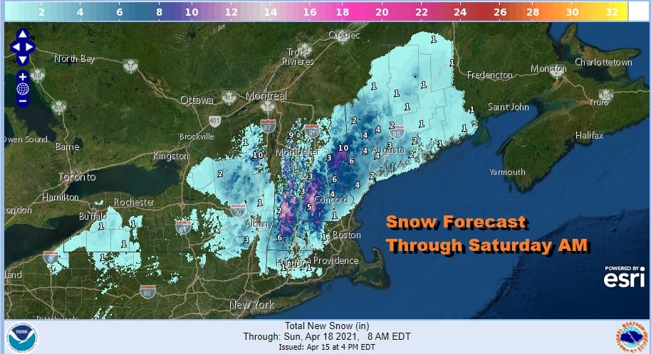
For those of you whose minds are still on snow above is the National Weather Service digital forecast map for snow amounts in New England. Vermont, New Hampshire and Western Maine seem to get the brunt of any snow from this system. Arears to the south in the Catskills and Poconos should see little or nothing from this as the upper low track continues to inch further north with each passing model run.
BE SURE TO DOWNLOAD THE FREE METEOROLOGIST JOE CIOFFI WEATHER APP &
ANGRY BEN’S FREE WEATHER APP “THE ANGRY WEATHERMAN!
MANY THANKS TO TROPICAL TIDBITS FOR THE USE OF MAPS
Please note that with regards to any severe weather, tropical storms, or hurricanes, should a storm be threatening, please consult your local National Weather Service office or your local government officials about what action you should be taking to protect life and property.


