DOWNLOAD MY NEW FREE JOESTRADAMUS WEATHER APP FOR ALL DEVICES
Lots of Clouds Today Soaking Rain Late Tonight Sunday

The weekend is here and unfortunately not much has changed since yesterday. Overnight downpours and thunderstorms have played through. We were hoping that we would some sort of modest improvement in weather conditions today with at least some brightening of skies or a few breaks of sun. Keep your fingers crossed that this happens. We have lots of clouds around with damp dreary conditions and it appears we will be struggling all day. The frontal boundary likes to the south this morning and the onshore flow conditions remain in place.
REGIONAL RADAR

On the radars this morning we are seeing some scattered areas of showers and downpours and we need to leave the risk in the forecast for today. It is far more likely that you miss out on any showers due to the scattered nature of the precipitation. Nothing widespread is expected today. With clouds dominating and the frontal boundary to the south, temperatures are going to struggle as well with highs in the 60s in most places…50s along the immediate coast
LOCAL RADAR NEW YORK CITY

LOCAL RADAR PHILADELPHIA


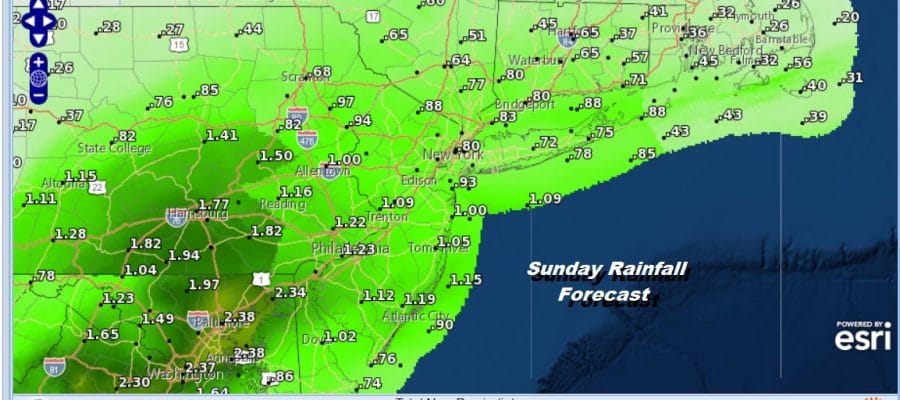
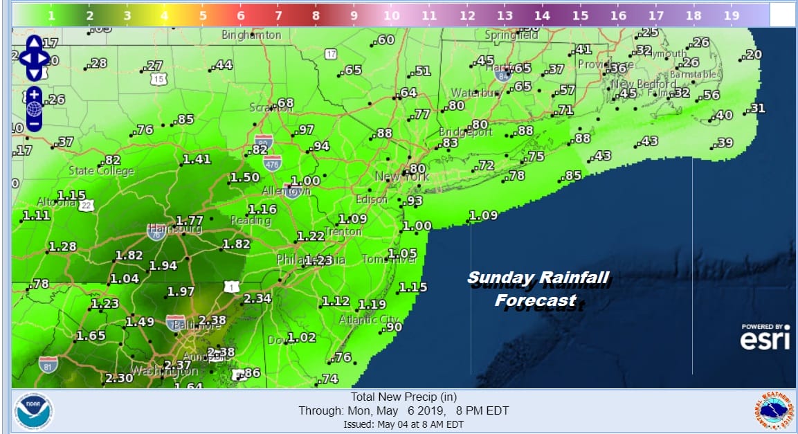
Tonight we will be watching low pressure developing to our south. Rain arrives in Eastern Pennsylvania late this evening, reaches NYC and nearby around 2am or so and over Long Island and Southern New England an hour or two after. It rains pretty much all day Sunday and comes to an end late in the afternoon or early evening from west to east. Rainfall amounts of 1 to 2 inches are likely. It will be a raw miserable day with temperatures just in the 50s.
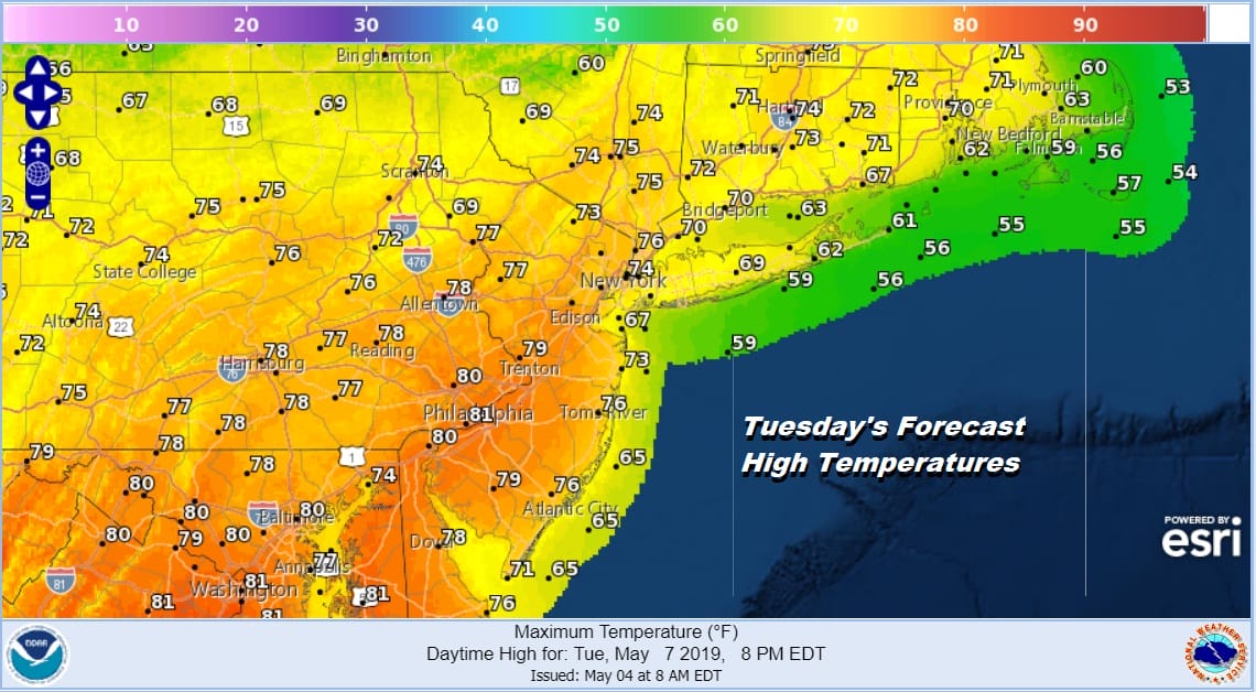
The new week begins with sunshine on Monday as we catch a break for a day or two. The next cold front won’t arrive until late Tuesday and it should warm up nicely. Highs Monday will reach the 70s in most places and Tuesday’s highs will be in the mid 70s to lower 80s. There is a chance for showers late in the day as the next cold front pushes through.
After that front moves through the onshore flow returns on Wednesday though it seems that any rain will likely hold off until Wednesday night or Thursday as the next wave of low pressure moves eastward. At least we are going to catch a break with some nice warmer weather for the start of next week before the parade of waves returns.
MANY THANKS TO TROPICAL TIDBITS FOR THE USE OF MAPS
Please note that with regards to any tropical storms or hurricanes, should a storm be threatening, please consult your local National Weather Service office or your local government officials about what action you should be taking to protect life and property.


