
DOWNLOAD MY NEW FREE JOESTRADAMUS WEATHER APP FOR ALL DEVICES
Flood Watch Sunday Parts of New Jersey Washout Sunday
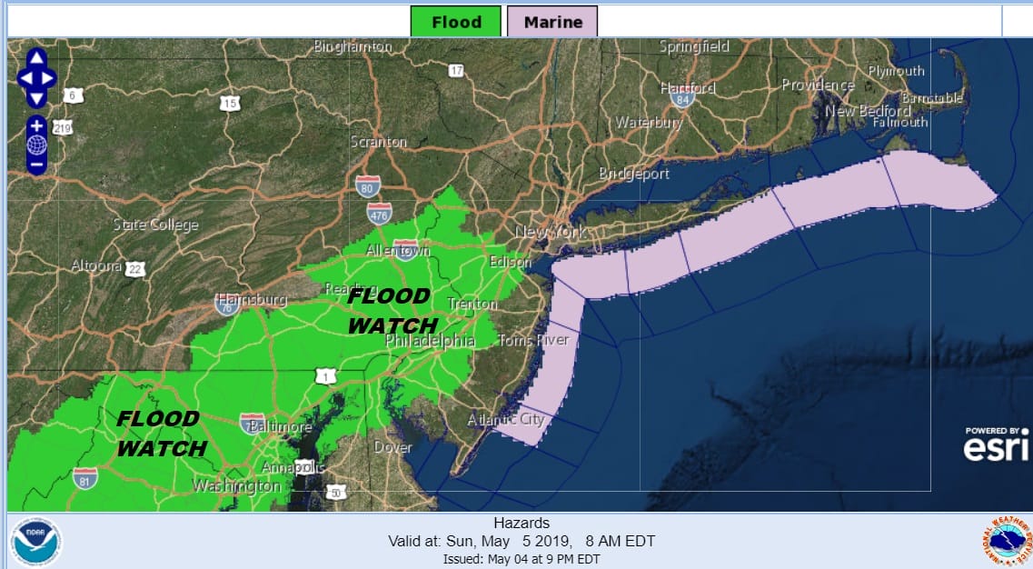
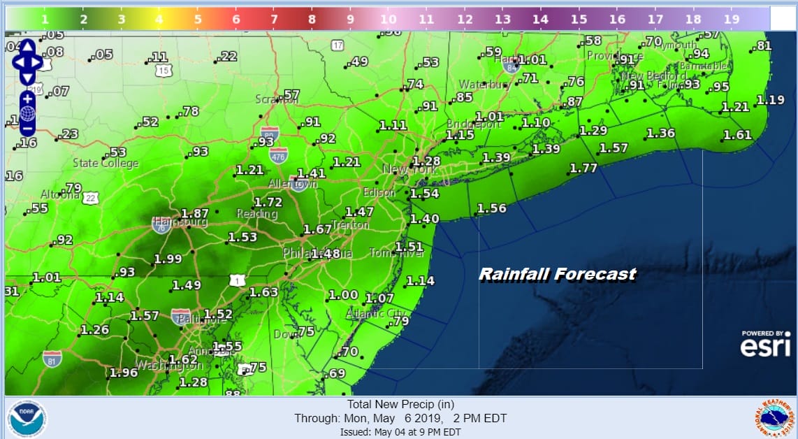
I hope that everyone got to enjoy whatever sunshine you saw today as everything is on course for rain on Sunday. Flood Watches have been posted for parts of New Jersey and it is possible we will see the flood watches extended Sunday morning. Rainfall amounts will be in the 1 to 2 inch range and there will likely be locally higher amounts in some areas.
The satellite picture tonight shows low pressure in the east with a rather obvious comma shape signature. Thunderstorms with heavy rains are moving through the Tennessee Valley into the Southeast US. Higher cloud tops also reflect heavy downpours and thunderstorms moving through North Carolina and Virginia.
SATELLITE

REGIONAL RADAR

The lead area of rain and thunderstorms are within view of the regional radar. we are also seeing some rain breaking out on the local radars and rain will begin to develop over most of the area during the early morning hours on Sunday.
LOCAL RADAR NEW YORK CITY

LOCAL RADAR PHILADELPHIA


Sunday it is cloudy raw and rainy with some locally heavy downpours. Low pressure is taking a track off the Virginia coast and moving slowly northeastward. The HRRR model shows rain lasting all day and then gradually coming to an end from west to east Sunday evening. Being north of the low track means we northeast winds all day long with raw conditions and temperatures probably only in the 50s.

The good news is that weather conditions improve after that and we should have 2 nice days to start the new week. Monday look for sunshine to return with highs reaching the 70s away from the coast. Tuesday with a cold front dropping down from the north we should see sunshine into the afternoon with a chance for showers or a thunderstorm by evening. Highs Tuesday will be in the mid 70s to some lower 80s before the front passes.

Once again the onshore flow returns on Wednesday with cooler air on northeast winds thanks to a cold high across Southern Canada and the Great Lakes. It appears that we won’t see much or any rain on Wednesday but it will be much cooler. A storm from the Central Plains will head to the Great Lakes and rain will return here at the end of the week.
MANY THANKS TO TROPICAL TIDBITS FOR THE USE OF MAPS
Please note that with regards to any tropical storms or hurricanes, should a storm be threatening, please consult your local National Weather Service office or your local government officials about what action you should be taking to protect life and property.


