
Long Range GFS Keeps Blowtorch On!
The overnight run of the long range gfs pretty is in on course with prior runs and shows now real important changes through Christmas. However tonight’s run seems to be at it again beyond the day 10 range where it indicates that something is going on in the large scale pattern. Frankly we are beyond dubious about this for obvious reasons. We have been led down this path before on not one but numerous occasions only to be dealt the reality of the ridge off the southeast coast of the United States. It is the same old story there through day 10 which is Chirstmas Eve right at about the time I’m sitting down to a seafood dinner. What is remarkable about the last half a dozen runs is that the gfs model has not varied very much.
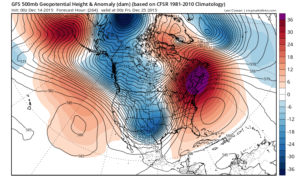
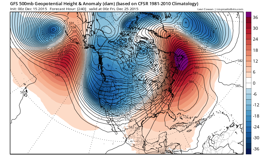
I went back 4 runs to show the 264 hour from Sunday night and the 240 hour of the most recent run which match up to 7pm Christmas Eve. The trough in the west is actually a little broader in scope and the Pacific is a little different with a major storm shown south of the Aleutians but the east is about the same. Perhaps the ridge is a shade flatter but not by much. The idea is pretty much the same.
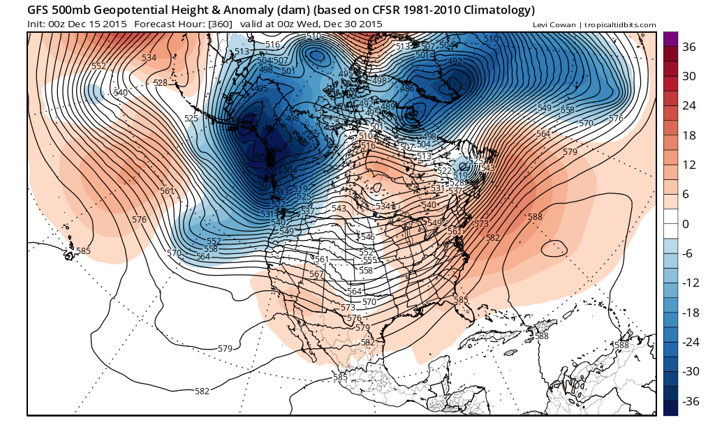
Out to 360 hours which takes us to New Years Eve, it shows a more zonal flow across the United States but Canada is still a mess. While not a blow torch it is by no means an ice box or even a refrigerator, The best you can say is that it is a little closer to seasonal and that about it. Frankly I remain unmoved and unimpressed with all this at this stage of the game. Two cold fronts are players here. One around Christmas Even and another around the 28th. Both are arguments for 50s ahead of each front. Other than that it looks to be a snooze fest during the Christmas holidays.
One thing about this run that stands out. If you are a skier and are planning a ski vacation between Christmas and New Years, I hope its out west because there isn’t any hope for big snows or even little snows in the northeast ski areas right through the long range period if this is right.
JOESTRADAMUS MONDAY ANALYSIS ON THE BLOWTORCH WEATHER PATTERN
JOESTRADAMUS SUNDAY ANALYSIS ON THE LONG RANGE
NEW YORK CITY & HUDSON VALLEY FORECAST