
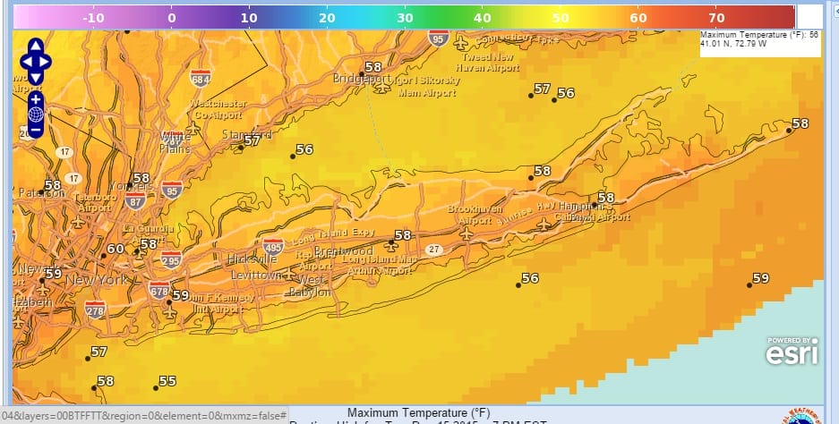
Long Island Record Highs 6 Days Consecutive!
We have not only broken record high temperatures 6 days in a row on Long Island but we have done it with real cleverness! Last night we set two records in 2 minutes by breaking the record for Monday at 11:59pm and setting the record for Tuesday at 12 midnight! To top that off we actually needed a south southeast wind to cool off instead of warm up given the time of year! This has truly been a remarkable stretch of weather.
This is the last day of record highs as we will turn progressively cooler over the next few days. The atmosphere is getting ready for a blast of cold air for the weekend which will bring temperatures down to near normal (wow!) for 2 days before the blow torch returns for Christmas week and for New Years as well. There is simply no sign of any change to this pattern as we indicated in our long range post earlier this morning.
So today it is sunshine with a few clouds and a gusty wind with temperatures in the 50s to near 60 and tonight should be clear with lows in the upper 30s to lower 40s


Wednesday looks good with sunshine and highs in the 50s. Some high clouds will arrive later in the day.
The next change is another cold front and low pressure coming up from the south along that front and we could get a nice decent shot of rain with that on Thursday. Once the front passes the question is whether there could be a second weaker wave but models are moving away from that idea. Thurday temperatures may reach the 50s but then start to ease on Friday with highs in the 40s. Saturday will be cold with temperatures not out of the 30s all day. That is the extent of the winter weather that is coming because a warm up begins Sunday and takes us back into the blow torch pattern.
Willard Scott retired today after 35 years on NBC’s Today Program. It is a sad and happy day for me. Read more.
JOESTRADAMUS VIDEO ANALYSIS 12/15/2015