
Long Range Active Cool Start to June
Trough Sets Up In The East
Whether you technically had a heatwave or not really depended on where you are. Much of central and northern New Jersey had 3 consecutive days of 90 degrees plus with Newark hitting 96 Friday and setting a record. Elsewhere however the ocean sea breeze or the prevailing southwest wind kept temperatures under 90. All of this early very warm or heatwave weather comes to an end on Monday Memorial Day as we have rain moving northward from Tropical Storm Bonnie (what’s left of it) combining with a cold front pushing in from the northwest.
Long Range Active Cool Start to June GFS UPPER AIR TUESDAY

Usually these things tend to move in an orderly fashion however the main core circulation of Tropical Storm Bonnie is actually getting left behind while the tropical moisture from it is moving north northeastward around the edge of the offshore upper high. This unfortunately comes just in time for Memorial Day and models are lingering the rain well into the afternoon especially for coastal areas. The Euro weather model is the only one that seems to want to get the rain out of here by late morning or early afternoon. I think its fair to say that at least the first half of the day is going to be washed out. The second half might see improvement in western areas. The GFS model has it raining in most places into Monday evening.
Longer range we have a very interesting pattern setting up for the first half of the month of June. Both the European weather model and the GFS weather model are telegraphing a trough in the east. In fact the troughing being indicated looks to be much deeper than you usually see for this time of year.
Long Range Active Cool Start to June GFS UPPER AIR NEXT SUNDAY
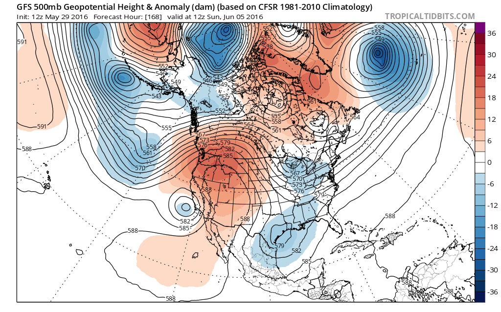
Long Range Active Cool Start to June Euro Model Next Sunday
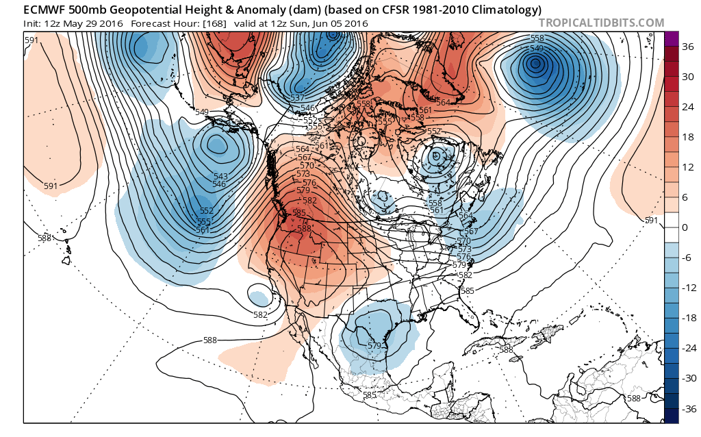
This set up means that we will have cold fronts coming through here every 2 or 3 days. It also means that any warm ups that occur ahead of these fronts may only be limited to a day or so. This rules out heatwaves. It also means that we could see more shower and thunderstorm activity over the next couple of weeks. This might be a genuine break in the longer term dry pattern we have been in. It also probably means temperatures will average near or below normal over the next couple of weeks.
Long Range Active Cool Start to June GFS UPPER AIR 6/8/2016

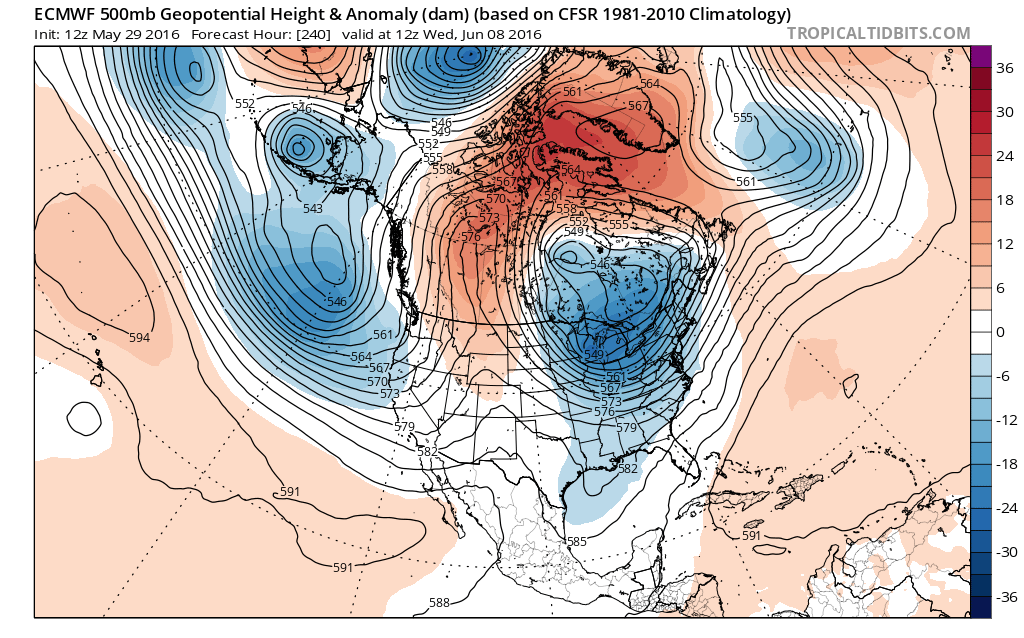
Long Range Active Cool Start to June Euro Model 6/8/2016
 The Euro weather model is especially deep with this vortex that develops in Eastern Canada. The GFS model is not as deep but actually gets to the same place a little later in time. This type of pattern could also mean some occasional threats of severe weather as these weather fronts approach. It looks like an active next couple of weeks.


MENTION JOE CIOFFI AND GET A 5% DISCOUNT
FiOS1 News Weather Forecast For Long Island
FiOS1 News Weather Forecast For New Jersey
FiOS1 News Weather Forecast For Hudson Valley
NATIONAL WEATHER SERVICE SNOW FORECASTS
LATEST JOESTRADAMUS ON THE LONG RANGE

NOMINATED FOR AN APPY AWARD FOR BEST WEATHER APP!!
Weather App

Don’t be without Meteorologist Joe Cioffi’s weather app. It is really a meteorologist app because you get my forecasts and my analysis and not some automated computer generated forecast based on the GFS model. This is why your app forecast changes every 6 hours. It is model driven with no human input at all. It gives you an icon, a temperature and no insight whatsoever.
It is a complete weather app to suit your forecast needs. All the weather information you need is right on your phone. Android or I-phone, use it to keep track of all the latest weather information and forecasts. This weather app is also free of advertising so you don’t have to worry about security issues with your device. An accurate forecast and no worries that your device is being compromised.
Use it in conjunction with my website and my facebook and twitter and you have complete weather coverage of all the latest weather and the long range outlook. The website has been redone and upgraded. Its easy to use and everything is archived so you can see how well Joe does or doesn’t do when it comes to forecasts and outlooks.
Just click on the google play button or the apple store button on the sidebar for my app which is on My Weather Concierge. Download the app for free. Subscribe to my forecasts on an ad free environment for just 99 cents a month.
Get my forecasts in the palm of your hand for less than the cost of a cup of Joe!
![]()

