Labor Day Weekend Continues Clouds Some Sun Sunday
Shower Thunderstorm Late Monday
HURRICANE DORIAN 8AM
LOCATION…26.5N 76.5W
ABOUT 35 MI…55 KM E OF GREAT ABACO ISLAND
ABOUT 225 MI…360 KM E OF WEST PALM BEACH FLORIDA
MAXIMUM SUSTAINED WINDS…160 MPH…260 KM/H
PRESENT MOVEMENT…W OR 275 DEGREES AT 8 MPH…13 KM/H
MINIMUM CENTRAL PRESSURE…927 MB…27.37 INCHES
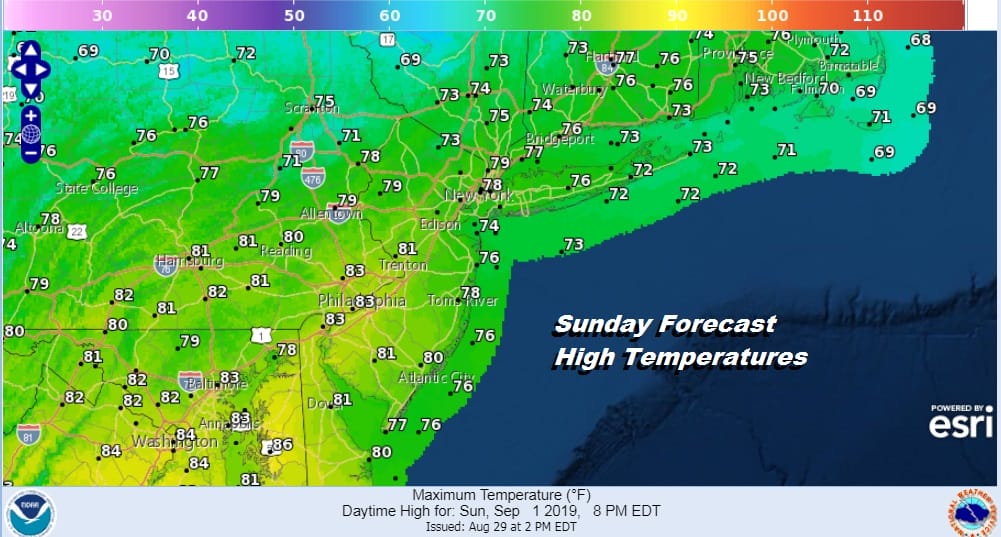
We are into the second day of the Labor Day holiday weekend and today we are seeing the beginnings of change. The flow is turning more onshore as the day wears on. We also have some clouds to the west with an approaching weak cold front. The satellite picture this morning shows clouds but it also shows some breaks in the cloud cover. We should see no worse than partly sunny skies on average today but there will be more clouds to the west as you head into Pennsylvania. Reduced sunshine and the onshore flow will keep temperatures today mostly in the 70s.
SATELLITE

Hurricane Dorian is plainly obvious on the satellite picture this morning and as of 8am the winds are now 175 mph as a category 5 hurricane about to move over Great Abaco Island in the Bahamas with potential for catastrophic damage.
REGIONAL RADAR

There are some showers showing up on the regional radar in parts of Pennsylvania and upstate NY and they are moving east however most will dry up as they near the coast and the majority of any showers will probably be inland well north and northwest of coastal areas.
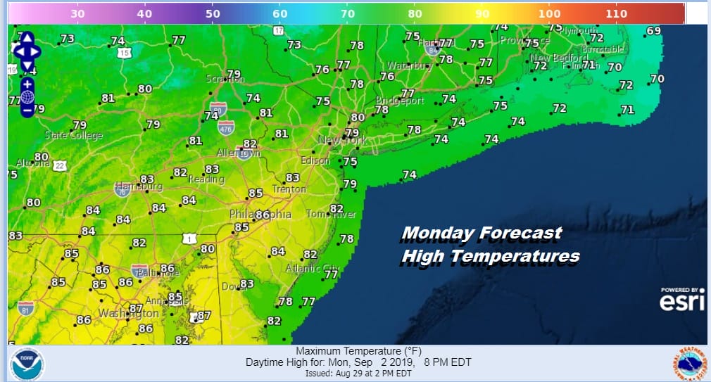
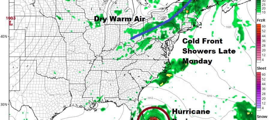
Monday is Labor Day and we have a cold front nearing us later in the day which will bring an increase in humidity and the chance for a shower or thunderstorm later in the day Monday into Monday night. Most highs will reach the upper 70s to lower 80s from NYC North and east and low to mid 80s South Jersey & Southeastern PA southward. There will be dry stretches Monday with some sun in the mix as well and it is possible that some areas won’t see any rain at all.
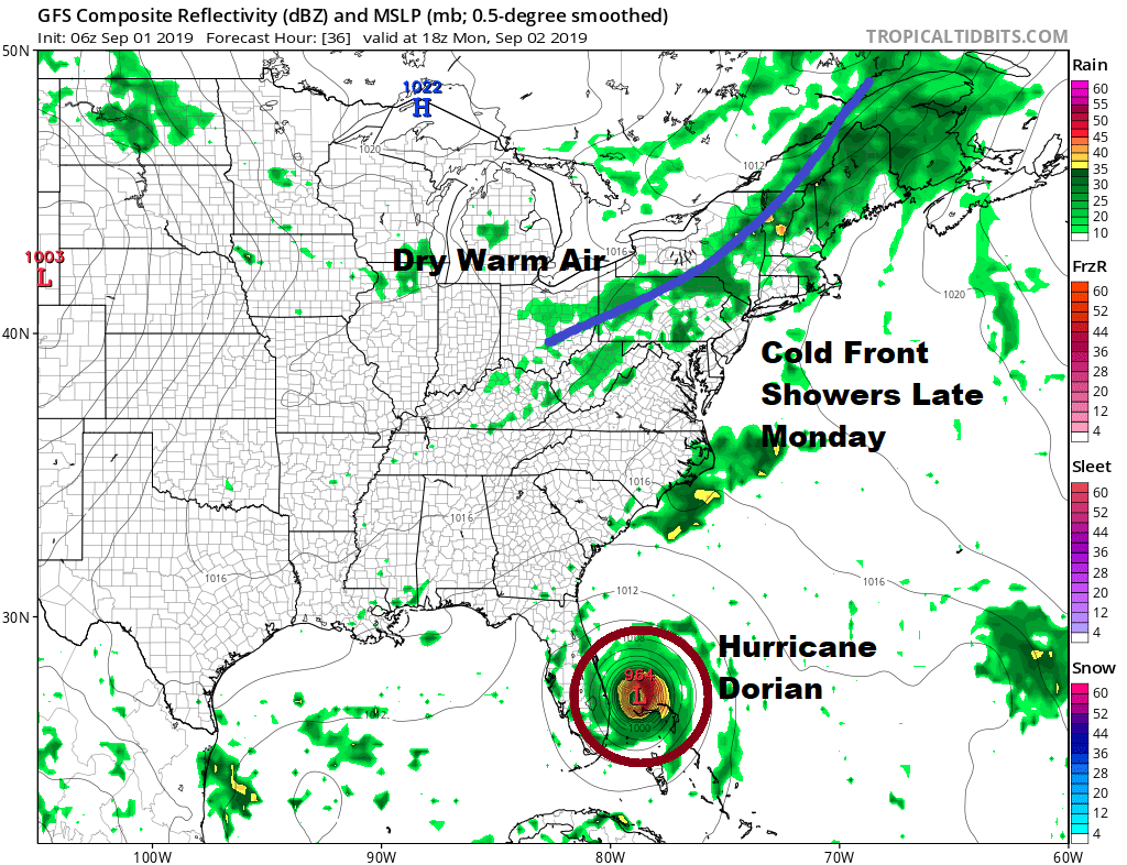
Tuesday and Wednesday will be warm days with humidity levels going up a bit into Wednesday but manageable. We have a second cold front that approaches on Wednesday and there could be a late shower or thunderstorm with that when it passes though it is entirely possible it comes through dry. We should see some sunshine both Tuesday and Wednesday with high in the low to mid 80s. That front moves offshore and basically creates a weakness for Hurricane Dorian to turn into as it moves up the East Coast. Dorian will be impacting the Carolinas Wednesday and Thursday in some form. There is still much uncertainty over this. Then it is northeast bound from there like we would watch a storm in the winter time offshore and wonder how far north and west it gets.
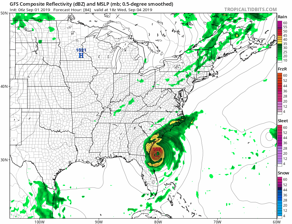
Some models are bringing wind and rain from New Jersey to SouthernNew England at least along the coast for late this week. It is certainly possible that we could see Dorian morph into a storm which looks more like a winter noreaster than a hurricane but this could also be suppressed more to the east northeast depending on the strength of the northern jet stream. We are still focused on Florida for the next two days and then the Southeast US. Clearly if this becomes an issue for the Northern Mid Atlantic to New England we will let you know but it is 5 days away and we still have the rest of the weekend and much of next week. It is clear that Dorian has no impact on the weather in our area through the middle of this coming week.
MANY THANKS TO TROPICAL TIDBITS FOR THE USE OF MAPS
Please note that with regards to any tropical storms or hurricanes, should a storm be threatening, please consult your local National Weather Service office or your local government officials about what action you should be taking to protect life and property.


